Canvas Print > Fine Art Storehouse > Map
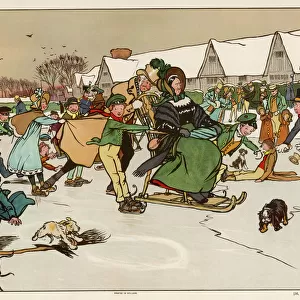
Canvas Print : Schleswig-Holstein, lithograph, published in 1878


![]()
Canvas Prints from Fine Art Storehouse
Schleswig-Holstein, lithograph, published in 1878
Map of Schleswig-Holstein. Lithograph, published in 1878
Unleash your creativity and transform your space into a visual masterpiece!
Media ID 13666807
© ZU_09
Atlantic Ocean Contour Drawing Country Geographic Area Elbe River German Culture German North Sea Region Hamburg Germany Island Nordfriesland North Frisia North Frisian Islands North Sea Schleswig Holstein Sylt Topographic Map Topography Frisian Islands
20"x16" (51x41cm) Canvas Print
Step back in time with our exquisite Canvas Print of Schleswig-Holstein, a beautiful lithograph published in 1878. This fine art piece transports you to the historical landscape of Schleswig-Holstein, a region rich in culture and tradition. The intricate details and vibrant colors bring the map to life, making it a stunning addition to any home or office. Our Canvas Prints are crafted with the highest quality materials, ensuring a long-lasting and eye-catching display. Bring a piece of history into your space with our Schleswig-Holstein Canvas Print from the Media Storehouse Fine Art collection.
Delivered stretched and ready to hang our premium quality canvas prints are made from a polyester/cotton blend canvas and stretched over a 1.25" (32mm) kiln dried knot free wood stretcher bar. Packaged in a plastic bag and secured to a cardboard insert for safe transit.
Canvas Prints add colour, depth and texture to any space. Professionally Stretched Canvas over a hidden Wooden Box Frame and Ready to Hang
Estimated Product Size is 40.6cm x 50.8cm (16" x 20")
These are individually made so all sizes are approximate
Artwork printed orientated as per the preview above, with portrait (vertical) orientation to match the source image.
FEATURES IN THESE COLLECTIONS
> Fine Art Storehouse
> Map
> Historical Maps
EDITORS COMMENTS
This lithograph, published in 1878, showcases the stunning region of Schleswig-Holstein in Germany. The antique engraved image provides a glimpse into the rich history and topography of this German North Sea region. The lithograph beautifully captures the intricate details of Schleswig-Holstein's coastline, stretching along the Elbe River and encompassing iconic landmarks such as Sylt and the Frisian Islands. These ancient islands hold significant cultural importance within German culture. With its vertical composition, this map offers a comprehensive view of Hamburg, Germany's second-largest city located within Schleswig-Holstein. As one explores further northward on this topographic map, they encounter Nordfriesland and its enchanting North Friesian Islands like Föhr Island. The lithograph not only serves as an artistic representation but also acts as a historical document showcasing the country's geographic area during that time period. Its contour drawing technique adds depth to every curve and line, allowing viewers to appreciate both the natural beauty and man-made structures present in this coastal landscape. Displayed outdoors or indoors, this print transports us back to 1878 when cartography was at its peak. It is a testament to human curiosity about our surroundings and an homage to the timeless allure of maps themselves.
MADE IN THE USA
Safe Shipping with 30 Day Money Back Guarantee
FREE PERSONALISATION*
We are proud to offer a range of customisation features including Personalised Captions, Color Filters and Picture Zoom Tools
SECURE PAYMENTS
We happily accept a wide range of payment options so you can pay for the things you need in the way that is most convenient for you
* Options may vary by product and licensing agreement. Zoomed Pictures can be adjusted in the Cart.