Canvas Print > Africa > Egypt > Maps
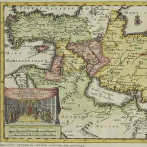
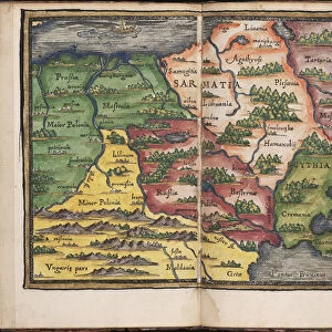
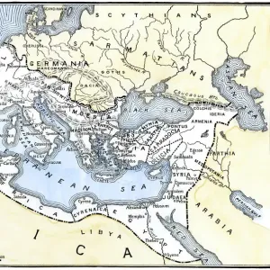
Canvas Print : Antique map of the Middle East by Halma


![]()
Canvas Prints from Fine Art Storehouse
Antique map of the Middle East by Halma
Unleash your creativity and transform your space into a visual masterpiece!
Hemera Technologies
Media ID 13609409
© Getty Images
18th Century 18th Century Style Arabia Armenia Border Cartouche Decorative Direction Document Egypt Geography Historical Palestine Holy Land Legend Location Mesopotamia Mesopotamian Middle East Ornate Place Positioning Scale Syria
30"x20" (76x51cm) Canvas Print
"Discover the rich history of the Middle East with our stunning Antique Map of the Middle East by Halma, now available as a canvas print from Media Storehouse's Fine Art Storehouse. This exquisite piece, brought to you by Hemera Technologies, transports you back in time with intricate detail and vibrant colors. The aged parchment texture and ornate cartouches add an air of sophistication to any space. Elevate your home or office decor with this unique and captivating work of art."
Delivered stretched and ready to hang our premium quality canvas prints are made from a polyester/cotton blend canvas and stretched over a 1.25" (32mm) kiln dried knot free wood stretcher bar. Packaged in a plastic bag and secured to a cardboard insert for safe transit.
Canvas Prints add colour, depth and texture to any space. Professionally Stretched Canvas over a hidden Wooden Box Frame and Ready to Hang
Estimated Product Size is 76.2cm x 50.8cm (30" x 20")
These are individually made so all sizes are approximate
Artwork printed orientated as per the preview above, with landscape (horizontal) orientation to match the source image.
FEATURES IN THESE COLLECTIONS
> Africa
> Egypt
> Related Images
> Arts
> Artists
> S
> Syrian Syrian
> Asia
> Armenia
> Related Images
> Asia
> Palestine
> Related Images
> Asia
> Syria
> Related Images
> Fine Art Storehouse
> Map
> Historical Maps
EDITORS COMMENTS
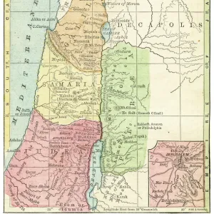
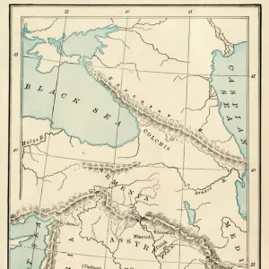
This print showcases an exquisite antique map of the Middle East, meticulously crafted by Halma in the 18th century. Steeped in history and cultural significance, this archival piece takes us on a visual journey through the enchanting lands of Arabia, Armenia, Egypt, Syria, and Mesopotamia. With its ornate cartouche and decorative elements, this map is not only a remarkable cartographic document but also a work of art. The intricate engravings depict key locations and borders with utmost precision while providing valuable insights into the region's geography during that era. The "Descriptio Paradisi et Terrae Canaan" inscription adds to its allure as it references the Holy Land and historical Palestine. Its scale allows for detailed exploration of various regions inhabited by patriarchs centuries ago. Transport yourself back in time as you immerse yourself in this vintage masterpiece. The horizontal positioning enhances its grandeur while the color image brings life to every corner. This photograph captures every minute detail of Halma's creation with impeccable clarity. Whether you are an avid historian or simply appreciate fine craftsmanship, this print is sure to captivate your imagination. Let it adorn your walls as a testament to both human curiosity and artistic brilliance from centuries past.
MADE IN THE USA
Safe Shipping with 30 Day Money Back Guarantee
FREE PERSONALISATION*
We are proud to offer a range of customisation features including Personalised Captions, Color Filters and Picture Zoom Tools
SECURE PAYMENTS
We happily accept a wide range of payment options so you can pay for the things you need in the way that is most convenient for you
* Options may vary by product and licensing agreement. Zoomed Pictures can be adjusted in the Cart.