Canvas Print > Europe > Czech Republic > Heritage Sites > Historic Centre of Prague
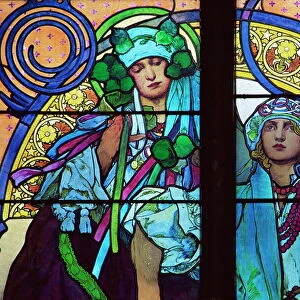
Canvas Print : Prague map 1896


![]()
Canvas Prints from Fine Art Storehouse
Prague map 1896
Meyers Konversations-Lexikon
Unleash your creativity and transform your space into a visual masterpiece!
THEPALMER
Media ID 13612367
© Roberto A Sanchez
Bohemia Czech Republic Dictionary European Union Prague Retro Styled
30"x20" (76x51cm) Canvas Print
Introducing the Prague Map 1896 Canvas Print from Media Storehouse's Fine Art Storehouse collection. This stunning piece of art transports you back in time with its intricate and detailed representation of Prague as it appeared over a century ago. Meticulously sourced from Meyers Konversations-Lexikon, this vintage map by THEPALMER is brought to life on a high-quality canvas, adding an elegant and timeless touch to any space. Let the history of Prague unfold before your eyes with this captivating and conversation-starting addition to your home or office decor.
Delivered stretched and ready to hang our premium quality canvas prints are made from a polyester/cotton blend canvas and stretched over a 1.25" (32mm) kiln dried knot free wood stretcher bar. Packaged in a plastic bag and secured to a cardboard insert for safe transit.
Canvas Prints add colour, depth and texture to any space. Professionally Stretched Canvas over a hidden Wooden Box Frame and Ready to Hang
Estimated Product Size is 76.2cm x 50.8cm (30" x 20")
These are individually made so all sizes are approximate
Artwork printed orientated as per the preview above, with landscape (horizontal) orientation to match the source image.
FEATURES IN THESE COLLECTIONS
> Europe
> Czech Republic
> Heritage Sites
> Historic Centre of Prague
> Europe
> Czech Republic
> Maps
> Europe
> Czech Republic
> Posters
> Europe
> Czech Republic
> Prague
> Europe
> Czech Republic
> Related Images
> Europe
> Related Images
> Maps and Charts
> Related Images
> Fine Art Storehouse
> The Magical World of Illustration
> Palmer Illustrated Collection
> Fine Art Storehouse
> Map
> Historical Maps
> Fine Art Storehouse
> Top Sellers - Art Prints
EDITORS COMMENTS
This print takes us back in time to the enchanting city of Prague in 1896. A vintage map, sourced from Meyers Konversations-Lexikon, beautifully captures the essence of this European gem. The retro-styled engraving showcases intricate details and a level of craftsmanship that is seldom seen today. As we gaze upon this antique image, we are transported to an era when cartography was both an art form and a scientific endeavor. The carefully etched lines depict the physical geography of Prague with precision, highlighting its position as the capital city of Bohemia within the Czech Republic. The horizontal composition allows us to explore every corner of this historic metropolis. From its charming cobblestone streets to its majestic landmarks, each element on the map tells a story about Prague's rich heritage. Intriguingly, this illustration also serves as a reminder of how cities evolve over time. As part of the European Union now, it is fascinating to see how Prague has transformed since 1896 while still retaining its old-world charm. Whether you are a history enthusiast or simply captivated by beautiful artwork, "Prague Map 1896" offers a glimpse into a bygone era. This stunning piece curated by THEPALMER brings together nostalgia and fascination for those who appreciate fine art prints that transcend time and place.
MADE IN THE USA
Safe Shipping with 30 Day Money Back Guarantee
FREE PERSONALISATION*
We are proud to offer a range of customisation features including Personalised Captions, Color Filters and Picture Zoom Tools
SECURE PAYMENTS
We happily accept a wide range of payment options so you can pay for the things you need in the way that is most convenient for you
* Options may vary by product and licensing agreement. Zoomed Pictures can be adjusted in the Cart.