Fraud Blocker Skip to main content

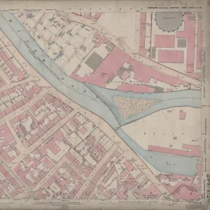
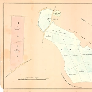
Ordnance Survey map: Totley, 1876

Ordnance Survey map: Totley, 1876
Sold 1
In Stock
We accept all major payment options so you can pay for the things you need in the way that is most convenient for you
Framed Photos
Buy from $79.99
Photo Prints
Buy from $9.99
Jigsaw Puzzles
Buy from $39.99
Poster Prints
Buy from $24.99
Canvas Prints
Buy from $99.99
Fine Art Prints
Buy from $60.90
Metal Prints
Buy from $169.99
Home Decor
Buy from $16.99

Sheffield City Archives Photo Prints and Wall Art

Ordnance Survey map: Totley, 1876

Scale: 25 inches to 1 mile.Original at Sheffield Local Studies Library: Derbyshire sheet XI.15.Includes: Old Hay Brook, Grove House, Crown Inn, Hillfoot, Totley Bents, Cricket Inn, recreation ground, Needhams Dike, Sunnybrook, Fleur de Lis Public House, Cross Scythes Public House, Totley Hall Farm, Infants School, Boys and girls School, Wesyleyan Methodist Chapel, The Folds. Sheffield City Archives and Local Studies Library has an unrivalled collection of images of Sheffield, England. © Sheffield City Council

Media ID 14050517

Brook Chapel Churches Cricket Farm Farming Farms Green Ground Hall Hill Hotel Hotels House Houses Lane Maps Primary Public Road School Schools Street Baslow Bents Butts Fleur Grove Hillfoot Rise Scythes Stocks Totley Wesleyan

SECURE PAYMENTS
We accept all major payment options so you can pay for the things you need in the way that is most convenient for you

Made in USA
Safe Shipping, Easy Returns

FREE PERSONALISATION
We are proud to offer a range of customisation including Cropping, Captions, and Filters. Zoom Cropping can be adjusted in the basket


EDITORS COMMENTS

This print showcases an Ordnance Survey map of Totley from the year 1876. The intricate details and precision of this map are truly remarkable, providing a fascinating glimpse into the past. With a scale of 25 inches to 1 mile, every street, lane, and road is meticulously documented. The map highlights various landmarks and points of interest within Totley's boundaries. From the Old Hay Brook to Grove House, Crown Inn to Hillfoot, all these locations are etched onto this historical piece. Notably featured are popular establishments such as Cricket Inn and Fleur de Lis Public House, which were undoubtedly bustling with activity during that era. In addition to public houses and hotels, the map also pinpoints essential community facilities like schools and churches. Both Infants School and Boys and Girls School can be spotted on this detailed representation alongside Wesleyan Methodist Chapel. As we explore further into Totley's landscape through this photograph, we encounter names like Needhams Dike, Sunnybrook, Cross Scythes Public House, Totley Hall Farm - all contributing to the rich tapestry of life in this vibrant village. Preserved at Sheffield Local Studies Library under Derbyshire sheet XI. 15. , this invaluable artifact allows us to appreciate how much has changed over time while cherishing our heritage. Let us delve deep into history by examining these old roads like Baslow Road or Street Lane or discovering hidden gems such as Overcroft Rise or Stocks Green Drive.


Framed Prints of Ordnance Survey map: Totley, 1876

Step back in time with our exclusive Framed Print from Media Storehouse, featuring an intriguing Ordnance Survey map of Totley from 1876. This antique map, hailing from the Sheffield City Archives, offers a captivating glimpse into the past with its intricate details. Discover the locations of Old Hay Brook, Grove House, Crown Inn, Hillfoot, Totley Bents, and Cricket Inn, all depicted in their original settings. Scale: 1:25,000. Bring history into your home with this unique and authentic piece, perfectly framed to preserve its character and beauty.


Photo Prints of Ordnance Survey map: Totley, 1876

Discover the history of Totley with our stunning Media Storehouse Photographic Print of an original Ordnance Survey map from 1876. This intricately detailed map, sourced from Sheffield City Archives, showcases the area around Totley as it once was. Key landmarks such as Old Hay Brook, Grove House, Crown Inn, Hillfoot, Totley Bents, and the Cricket Inn are clearly marked. Travel back in time and add a unique touch to your home or office decor with this captivating piece of local history. Scale: 25 inches to 1 mile. (Original at Sheffield Local Studies Library: Derbyshire sheet XI.15)".


Poster Prints of Ordnance Survey map: Totley, 1876

"Discover the history of Totley with our vintage Ordnance Survey Map Print from Media Storehouse. Dating back to 1876, this antique map from Sheffield City Archives captures the essence of Totley as it once was. Detailed features include Old Hay Brook, Grove House, Crown Inn, Hillfoot, Totley Bents, and the Cricket Inn, making this print an excellent addition to any local history or nostalgia-inspired decor. Scale: 1 inch to 25 miles. Bring a piece of the past into your home with our authentic reproduction of this original map, held at the Derbyshire sheet XI.15 in Sheffield Local Studies Library."


Jigsaw Puzzles of Ordnance Survey map: Totley, 1876

Discover the charm of the past with Media Storehouse's Jigsaw Puzzle featuring an intricately detailed Ordnance Survey map of Totley, 1876. This captivating puzzle, drawn from the archives of Sheffield City Archives, offers a fascinating glimpse into the history of this charming town. With landmarks such as Old Hay Brook, Grove House, Crown Inn, Hillfoot, Totley Bents, and the Cricket Inn depicted, this puzzle is not only a fun and engaging activity, but also a great educational tool for history enthusiasts and puzzle lovers alike. Immerse yourself in the intricacies of the map's design, as you piece together the past of Totley, brought to you by Media Storehouse.

diamond
Made With High Grade Materials
thumb_up
Professional Quality Finish
package_2
Carefully Packed To Aid Safe Arrival

You May Also Like


Totley enclosure map, 1842Totley enclosure map, 1842
Add to Basket
Ordnance Survey map: Totley, 1876Ordnance Survey map: Totley, 1876
Add to Basket
Farmhouse at Dore for sale by auction, 1858Farmhouse at Dore for sale by auction, 1858
Add to Basket
Plan of building land near Pond Street to be sold by auction, 1860Plan of building land near Pond Street to be sold by auction, 1860
Add to Basket
Map of the Rivelin Valley Estate, 1934Map of the Rivelin Valley Estate, 1934
Add to Basket
Cover design, Womans LifeCover design, Womans Life
Add to Basket
Liverpool 0 Arsenal 2Liverpool 0 Arsenal 2
Add to Basket
Endcliffe Park Boating Lake and Holme (Second Endcliffe) Grinding Wheel, Sheffield, Yorkshire. c. 1900Endcliffe Park Boating Lake and Holme (Second Endcliffe) Grinding Wheel, Sheffield, Yorkshire. c. 1900
Add to Basket
Map of Woodthorpe Hall Farm [Holmesfield] in the parish of Dronfield, County of Derby, 1736Map of Woodthorpe Hall Farm [Holmesfield] in the parish of Dronfield, County of Derby, 1736
Add to Basket
Plan of the Abbeydale Estate as allotted for sale, 1860Plan of the Abbeydale Estate as allotted for sale, 1860
Add to Basket
Contoured plan of Rivelin Valley Road, Sheffield, Yorkshire, c. 1900Contoured plan of Rivelin Valley Road, Sheffield, Yorkshire, c. 1900
Add to Basket
The great inundation near Sheffield: supplement to the Barnsley Chronicle, 26 March 1864The great inundation near Sheffield: supplement to the Barnsley Chronicle, 26 March 1864
Add to Basket

Gallery Wall Inspiration

A new map of Yorkshire, divided into its ridings and wapentakes, exhibiting its roads, rivers, parks, etc. John Cary, 1810
A Plan of the town of Sheffield in the county of York drawn by W. Fairbank 1797. Engraved by Thomas Harris
Plan of Hillsborough Park, 1897
A plan of the intended canal from Sheffield to Tinsley by W. and J. Fairbank, 1815
Map of the parish of Sheffield by W. Fairbank and Son (engraved by J. Cary), 1795
Map of the Rivelin Valley Estate, 1934
South Yorkshire Coalfield, c. 1925
Plan of Navigable Rivers and Canals connected with the Aire and Calder Navigation; with a Proposed Canal from Knottingley to Goole, 1818
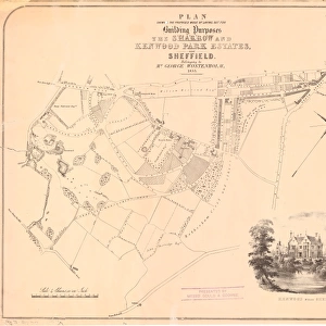
Proposed mode of laying out for building purposes the Sharrow and Kenwood Park Estates near Sheffield belonging to George Wostenholm, 1853
Plan of Endcliffe Park, 1897
Ordnance Survey map of north Sheffield copied by the Germans, and marked with bombing targets
Plan of the Meersbrook Bank Estate near Sheffield, 1876
Plan of The Crown and Glove Public house and other land and property at Stannington, for sale
Plan of Sheffield c. 1880
Sale plan for the Endcliffe Grange Estate, Endcliffe Vale Road, 1867
A map of Attercliffe Forge and the Farm, Tenements etc annxed thereto... belonging to the Duke of Norfolk and... Eliz Fell, 1768
Map of Sheffield
Street map of Nether Hallam
Plan of lands at Neepsend by The Sheffield Gas Company, 1929
Sheffield United Football Club, Bramall Lane, Sheffield - proposed new terracing, 1901
South Yorkshire Asylum - also referred to as Wadsley Asylum later Middlewood Hospital - plan of estate
Preliminary layout and development plan of the Manor Estate Housing Scheme, 1924
Sheffield (Central) Planning Scheme; Draft Scheme Map, 1939
Plan of Lydgate Hall Estate as allotted for sale, 1860
Plan of part of the Town of Sheffield shewing the existing markets, the property of His Grace the Duke of Norfolk, and the Projected improvements, 1847
Ordnance Survey map of north east Sheffield copied by the Germans, and marked with bombing targets, c. 1940
Ordnance Survey map: Totley, 1876


© Copyright Media Storehouse, All Rights Reserved 2003 - 2024
Facebook     Pinterest     100% Payment Secure     Reviews IO