Premium Framed Print > Europe > France > Canton > Landes
Premium Framed Print : 1855, Colton Map of Scandinavia, Norway, Sweden, Finland, topography, cartography


![]()
Framed Photos From Liszt Collection
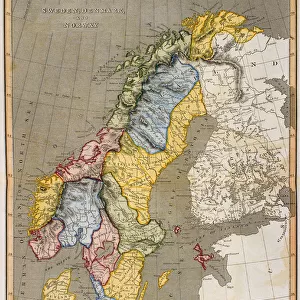
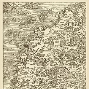
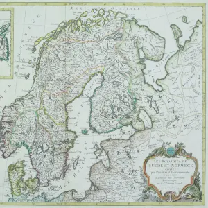
1855, Colton Map of Scandinavia, Norway, Sweden, Finland, topography, cartography
1855, Colton Map of Scandinavia, Norway, Sweden, Finland
Liszt Collection of nineteenth-century engravings and images to browse and enjoy
Media ID 14005495
© Artokoloro Quint Lox Limited
1855 Finland Norway Sweden Antique Map Latitude Longitude Mappa Mundi Old Antique Plan Old Antique View Ols Antique Map Rare Old Maps Topo
14"x16" Premium Frame
Contemporary style Premium Wooden Frame with 8"x10" Print. Complete with 2" White Mat and 1.25" thick MDF frame. Printed on 260 gsm premium paper. Glazed with shatter proof UV coated acrylic glass. Backing is paper covered backing with rubber bumpers. Supplied ready to hang with a pre-installed sawtooth/wire hanger. Care Instructions: Spot clean with a damp cloth. Securely packaged in a clear plastic bag and envelope in a reinforced cardboard shipper
FSC Real Wood Frame and Double Mounted with White Conservation Mountboard - Professionally Made and Ready to Hang
Estimated Image Size (if not cropped) is 20.3cm x 25.4cm (8" x 10")
Estimated Product Size is 35.6cm x 40.6cm (14" x 16")
These are individually made so all sizes are approximate
Artwork printed orientated as per the preview above, with portrait (vertical) orientation to match the source image.
FEATURES IN THESE COLLECTIONS
> Europe
> Finland
> Related Images
> Europe
> France
> Canton
> Landes
> Europe
> Norway
> Related Images
> Europe
> Sweden
> Related Images
EDITORS COMMENTS
This print showcases a remarkable piece of history - the 1855 Colton Map of Scandinavia, Norway, Sweden, and Finland. With its intricate topography and meticulous cartography, this map offers a fascinating glimpse into the geographical features and land formations of these Nordic countries during that era. The vintage charm of this ancient map is evident in its aged paper texture and retro artistic style. It serves as a testament to the artistry and skill involved in creating such detailed illustrations before the advent of modern technology. As you explore this historic treasure, you can't help but be transported back in time to an age when navigation relied on maps like these for exploration and discovery. The grid lines depicting latitude and longitude add a touch of geometric precision to the overall composition. This rare antique map not only provides valuable insights into Scandinavia's past but also serves as an intriguing decorative piece for any space. Its historical significance makes it a must-have for collectors or anyone with an appreciation for world history. Whether displayed in your home or office, this stunning print from Liszt Collection invites you to embark on a journey through time while admiring the beauty of our planet's diverse regions.
MADE IN THE USA
Safe Shipping with 30 Day Money Back Guarantee
FREE PERSONALISATION*
We are proud to offer a range of customisation features including Personalised Captions, Color Filters and Picture Zoom Tools
SECURE PAYMENTS
We happily accept a wide range of payment options so you can pay for the things you need in the way that is most convenient for you
* Options may vary by product and licensing agreement. Zoomed Pictures can be adjusted in the Basket.