Premium Framed Print > Arts > Artists > O > Oceanic Oceanic
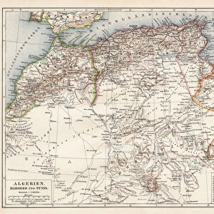
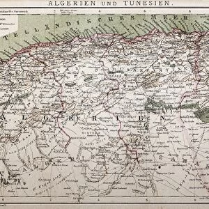
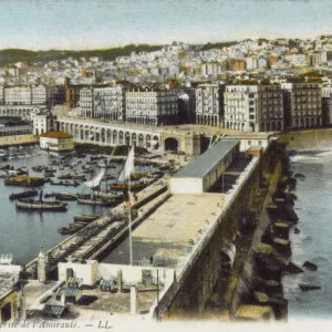
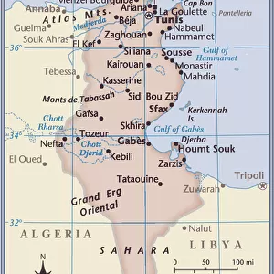
Premium Framed Print : North Africa: Algeria, Morocco and Tunisia, lithograph, published in 1897


![]()
Framed Photos from Fine Art Storehouse
North Africa: Algeria, Morocco and Tunisia, lithograph, published in 1897
Topographic map of Algeria, Morocco and Tunisia with the borders at the end of the 19th century. Lithograph, published in 1897
Unleash your creativity and transform your space into a visual masterpiece!
Media ID 14756392
© This content is subject to copyright
African Culture Algeria Atlantic Ocean Colorful Country Fezzan Gibraltar Marrakech Mediterranean Sea Morocco North Africa Sahara Topographic Map Topography Tripoli Tunis Tunisia Algiers Tuareg
14"x16" Premium Frame
Contemporary style Premium Wooden Frame with 8"x10" Print. Complete with 2" White Mat and 1.25" thick MDF frame. Printed on 260 gsm premium paper. Glazed with shatter proof UV coated acrylic glass. Backing is paper covered backing with rubber bumpers. Supplied ready to hang with a pre-installed sawtooth/wire hanger. Care Instructions: Spot clean with a damp cloth. Securely packaged in a clear plastic bag and envelope in a reinforced cardboard shipper
FSC Real Wood Frame and Double Mounted with White Conservation Mountboard - Professionally Made and Ready to Hang
Estimated Image Size (if not cropped) is 25.4cm x 20.3cm (10" x 8")
Estimated Product Size is 40.6cm x 35.6cm (16" x 14")
These are individually made so all sizes are approximate
Artwork printed orientated as per the preview above, with landscape (horizontal) orientation to match the source image.
FEATURES IN THESE COLLECTIONS
> Fine Art Storehouse
> Map
> Historical Maps
> Fine Art Storehouse
> Travel Imagery
> Travel Destinations
> Morocco, North Africa
> Africa
> Algeria
> Related Images
> Africa
> Morocco
> Related Images
> Africa
> Related Images
> Africa
> Tunisia
> Related Images
> Arts
> Artists
> O
> Oceanic Oceanic
EDITORS COMMENTS
This vibrant lithograph, published in 1897, showcases a topographic map of North Africa's captivating trio: Algeria, Morocco, and Tunisia. With borders reflecting the end of the 19th century, this print offers a fascinating glimpse into the region's historical geography. The map encompasses an array of notable landmarks and regions that define North African culture and history. From the vast Sahara Desert stretching across Algeria to the picturesque coastal cities like Algiers and Tunis along the Mediterranean Sea, every detail is meticulously captured in this colorful engraving. As one explores this intricate artwork further, significant locations such as Gibraltar Strait connecting Europe to Africa become apparent. The Tuareg territories in Libya's Tripoli region are also highlighted alongside Fezzan's desert expanse. Meanwhile, iconic Moroccan cities like Fes and Marrakech add their own charm to this comprehensive representation. Beyond its geographical significance lies a deeper appreciation for African heritage. This horizontal lithograph not only serves as an educational tool but also celebrates the rich tapestry of African cultures intertwined within these countries' landscapes. Whether you are an avid historian or simply captivated by artistry, this stunning lithograph transports you back in time while providing valuable insights into North Africa's past. Displayed proudly on any wall or study space, it invites exploration and sparks curiosity about a region steeped in tradition and beauty.
MADE IN THE USA
Safe Shipping with 30 Day Money Back Guarantee
FREE PERSONALISATION*
We are proud to offer a range of customisation features including Personalised Captions, Color Filters and Picture Zoom Tools
SECURE PAYMENTS
We happily accept a wide range of payment options so you can pay for the things you need in the way that is most convenient for you
* Options may vary by product and licensing agreement. Zoomed Pictures can be adjusted in the Cart.