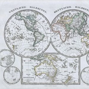
Poster Print > Europe > United Kingdom > England > London > Related Images
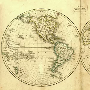
Poster Print : 1744, Wren Map of London, England, topography, cartography, geography, land, illustration


![]()
Poster Prints From Liszt Collection
1744, Wren Map of London, England, topography, cartography, geography, land, illustration
1744, Wren Map of London, England
Liszt Collection of nineteenth-century engravings and images to browse and enjoy
Media ID 14004541
© Artokoloro Quint Lox Limited
1744 Antique Map Latitude Longitude Mappa Mundi Old Antique Plan Old Antique View Ols Antique Map Rare Old Maps Topo
18x24 inch Poster Print
Discover the rich history of London with our stunning 1744 Wren Map of London print from the Liszt Collection. This exquisite poster showcases Christopher Wren's topographical masterpiece, a detailed and accurate representation of London's geography during that time. With intricate cartography and illustrations of the city's landmarks, this poster is a must-have for history enthusiasts, cartography collectors, or anyone who appreciates the beauty of old maps. Bring a piece of London's past into your home or office with our high-quality, museum-grade poster prints.
Poster prints are budget friendly enlarged prints in standard poster paper sizes. Printed on 150 gsm Matte Paper for a natural feel and supplied rolled in a tube. Great for framing and should last many years. To clean wipe with a microfiber, non-abrasive cloth or napkin. Our Archival Quality Photo Prints and Fine Art Paper Prints are printed on higher quality paper and the choice of which largely depends on your budget.
Poster prints are budget friendly enlarged prints in standard poster paper sizes (A0, A1, A2, A3 etc). Whilst poster paper is sometimes thinner and less durable than our other paper types, they are still ok for framing and should last many years. Our Archival Quality Photo Prints and Fine Art Paper Prints are printed on higher quality paper and the choice of which largely depends on your budget.
Estimated Product Size is 61.6cm x 46.3cm (24.3" x 18.2")
These are individually made so all sizes are approximate
Artwork printed orientated as per the preview above, with landscape (horizontal) orientation to match the source image.
EDITORS COMMENTS
This print showcases the exquisite 1744 Wren Map of London, England. A true masterpiece in topography and cartography, this vintage illustration takes us on a journey back in time to explore the intricate geography and land formations of one of the world's most iconic cities. The map's meticulous details are beautifully captured in this print, allowing us to marvel at its historical significance. With its precise grid lines marking latitude and longitude, this ancient artifact served as a vital navigational tool for travelers and explorers alike. Its decorative elements add an artistic touch to its practicality, making it not only a functional map but also a work of art. The aged appearance of the paper adds an air of authenticity and reminds us of the rich history that lies within these carefully drawn lines. As we gaze upon this rare old map, we can't help but imagine how London looked centuries ago - bustling with life yet steeped in mystery. Whether you're a history enthusiast or simply appreciate the beauty of antique maps, this stunning print from Liszt Collection is sure to captivate your imagination. Let yourself be transported through time as you admire this remarkable piece that encapsulates both artistry and exploration.
MADE IN THE USA
Safe Shipping with 30 Day Money Back Guarantee
FREE PERSONALISATION*
We are proud to offer a range of customisation features including Personalised Captions, Color Filters and Picture Zoom Tools
SECURE PAYMENTS
We happily accept a wide range of payment options so you can pay for the things you need in the way that is most convenient for you
* Options may vary by product and licensing agreement. Zoomed Pictures can be adjusted in the Basket.