Poster Print > Europe > Italy > Related Images
Poster Print : WORLD WAR I: WESTERN FRONT. Map, 1919, showing the zone of active operations on the Western

![]()
Poster Prints From Granger
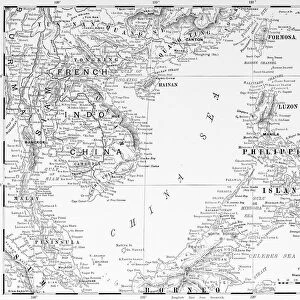
WORLD WAR I: WESTERN FRONT. Map, 1919, showing the zone of active operations on the Western
WORLD WAR I: WESTERN FRONT.
Map, 1919, showing the zone of active operations on the Western and Italian fronts during World War I
Granger holds millions of images spanning more than 25,000 years of world history, from before the Stone Age to the dawn of the Space Age
Media ID 12406114
1914 1915 1916 1917 1918 Austria Hungary Front Germany Plan Western Front World War I
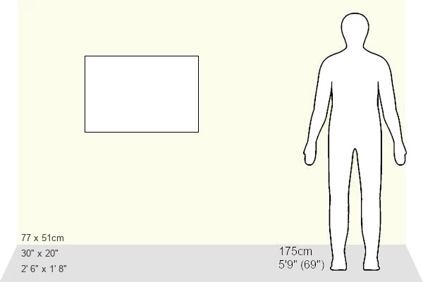
20x30 inch Poster Print
Step back in time with our WORLD WAR I: WESTERN FRONT Map Print from Media Storehouse, brought to you by Granger Art on Demand. This historic print, originally created in 1919, showcases the active operations zone on the Western and Italian fronts during the First World War. Perfect for history enthusiasts, educators, or those looking to add a unique touch to their decor, this poster print is a must-have for any collection. Immerse yourself in the past and relive the events that shaped our world's history.
Poster prints are budget friendly enlarged prints in standard poster paper sizes. Printed on 150 gsm Matte Paper for a natural feel and supplied rolled in a tube. Great for framing and should last many years. To clean wipe with a microfiber, non-abrasive cloth or napkin. Our Archival Quality Photo Prints and Fine Art Paper Prints are printed on higher quality paper and the choice of which largely depends on your budget.
Poster prints are budget friendly enlarged prints in standard poster paper sizes (A0, A1, A2, A3 etc). Whilst poster paper is sometimes thinner and less durable than our other paper types, they are still ok for framing and should last many years. Our Archival Quality Photo Prints and Fine Art Paper Prints are printed on higher quality paper and the choice of which largely depends on your budget.
Estimated Product Size is 76.8cm x 51.4cm (30.2" x 20.2")
These are individually made so all sizes are approximate
Artwork printed orientated as per the preview above, with landscape (horizontal) or portrait (vertical) orientation to match the source image.
FEATURES IN THESE COLLECTIONS
> Granger Art on Demand
> 20th Century Wars
> Europe
> Italy
> Related Images
EDITORS COMMENTS
This print from Granger Art on Demand showcases a map of the Western Front during World War I. Created in 1919, this sepia-toned image provides a detailed overview of the zone of active operations on both the Western and Italian fronts throughout the years 1914 to 1918. The intricate lines and text on the map depict various key locations such as Austria-Hungary, France, Germany, and Italy. The significance of this historical artifact lies in its ability to transport us back to a time when nations clashed in one of history's deadliest conflicts. It serves as a visual representation of the immense scale and complexity involved in waging war on multiple fronts simultaneously. As we gaze upon this map, we are reminded of the strategic planning that took place behind closed doors, with military leaders meticulously plotting their moves across vast territories. The faded sepia tones evoke a sense of nostalgia for an era long gone but not forgotten. This print is more than just an artistic depiction; it is a testament to human resilience and sacrifice during times of great adversity. It serves as a reminder that even amidst chaos and destruction, there is beauty to be found in historical artifacts like these – reminders that shape our understanding of past events while guiding us towards building a better future.
MADE IN THE USA
Safe Shipping with 30 Day Money Back Guarantee
FREE PERSONALISATION*
We are proud to offer a range of customisation features including Personalised Captions, Color Filters and Picture Zoom Tools
SECURE PAYMENTS
We happily accept a wide range of payment options so you can pay for the things you need in the way that is most convenient for you
* Options may vary by product and licensing agreement. Zoomed Pictures can be adjusted in the Basket.