Poster Print > Europe > Italy > Maps
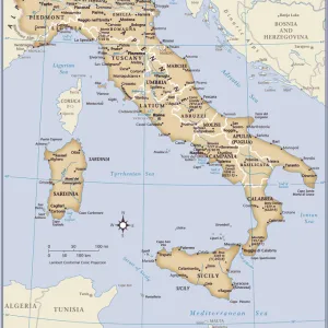
Poster Print : Map of the history of Italy, c. 1000-1866, lithograph, published 1897
![]()

Poster Prints From Fine Art Storehouse
Map of the history of Italy, c. 1000-1866, lithograph, published 1897
Map of the historical development of Italy from about 1000 to 1866. Lithograph, published in 1897
Unleash your creativity and transform your space into a visual masterpiece!
ZU_09
Media ID 18292297
18x24 inch Poster Print
Step back in time and explore the rich history of Italy with our stunning poster print, featuring a detailed map of its historical development from approximately 1000 to 1866. This captivating lithograph, published in 1897, beautifully illustrates the political and territorial changes that shaped Italy over the centuries. Add an element of history and culture to your space with this intriguing and informative piece from the Media Storehouse collection at Fine Art Storehouse.
Poster prints are budget friendly enlarged prints in standard poster paper sizes. Printed on 150 gsm Matte Paper for a natural feel and supplied rolled in a tube. Great for framing and should last many years. To clean wipe with a microfiber, non-abrasive cloth or napkin. Our Archival Quality Photo Prints and Fine Art Paper Prints are printed on higher quality paper and the choice of which largely depends on your budget.
Poster prints are budget friendly enlarged prints in standard poster paper sizes (A0, A1, A2, A3 etc). Whilst poster paper is sometimes thinner and less durable than our other paper types, they are still ok for framing and should last many years. Our Archival Quality Photo Prints and Fine Art Paper Prints are printed on higher quality paper and the choice of which largely depends on your budget.
Estimated Product Size is 46.3cm x 61.6cm (18.2" x 24.3")
These are individually made so all sizes are approximate
Artwork printed orientated as per the preview above, with portrait (vertical) orientation to match the source image.
FEATURES IN THESE COLLECTIONS
> Fine Art Storehouse
> Map
> Historical Maps
> Fine Art Storehouse
> Map
> Italian Maps
> Maps and Charts
> Early Maps
> Maps and Charts
> Italy
> Maps and Charts
> Related Images
EDITORS COMMENTS
This print showcases a remarkable piece of historical artwork titled "Map of the history of Italy, c. 1000-1866". Created as a lithograph and published in 1897, this map offers an intricate depiction of Italy's rich historical development spanning over eight centuries. The artist, ZU_09, skillfully captures the evolution and transformation of Italy from its medieval origins to the brink of modernity. Every detail on this meticulously crafted map tells a story - each city, region, and border represents significant milestones in Italian history. As we delve into this visual journey through time, we witness the rise and fall of powerful empires such as the Roman Empire and Byzantine Empire. We observe how various kingdoms emerged and faded away while new ones took their place. The unification process that led to the birth of modern-day Italy is also beautifully illustrated here. The lithograph technique employed by ZU_09 adds depth and texture to this already mesmerizing artwork. The subtle hues used throughout evoke a sense of nostalgia while highlighting key periods in Italian history. Whether you are an avid historian or simply appreciate fine art, this print serves as both an educational tool and a stunning decorative piece for any space. It invites us to explore Italy's past with curiosity and admiration for its cultural heritage that has shaped our world today.
MADE IN THE USA
Safe Shipping with 30 Day Money Back Guarantee
FREE PERSONALISATION*
We are proud to offer a range of customisation features including Personalised Captions, Color Filters and Picture Zoom Tools
SECURE PAYMENTS
We happily accept a wide range of payment options so you can pay for the things you need in the way that is most convenient for you
* Options may vary by product and licensing agreement. Zoomed Pictures can be adjusted in the Basket.


