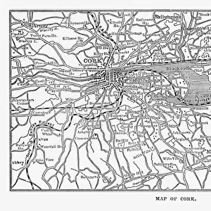
Photo Mug > Europe > Republic of Ireland > Cork
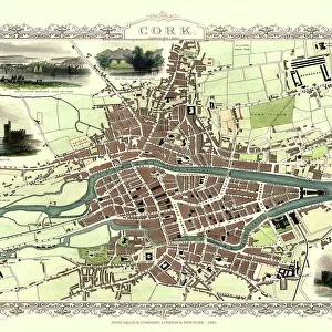
Photo Mug : Ireland / Cork / 1633 Map


![]()
Home Decor from Mary Evans Picture Library
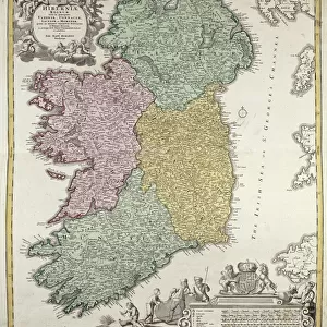
Ireland / Cork / 1633 Map
Primitive relief map of the city
Mary Evans Picture Library makes available wonderful images created for people to enjoy over the centuries
Media ID 4324917
© Mary Evans Picture Library 2015 - https://copyrighthub.org/s0/hub1/creation/maryevans/MaryEvansPictureID/10026009
Large Photo Mug (15 oz)
Discover the charm of Ireland's rich history with our Media Storehouse Photo Mug featuring a captivating 1633 map of Cork. This exquisite map, sourced from Mary Evans Prints Online, showcases a primitive relief depiction of the city. Each sip from this mug brings you closer to the enchanting tales of Ireland's past. Embrace the beauty of history with every use. Cheers to a journey through time! #Ireland #Cork #History #VintageMap #PhotoMug
Elevate your coffee or tea experience with our premium white ceramic mug. Its wide, comfortable handle makes drinking easy, and you can rely on it to be both microwave and dishwasher safe. Sold in single units, preview may show both sides of the same mug so you can see how the picture wraps around.
Elevate your coffee or tea experience with our premium white ceramic mug. Its wide, comfortable handle makes drinking easy, and you can rely on it to be both microwave and dishwasher safe. Sold in single units, preview may show both sides of the same mug so you can see how the picture wraps around.
These are individually made so all sizes are approximate
FEATURES IN THESE COLLECTIONS
> Europe
> Republic of Ireland
> Cork
> Europe
> Republic of Ireland
> Maps
> Maps and Charts
> Early Maps
> Maps and Charts
> Related Images
EDITORS COMMENTS
This stunning print captures a piece of history with an intricate map of Cork, Ireland from the year 1633. The primitive relief map showcases the city in incredible detail, highlighting its streets, buildings, and natural features. This historical artifact provides a fascinating glimpse into what Cork looked like over three centuries ago.
The texture of the relief map adds depth and dimension to the image, making it feel almost tangible as if you could reach out and touch the cityscape. The walls surrounding Cork are clearly delineated, giving insight into how the city was fortified during this time period.
As you study this map closely, you can imagine what life was like in Cork in 1633 - bustling markets, busy streets filled with merchants and traders, and ships coming in and out of the harbor. It's a snapshot frozen in time that allows us to connect with the past and appreciate how much has changed since then.
Whether you have a personal connection to Cork or simply appreciate history and cartography, this print is sure to captivate your imagination. Display it proudly on your wall as a conversation piece that will spark curiosity and admiration for centuries-old craftsmanship.
MADE IN THE USA
Safe Shipping with 30 Day Money Back Guarantee
FREE PERSONALISATION*
We are proud to offer a range of customisation features including Personalised Captions, Color Filters and Picture Zoom Tools
SECURE PAYMENTS
We happily accept a wide range of payment options so you can pay for the things you need in the way that is most convenient for you
* Options may vary by product and licensing agreement. Zoomed Pictures can be adjusted in the Cart.