Photo Mug : 1853, Mitchell Map of Greece, topography, cartography, geography, land, illustration


![]()
Home Decor From Liszt Collection
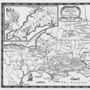
1853, Mitchell Map of Greece, topography, cartography, geography, land, illustration
1853, Mitchell Map of Greece
Liszt Collection of nineteenth-century engravings and images to browse and enjoy
Media ID 14007418
© Artokoloro Quint Lox Limited
1853 Antique Map Latitude Longitude Mappa Mundi Old Antique Plan Old Antique View Ols Antique Map Rare Old Maps Topo
Large Photo Mug (15 oz)
Step back in time with our Media Storehouse Photo Mug featuring the iconic 1853 Mitchell Map of Greece. This beautifully illustrated mug showcases intricate topography, cartography, and geographical details of ancient Greece. Each sip brings you closer to the rich history of this fascinating land. The high-quality image from the Liszt Collection is printed on both sides of the mug, ensuring a stunning display of historical detail. Perfect for history enthusiasts, cartography lovers, or anyone who appreciates the beauty of vintage maps. Enjoy your favorite beverage while immersing yourself in the wonders of ancient Greece.
Elevate your coffee or tea experience with our premium white ceramic mug. Its wide, comfortable handle makes drinking easy, and you can rely on it to be both microwave and dishwasher safe. Sold in single units, preview may show both sides of the same mug so you can see how the picture wraps around.
Elevate your coffee or tea experience with our premium white ceramic mug. Its wide, comfortable handle makes drinking easy, and you can rely on it to be both microwave and dishwasher safe. Sold in single units, preview may show both sides of the same mug so you can see how the picture wraps around.
These are individually made so all sizes are approximate
EDITORS COMMENTS
This print showcases the intricate details of the 1853 Mitchell Map of Greece, a true masterpiece in cartography and topography. The artistry and precision evident in this vintage illustration transport us back to a time when maps were meticulously hand-drawn works of art. The map's geometric grid, latitude, and longitude lines provide an accurate representation of Greece's diverse landscape. From its rugged mountains to its stunning coastlines, every contour is skillfully depicted on this historic piece. This ancient artifact not only serves as a navigational tool but also offers valuable insights into Greece's rich history and geographical features. As we gaze upon this aged treasure, we are reminded of the countless journeys and explorations that have taken place throughout centuries past. Its decorative elements add an artistic touch to our understanding of the world as it was perceived during that era. The Mitchell Map takes us on a visual voyage through time, allowing us to appreciate the craftsmanship involved in creating such detailed representations before modern technology took over cartographic endeavors. It stands as a testament to human curiosity and our innate desire for exploration. This rare antique map from the Liszt Collection holds immense historical value while simultaneously serving as an exquisite piece of artwork worthy of admiration. Its presence evokes a sense of wonderment about our planet's vast regions and inspires us to embark on our own personal journeys towards discovery.
MADE IN THE USA
Safe Shipping with 30 Day Money Back Guarantee
FREE PERSONALISATION*
We are proud to offer a range of customisation features including Personalised Captions, Color Filters and Picture Zoom Tools
SECURE PAYMENTS
We happily accept a wide range of payment options so you can pay for the things you need in the way that is most convenient for you
* Options may vary by product and licensing agreement. Zoomed Pictures can be adjusted in the Basket.