Fraud Blocker Skip to main content

Photo Mug > Fine Art Storehouse > Map > Historical Maps

Historical Maps Photo Mug Collection

Choose a picture from our Historical Maps Photo Mug Collection for your Wall Art and Photo Gifts

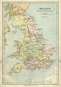
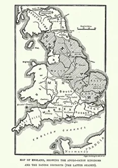
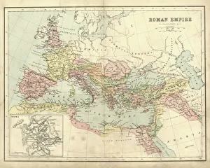
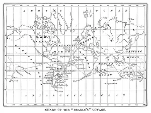
Step into a captivating world of cartographic wonders with our collection of historical maps and plans. These exquisite prints transport you through time, unveiling the intricate details of the past. Delve into the rich tapestry of human civilisation as you explore maps that have guided explorers, navigators, and conquerors across uncharted territories. From ancient civilisations to the Age of Exploration, these maps provide a glimpse into the evolving perceptions of our world.


3,702 Photo Mugs

We are proud to offer this selection in partnership with Fine Art Storehouse

Background imageHistorical Maps Photo Mug Collection: Map Of New Holland

Map Of New Holland
circa 1798: A map of Australia and Polynesia. (Photo by Hulton Archive/Getty Images)

Background imageHistorical Maps Photo Mug Collection: Antique map of Britain under the Anglo Saxons

Antique map of Britain under the Anglo Saxons

Background imageHistorical Maps Photo Mug Collection: Map of Anglo-Saxon Kingdoms and the Danelaw, 9th Century

Map of Anglo-Saxon Kingdoms and the Danelaw, 9th Century
Vintage engraving of a Map of Anglo-Saxon Kingdoms and the Danelaw, 9th Century

Background imageHistorical Maps Photo Mug Collection: Antique map of the Roman Empire

Antique map of the Roman Empire, with a detail on Rome

Background imageHistorical Maps Photo Mug Collection: Chart of the Beagles voyage. Charles Darwin travel map

Chart of the Beagles voyage. Charles Darwin travel map - Scanned 1880 Engraving

Background imageHistorical Maps Photo Mug Collection: Map of Middle East - illustration

Map of Middle East - illustration
Colored Map of Middle East Asia with Country Names and Capital Cities

Background imageHistorical Maps Photo Mug Collection: Apostle Pauls Missionary Journeys, lithograph, published in 1886

Apostle Pauls Missionary Journeys, lithograph, published in 1886
Apostle Pauls Missionary Journeys: 1st (green); 2nd (red); 3rd (blue); last to Rome (yellow). Lithograph, published in 1886. Paul travelled over 10, 000 miles proclaiming the gospel of Jesus Christ

Background imageHistorical Maps Photo Mug Collection: Map of Ireland 1897

Map of Ireland 1897
Map of Ireland

Background imageHistorical Maps Photo Mug Collection: Ethnological map of the Austro-Hungarian Empire, lithograph, published in 1897

Ethnological map of the Austro-Hungarian Empire, lithograph, published in 1897
Ethnological map of the Austro-Hungarian Empire. Lithograph, published in 1897

Background imageHistorical Maps Photo Mug Collection: Map of the Byzantine Empire in the 9th Century

Map of the Byzantine Empire in the 9th Century
Vintage engraving of a Map of the Byzantine Empire in the 9th Century

Background imageHistorical Maps Photo Mug Collection: England in the Ninth Century

England in the Ninth Century
An antique map from 1875 showing the different kingdoms of England in the 9th century

Background imageHistorical Maps Photo Mug Collection: Cuba map 1896

Cuba map 1896
Andres Allgemeiner Handatlas - Bielefeld und Leipzig 1896

Background imageHistorical Maps Photo Mug Collection: Antique map, Liverpool and Birkenhead, England, 19th Century

Antique map, Liverpool and Birkenhead, England, 19th Century
Vintage engraving of a Antique map, Liverpool and Birkenhead, England, 19th Century

Background imageHistorical Maps Photo Mug Collection: Map of Samoan islands: Savai i, Upolu, and Tutuila, lithograph, 1897

Map of Samoan islands: Savai i, Upolu, and Tutuila, lithograph, 1897
Topographic map of Samoan islands: Savai i, Upolu, Tutuila (American Samoa) and separate maps of Upolu and the port of Apia. Lithograph, published in 1897

Background imageHistorical Maps Photo Mug Collection: Map of Southern States USA 1895

Map of Southern States USA 1895
The Rand-McNally Grammar School Geography 1895 - Chicago & New York

Background imageHistorical Maps Photo Mug Collection: Earth map according to Herodotus

Earth map according to Herodotus
Antique illustration of a earth map according to Herodotus

Background imageHistorical Maps Photo Mug Collection: Antique map of USA in the 19th Century, 1873

Antique map of USA in the 19th Century, 1873
Vintage engraving of a Antique map of United States of America in the 19th Century, 1873

Background imageHistorical Maps Photo Mug Collection: NYC Region and Long Island Map

NYC Region and Long Island Map
A map of the region around New York City and Long Island, including New Jersey and the coast of Connecticut. Includes major highways, cities, and lakes

Background imageHistorical Maps Photo Mug Collection: Antique map of South Africa, 1884, 19th Century

Antique map of South Africa, 1884, 19th Century
Vintage engraving of Antique map of South Africa, 1884, 19th Century

Background imageHistorical Maps Photo Mug Collection: Antique map of Greece, Romania, Bulgaria, 1897, late 19th Century

Antique map of Greece, Romania, Bulgaria, 1897, late 19th Century
Vintage engraving of a Antique map of Greece, Romania, Bulgaria, 1897, late 19th Century

Background imageHistorical Maps Photo Mug Collection: City map of Florence, Italy, lithograph, published in 1897

City map of Florence, Italy, lithograph, published in 1897
City map of Florence - capital city of the Italian region of Tuscany. Lithograph, published in 1897

Background imageHistorical Maps Photo Mug Collection: Ancient History - Map of Alexander the Great Campaigns

Ancient History - Map of Alexander the Great Campaigns
Vintage engraving of a map of the campaigns and marches of Alexander the Great

Background imageHistorical Maps Photo Mug Collection: Antique map of Austria Hungary 19th Century

Antique map of Austria Hungary 19th Century
Vintage engraving of a Antique damaged map of Austro-Hungarian Empire in the 19th Century, 1873

Background imageHistorical Maps Photo Mug Collection: American Civil War, Map of Battle of Shiloh

American Civil War, Map of Battle of Shiloh
Vintage engraving of the Battle of Shiloh also known as the Battle of Pittsburgh Landing, was a major battle in the Western Theater of the American Civil War, fought April 6a'7, 1862

Background imageHistorical Maps Photo Mug Collection: Haiti and Dominican republic map 1883

Haiti and Dominican republic map 1883
Encyclopedia Britannica 9th Edition New York Samuel L. Hall 1883 Vol XI

Background imageHistorical Maps Photo Mug Collection: Arizona map 1893

Arizona map 1893
Johnsonas Universal Cyclopedia - Charles Kendall - New York 1893

Background imageHistorical Maps Photo Mug Collection: China map

China map
illustration of a South Eastern Asia map

Background imageHistorical Maps Photo Mug Collection: Map of Maine USA 1883

Map of Maine USA 1883
Warrens Common School Geography

Background imageHistorical Maps Photo Mug Collection: Map of Australia and New Zealand 1856

Map of Australia and New Zealand 1856
Colton and Fitchs Modern School Geography by George W. Fitch - New York 1856

Background imageHistorical Maps Photo Mug Collection: Travels of The Apostle Paul Map Engraving

Travels of The Apostle Paul Map Engraving
Engraved illustration of the Travels of The Apostle Paul Map Engraving from The Popular Pictorial Bible, Containing the Old and New Testaments, Published in 1862

Background imageHistorical Maps Photo Mug Collection: Map of Panama 1864

Map of Panama 1864
Map of Panama - combined with 2 different texture overlays

Background imageHistorical Maps Photo Mug Collection: England and Wales map 1875

England and Wales map 1875
The Independent Course Comprehensive Geography by James Monteith, A.S. Barnes & Co, New York & Chicago 1875

Background imageHistorical Maps Photo Mug Collection: Map of the Battle of Waterloo, Belgium, 18 June 1815

Map of the Battle of Waterloo, Belgium, 18 June 1815
Topographic map of the Battle of Waterloo, Belgium. The defeat of the French army under the command of Napoleon Bonaparte on 18 June 1815 marked the end of the Napoleonic Wars

Background imageHistorical Maps Photo Mug Collection: Map of the Ancient World according to Herodotus

Map of the Ancient World according to Herodotus
Vintage engraving of a Map of the Ancient World according to Herodotus. Herodotus was a Greek historian who was born in Halicarnassus, Caria and lived in the fifth century BC

Background imageHistorical Maps Photo Mug Collection: Historical city map of Heidelberg, Baden-WAOErttemberg, Germany, lithograph, published 1897

Historical city map of Heidelberg, Baden-WAOErttemberg, Germany, lithograph, published 1897
Historical city map of Heidelberg, Baden-WAOErttemberg, Germany. Lithograph, published in 1897

Background imageHistorical Maps Photo Mug Collection: Map of South East England, Hampshire, Dorset, Wiltshire 1891

Map of South East England, Hampshire, Dorset, Wiltshire 1891
Antique Map of Map of South East England, showing Hampshire, Dorset, Wiltshire, and the Isle of Wight 1891

Background imageHistorical Maps Photo Mug Collection: Antique map, Scotland, Jura, Mull, Argyll, Islay 19th Century

Antique map, Scotland, Jura, Mull, Argyll, Islay 19th Century
Vintage engraving of a Antique map, Scotland, Jura, Mull, Argyll, Islay 19th Century

Background imageHistorical Maps Photo Mug Collection: Map of Great Britain and Ireland 1877

Map of Great Britain and Ireland 1877
Warrens Common School Geography 1877

Background imageHistorical Maps Photo Mug Collection: Map of the Battle of Hampton Roads

Map of the Battle of Hampton Roads
Vintage engraving of a Map of the Battle of Hampton Roads, often referred to as either the Battle of the Monitor and Merrimack (or Virginia) or the Battle of Ironclads

Background imageHistorical Maps Photo Mug Collection: Map of Assyria illustrating the biblical Patriarchal Age

Map of Assyria illustrating the biblical Patriarchal Age
Vintage engraving of a Map of Assyria illustrating the biblical Patriarchal Age

Background imageHistorical Maps Photo Mug Collection: Iowa 1852 Map

Iowa 1852 Map

Background imageHistorical Maps Photo Mug Collection: World map by Martin Behaim, 1492, wood engraving, published 1884

World map by Martin Behaim, 1492, wood engraving, published 1884
World map by Martin Behaim, 1492. Woodcut engraving from my archive, published in 1884

Background imageHistorical Maps Photo Mug Collection: Map of the Netherlands, lithograph, published in 1877

Map of the Netherlands, lithograph, published in 1877
Map of the Netherlands. Lithograph, published in 1877

Background imageHistorical Maps Photo Mug Collection: Italy map 1875

Italy map 1875
The Independent Course Comprehensive Geography by James Monteith, A.S. Barnes & Co, New York & Chicago 1875

Background imageHistorical Maps Photo Mug Collection: Sicily map 1895

Sicily map 1895
Meyers Konversations-Lexikon. Ein Nachschlagewerk des allgemeinen Wissens, 5th edition 17 volumes Bibliographisches Institut - Leipzig 1895-1897

Background imageHistorical Maps Photo Mug Collection: Antique Damaged Map of Italy 19th Century

Antique Damaged Map of Italy 19th Century
Antique damaged map of Italy 19th Century

Background imageHistorical Maps Photo Mug Collection: Antique damaged map of German Empire 19th Century

Antique damaged map of German Empire 19th Century

Background imageHistorical Maps Photo Mug Collection: Map of Portugal

Map of Portugal
Antique illustration engraving map og Portugal


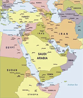
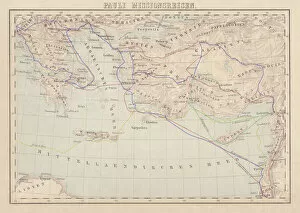
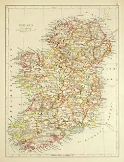
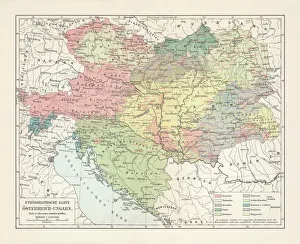
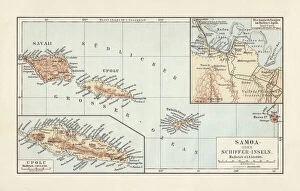
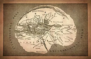
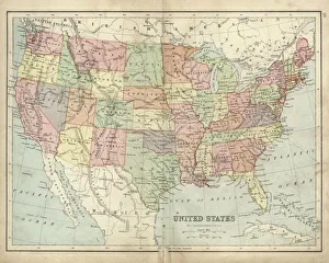
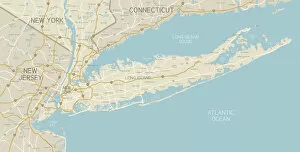
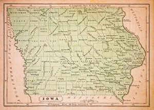
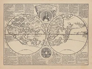
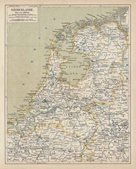
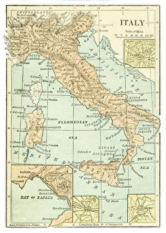
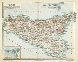
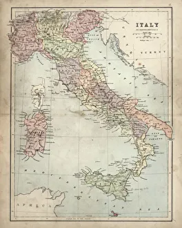
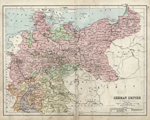
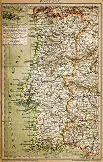
Whether you are a history buff, a curious traveller, or an art enthusiast, this collection offers a captivating journey through the ages, allowing you to witness the ever-changing landscapes of our shared human history. Explore our extraordinary collection of historical maps and plans, guiding you through captivating journeys across time. Uncover the artistry and precision of these historical masterpieces, inviting you to witness the rich tapestry of human civilization. Embark on a visual adventure with Fine Art Storehouse, where each map tells a compelling story.

All Professionally Made to Order for Quick Shipping


-

Why Choose Us?

We are a leading provider of Art Prints and Photo Gifts since 2003, working in partnership with a range of Sporting Clubs, Charities, Museums and Picture Libraries. A large share of profits from any of their images will go directly towards supporting that charity or club. Our archive of images is carefully curated to bring you a wide range of subjects, including landscapes, wildlife, architecture, and more. We ship from our partner labs in the UK, USA, EU (Netherlands) and Australia.
+

How do I place an order?

Ordering is quick & easy - Just follow 5 Simple Steps:
  1. Find your image: Use our search box or browse our online photo Collections to find the image you want.

  2. Choose your print format: Select your desired product and add it to your cart.

  3. Enter your details: If you're a returning customer, simply enter your email address and password, and we'll fill in your billing and shipping address details. All personal details are held securely and are fully GDPR compliant. As standard, we remove all Personally Identifiable Information after 12 months.

  4. Pay for your purchase: We use state-of-the-art security for online shopping and do not have access to your card details.

  5. Sit back and relax: We'll email you confirmation of your order and when it's dispatched. Registered customers can also track orders in the 'My Account' area.

+

How do I pay for an order?

You can pay for your order with most of the major credit and debit cards, or PayPal. For added security, major financial institutions process payment details separately and securely on our behalf. We do not have access to your online payment card details. Online payments are preferred however we do take phone orders. For UK customers only we accept cheques issued against a UK bank.
+

Is my data safe?

We take data security very seriously. We do not have access to your full card details and all payments are requested over a fully secure connection. Additionally, we fully comply with current European and GDPR legislation, and automatically remove all personal data after at most 12 months (unless you have an account with us and have signed in recently). We also have a strict opt-in policy and would never sell your personal details. Your data is only used to fulfill your order promptly and efficiently.
+

Is wall art ready to hang?

For quick and easy installation all wall art, including framed prints, canvas prints and metal prints are supplied with a ready to hang solution on the back. Generally, saw tooth hangers are applied as they allow wall art to hang flush against the wall. The serrated edge of the hanger prevents the frame from shifting or tilting when hung.
+

Are the photo prints fade resistant?

Yes, we use archival quality photo paper photographic paper for vivid reproduction Prints are an accurate representations of the original artwork, which is preserved for artistic character and authenticity. We guarantee they match previews shown on our web site