Metal Print > Asia > Japan > Maps
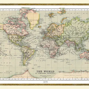
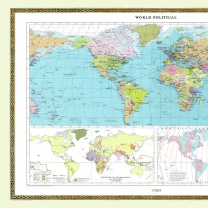
Metal Print : Old Map of the World 1875


![]()
Metal Prints From MapSeeker
Old Map of the World 1875
THE WORLD THAT WAS 1875 - Britain under Disraeli buys the Suez Canal to protect the sea route to India. USA expands settlement into Oregon. Egyptian invasion of Ethiopia. Treaty between Japan and Russia settles territorial claims. StanleyAEs African expedition continues, suffering enormous hardships
Welcome to the Mapseeker Image library and enter an historic gateway to one of the largest on-line collections of Historic Maps, Nostalgic Views, Vista's and Panorama's from a World gone by.
Media ID 20347209
© Collins Bartholomew - Mapseeker Publishing Ltd
Map Of The World Old Map Of The World The World World Map
16"x24" (61x41cm) Metal Print
Step back in time with our Old Map of the World 1875 Metal Print from Media Storehouse and MapSeeker. This captivating vintage map transports you to a bygone era, showcasing a world on the brink of significant change. Witness the global landscape as it was known during the reign of British Prime Minister Benjamin Disraeli, who secured the Suez Canal to safeguard the sea route to India. Observe the expansion of the United States into Oregon territory. And, be intrigued by the Egyptian invasion of Ethiopia. Our high-quality Metal Prints are not just decorative pieces; they're a window into history. Each print is meticulously crafted using premium metal sheets, ensuring a stunning, vibrant display that will add character and depth to any room in your home or office.
Made with durable metal and luxurious printing techniques, our metal photo prints go beyond traditional canvases, adding a cool, modern touch to your space. Wall mount on back. Eco-friendly 100% post-consumer recycled ChromaLuxe aluminum surface. The thickness of the print is 0.045". Featuring a Scratch-resistant surface and Rounded corners. Backing hangers are attached to the back of the print and float the print 1/2-inch off the wall when hung, the choice of hanger may vary depending on size and International orders will come with Float Mount hangers only. Finished with a brilliant white high gloss surface for unsurpassed detail and vibrance. Printed using Dye-Sublimation and for best care we recommend a non-ammonia glass cleaner, water, or isopropyl (rubbing) alcohol to prevent harming the print surface. We recommend using a clean, lint-free cloth to wipe off the print. The ultra-hard surface is scratch-resistant, waterproof and weatherproof. Avoid direct sunlight exposure.
Made with durable metal and luxurious printing techniques, metal prints bring images to life and add a modern touch to any space
Estimated Product Size is 61.5cm x 41.2cm (24.2" x 16.2")
These are individually made so all sizes are approximate
Artwork printed orientated as per the preview above, with landscape (horizontal) orientation to match the source image.
FEATURES IN THESE COLLECTIONS
> MapSeeker
> Maps Showing the World
> Maps of The World by Year PORTFOLIO
> Africa
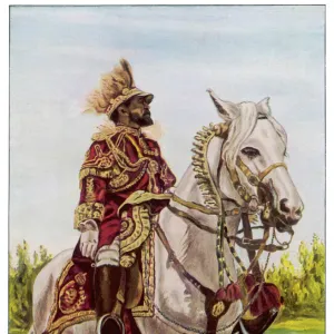
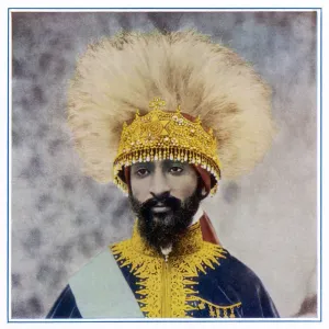
> Ethiopia (Abyssinia)
> Related Images
> Africa
> Ethiopia
> Related Images
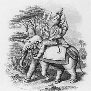
> Asia
> India
> Related Images
> Maps and Charts
> India
EDITORS COMMENTS
This print takes us back in time to the year 1875, offering a glimpse into the world as it once was. The old map of the world displayed here is not just a mere representation of geographical boundaries; it tells stories of significant historical events that shaped nations and continents. In this particular snapshot, we witness Britain's strategic move under Prime Minister Disraeli, acquiring the Suez Canal to safeguard its vital sea route to India. Meanwhile, across the Atlantic Ocean, the United States expands its settlements into Oregon, marking another milestone in their westward expansion. The map also highlights an intriguing conflict between Egypt and Ethiopia through an invasion by Egyptian forces. This event serves as a reminder of past tensions and power struggles within Africa during that era. Amidst these geopolitical developments, we find a glimmer of hope for peace with Japan and Russia reaching a treaty that settles territorial claims between them. Such diplomatic agreements were crucial in maintaining stability amidst global rivalries. Lastly, Stanley's African expedition stands out prominently on this map - an arduous journey fraught with immense hardships but driven by curiosity and exploration. This vintage map print encapsulates not only geographical information but also offers valuable insights into political dynamics and human endeavors from over a century ago. It serves as both an educational tool and a nostalgic window into our shared history.
MADE IN THE USA
Safe Shipping with 30 Day Money Back Guarantee
FREE PERSONALISATION*
We are proud to offer a range of customisation features including Personalised Captions, Color Filters and Picture Zoom Tools
SECURE PAYMENTS
We happily accept a wide range of payment options so you can pay for the things you need in the way that is most convenient for you
* Options may vary by product and licensing agreement. Zoomed Pictures can be adjusted in the Basket.