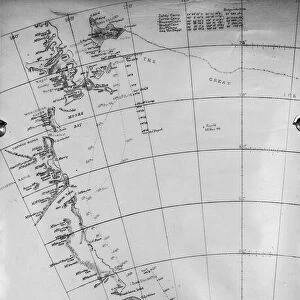
Map of the Terra Nova journey to the South Pole

![]()
Wall Art and Photo Gifts from Mary Evans Picture Library
Map of the Terra Nova journey to the South Pole
Map showing the journey to the South Pole 1910-13, taken from the Terra Nova reports
Mary Evans Picture Library makes available wonderful images created for people to enjoy over the centuries
Media ID 8625890
© Mary Evans Picture Library 2015 - https://copyrighthub.org/s0/hub1/creation/maryevans/MaryEvansPictureID/10716862
Antarctic Antarctica Discovery Journey Scott South Pole Terra Nova Terra Nova Expedition
EDITORS COMMENTS
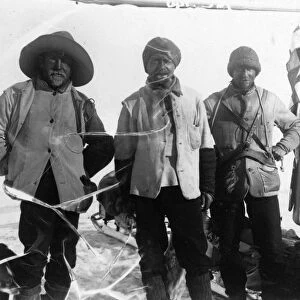
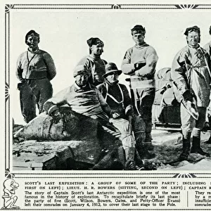
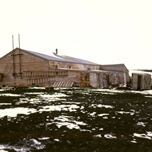
This map print depicts the epic journey of the Terra Nova Expedition to the South Pole, led by the legendary explorer Robert Falcon Scott and his team between 1910 and 1913. The map, taken from the Terra Nova reports, meticulously charts the expedition's route as they ventured into the uncharted territories of the Antarctic continent. Scott's Terra Nova Expedition was the fifth British attempt to reach the geographic South Pole. The team, which included members such as Edgar Evans, Lawrence Oates, and Tom Crean, faced numerous challenges, including extreme weather conditions, treacherous terrain, and dwindling supplies. Despite these obstacles, they pressed on, driven by their determination to be the first to reach the pole. The map illustrates the various camps the team established along their journey, including their base camp at Cape Evans and their final camp at One Ton Depot, located approximately 80 miles from the pole. The map also highlights the location of key landmarks, such as the Beardmore Glacier and the Ross Ice Shelf. Tragically, Scott and his team reached the South Pole on January 17, 1912, only to find that Roald Amundsen and his Norwegian team had beaten them by five weeks. Scott and his companions perished on their return journey, but their heroic efforts and the valuable scientific data they collected paved the way for future Antarctic explorations. This exquisite map print serves as a poignant reminder of the indomitable human spirit and the incredible feats of exploration that have shaped our understanding of the world. It is a testament to the courage and determination of Scott and his team, and a fascinating glimpse into the history of Antarctic exploration.
MADE IN THE USA
Safe Shipping with 30 Day Money Back Guarantee
FREE PERSONALISATION*
We are proud to offer a range of customisation features including Personalised Captions, Color Filters and Picture Zoom Tools
SECURE PAYMENTS
We happily accept a wide range of payment options so you can pay for the things you need in the way that is most convenient for you
* Options may vary by product and licensing agreement. Zoomed Pictures can be adjusted in the Cart.