Fraud Blocker Skip to main content

Home > Arts > Artists > H > Jodocus Hondius

Old County Map of Fife 1654 by Johan Blaeu from the Atlas Novus

Old County Map of Fife 1654 by Johan Blaeu from the Atlas Novus
Sold 2
In Stock
We accept all major payment options so you can pay for the things you need in the way that is most convenient for you

MapSeeker Photo Prints and Wall Art

Old County Map of Fife 1654 by Johan Blaeu from the Atlas Novus

This detailed and most attractive reproduction map of Fife has been carefully art worked from a scan of an antique original. The famous firm of Dutch cartographers and publishers was established in the late 16th century by Willem Janszoon Blaeu in Amsterdam. Blaeu was a maker of globes and scientific instruments and purchased some of his early map plates from Jodocus Hondius. From this small beginning was to emerge one of the largest and most prolific map publishing houses of the seventeenth century. Welcome to the Mapseeker Image library and enter an historic gateway to one of the largest on-line collections of Historic Maps, Nostalgic Views, Vista's and Panorama's from a World gone by.

Media ID 20347848

Blaeu Blaeu Family Blaue Map County Map County Map Of Scotland Johan Blaeu Johan Blaeu Map Old County Map Old Scottish County Map Scottish County Map Fife Fifeshire

FEATURES IN THESE COLLECTIONS

> Arts > Artists > B > Willem Blaeu

> Arts > Artists > H > Jodocus Hondius

> Arts > Photorealistic artworks > Detailed art pieces > Masterful detailing in art

> Europe > United Kingdom > Scotland > Fife > Related Images

> Europe > United Kingdom > Scotland > Maps

> Maps and Charts > Early Maps

> Maps and Charts > Scotland

> Maps and Charts > Willem Janszoon Blaeu

> MapSeeker > Maps from the British Isles > Scotland and Counties PORTFOLIO

SECURE PAYMENTS
We accept all major payment options so you can pay for the things you need in the way that is most convenient for you

Made in USA
Safe Shipping, Easy Returns

FREE PERSONALISATION
We are proud to offer a range of customisation including Cropping, Captions, and Filters. Zoom Cropping can be adjusted in the basket


EDITORS COMMENTS

This beautifully crafted print showcases an exquisite reproduction of the "Old County Map of Fife 1654" by Johan Blaeu, taken from the renowned Atlas Novus. Meticulously art worked from a scan of an antique original, this map captures the intricate details and allure of Fife's historical landscape. The Blaeu family, famous Dutch cartographers and publishers, established their firm in Amsterdam during the late 16th century. Willem Janszoon Blaeu, initially known for his globes and scientific instruments, acquired some map plates from Jodocus Hondius to kickstart his venture. Little did he know that this humble beginning would pave the way for one of the largest and most prolific map publishing houses in seventeenth-century Europe. With its rich history and cultural significance, Fife holds a special place within Scotland's heritage. This old Scottish county map offers a captivating glimpse into Fife's past, allowing us to trace its evolution over time. Whether you are a history enthusiast or simply appreciate fine craftsmanship, this historic Fife map is sure to captivate your imagination. Transport yourself back in time as you explore every nook and cranny of fifeshire through this meticulously reproduced piece. Discover ancient landmarks, follow winding rivers, and imagine what life was like centuries ago in this enchanting region. A true collector's item for those who cherish both history and cartography alike.


Framed Prints

Discover the rich history of Fife with our exquisite Old County Map of Fife 1654 by Johan Blaeu from the Atlas Novus. This stunning framed print, available from Media Storehouse, is a meticulously crafted reproduction of an antique original. The intricate details of the map, showcasing the counties, towns, and landscapes of Fife during the 17th century, have been carefully art worked from a high-resolution scan to bring out the beauty and authenticity of the original. Add this captivating piece to your home or office to transport yourself back in time and celebrate the heritage of Fife.


Photo Prints

Introducing the Old County Map of Fife 1654 by Johan Blaeu from the Atlas Novus, now available as a stunning photographic print from Media Storehouse. This exquisite reproduction captures the intricate details of the original antique map, bringing the history of Fife to life in a whole new way. Meticulously art worked from a high-resolution scan, the colors and contrasts have been expertly restored to showcase the intricate cartography and decorative elements of this rare map. Travel back in time as you explore the historical landmarks, settlements, and borders depicted on this beautifully detailed map of Fife. Add a touch of history and character to your home or office with this unique and captivating photographic print from Media Storehouse.


Poster Prints

Introducing the Old County Map of Fife 1654 by Johan Blaeu from the Atlas Novus, now available as a stunning poster print from Media Storehouse. This intricately detailed map transports you back in time, with its beautifully preserved lines and vibrant colors. Meticulously art-worked from a high-resolution scan of an original antique map, each print captures the essence of historical cartography. The Old County Map of Fife is a must-have for history enthusiasts, cartography collectors, or anyone who appreciates the beauty of a well-crafted map. Bring a piece of the past into your home or office with this exquisite reproduction.


Jigsaw Puzzles

Discover the rich history of Fife with our Old County Map of Fife 1654 by Johan Blaeu from the Atlas Novus. This stunning jigsaw puzzle, part of the Media Storehouse collection, is meticulously crafted from a high-resolution scan of an original antique map. Transport yourself back in time as you piece together this intricately detailed representation of Fife as it appeared over 350 years ago. The puzzle's vibrant colors and crisp lines bring the historical cartography to life, making it an engaging and educational experience for puzzle enthusiasts and history buffs alike. Immerse yourself in the past and create a beautiful display piece once completed.

diamond
Made With High Grade Materials
thumb_up
Professional Quality Finish
package_2
Carefully Packed To Aid Safe Arrival

You May Also Like


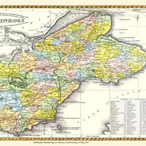
Old County Map of Fife and Kinross Scotland 1847 by A&C BlackOld County Map of Fife and Kinross Scotland 1847 by A&C Black
Add to Basket
1973 Jensen Healey1973 Jensen Healey
Add to Basket
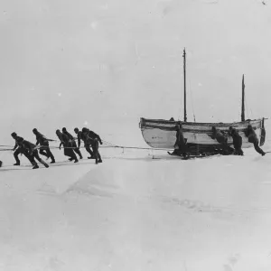
Shackletons Trans-Antarctic ExpeditionShackletons Trans-Antarctic Expedition
Add to Basket
crystal clear waters with surfers seen from abovecrystal clear waters with surfers seen from above
Add to Basket
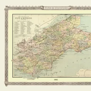
Old Map of the Counties of Fife and Kinross from the Philips Handy Atlas of 1882Old Map of the Counties of Fife and Kinross from the Philips Handy Atlas of 1882
Add to Basket
Shane Long celebrates scoring against DerbyShane Long celebrates scoring against Derby
Add to Basket
Northern Light, Aurora Borealis, Churchill, Manitoba, CanadaNorthern Light, Aurora Borealis, Churchill, Manitoba, Canada
Add to Basket
England, County Durham, Durham City. Fulling Mill, on the banks of the River WearEngland, County Durham, Durham City. Fulling Mill, on the banks of the River Wear
Add to Basket
Ancient Greeks holding the pass of Thermopylae, 480 BCAncient Greeks holding the pass of Thermopylae, 480 BC
Add to Basket
Billy LiarBilly Liar
Add to Basket
CM20 4941 Paul Linfoot, Ford Sierra RS500CM20 4941 Paul Linfoot, Ford Sierra RS500
Add to Basket
Selhurst Park Stadium Fine Art - Crystal Palace Football ClubSelhurst Park Stadium Fine Art - Crystal Palace Football Club
Add to Basket

Gallery Wall Inspiration

Scotland 1851
The Historic Map of Scotland "Scotland of Old"
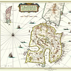
Old Map of the Isle of Islay Scotland 1654 by Johan Blaeu from the Atlas Novus
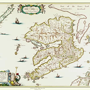
Old Map of the Isle of Mull Scotland 1654 by Johan Blaue from the Atlas Novus
Map of the Clans and Tartans of Scotland
Pictorial Story Map of Scotland
Pictorial History Map of Scotland 1963
Old County Map of Wigtown Scotland 1847 by A&C Black
Old Map of Scotland 1611 by John Speed
Old Map of Scotland 1852 by Henry George Collins
Old Map of the Isles of Shetland and Orkney 1654 from the Atlas Novus
Old County Map of Fife 1654 by Johan Blaeu from the Atlas Novus
Old County Map of Kyle and Mid Ayrshire 1654 by johan Blaeu from the Atlas Novus
Old County Map of Dunbartonshire, formally called Dumbartonshire, Scotland 1847 by A&C Black
Old Map of the County of Sutherland from the Philips Handy Atlas of 1882
Early Coastal Survey Map of The West Coast of Scotland 1796
Old County Map of Sutherland Scotland 1847 by A&C Black
Old County Map of Renfrew Scotland 1847 by A&C Black
Old County Map of Moray and Nairn Scotland 1847 by A&C Black
Old Map of the Counties of Ross and Cromarty from the Philips Handy Atlas of 1882
Old Map of the Counties of Stirling and Clackmannan from the Philips Handy Atlas of 1882
Old County Map of Renfrewshire Scotland 1654 by Johan Blaue from the Atlas Novus
Old Map of Scotland 1635 by Willem & Johan Blaeu from the Theatrum Orbis Terrarum
Old Map of Galloway Scotland 1654 by Johan Blaeu from the Atlas Novus
Old County Map of Dumfries Scotland 1847 by A&C Black
Old County Map of Aberdeen and Banff Scotland 1847 by A&C Black
Old County Map of Caithness Scotland 1847 by A&C Black

Discover Our Collections


Early MapsEarly Maps
View Collection
Willem BlaeuWillem Blaeu
View Collection
Jodocus HondiusJodocus Hondius
View Collection
Scotland and Counties PORTFOLIOScotland and Counties PORTFOLIO
View Collection
Fife Related ImagesFife Related Images
View Collection
ScotlandScotland
View Collection
MapsMaps
View Collection
Masterful detailing in artMasterful detailing in art
View Collection
Willem Janszoon BlaeuWillem Janszoon Blaeu
View Collection


© Copyright Media Storehouse, All Rights Reserved 2003 - 2024
Facebook     Pinterest     100% Payment Secure     Reviews IO