Maps from the British Isles Gallery
Maps Of The British Isles
Choose from 242 pictures in our Maps from the British Isles collection for your Wall Art or Photo Gift. All professionally made for Quick Shipping.
Abstract
Aerial
Africa
Animals
Architecture
Arts
Asia
Europe
Historic
Humour
Maps and Charts
Modern Art
North America
Oceania
People
Popular Themes
Posters
Religion
Science
Services
South America
Special Days
Sport
Transportation
All Images
Collections
MapSeeker
> Maps from the British Isles
>> British Isles Map PORTFOLIO
>> England with Wales PORTFOLIO
>> England and Counties PORTFOLIO
>> Wales and Counties PORTFOLIO
>> Scotland and Counties PORTFOLIO
>> Ireland and Provinces PORTFOLIO
>> Islands around Britain PORTFOLIO

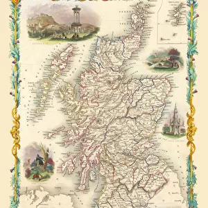
Maps british isles/scotland counties portfolio/historic map scotland scotland old
Full Range of Prints and Gifts in Stock

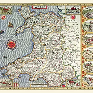
Maps british isles/wales counties portfolio/pictorial history map wales monmouth 1966
Full Range of Prints and Gifts in Stock

Maps british isles/scotland counties portfolio/old map isle islay scotland 1654 johan blaeu
Full Range of Prints and Gifts in Stock

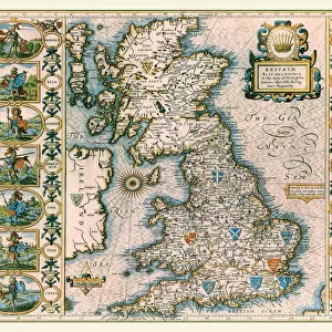
Old Map of The British Isles 1635 by Willem & Johan Blaeu from the Theatrum Orbis Terrarum
MapSeeker
Full Range of Prints and Gifts in Stock

Old Map of The British Isles 1635 by Willem & Johan Blaeu from the Theatrum Orbis Terrarum
This detailed and most attractive reproduction map of The British Isles has been carefully art worked from a scan of an antique original. The famous firm of Dutch cartographers and publishers was established in the late 16th century by Willem Janszoon Blaeu in Amsterdam. Blaeu was a maker of globes and scientific instruments and purchased some of his early map plates from Jodocus Hondius. From this small beginning was to emerge one of the largest and most prolific map publishing houses of the seventeenth century

Map of England and Wales as it appeared under the House of Lancaster
MapSeeker
Full Range of Prints and Gifts in Stock

Map of England and Wales as it appeared after the Accession of The House of Tuder
MapSeeker
Full Range of Prints and Gifts in Stock

Map of England and Wales as it appeared before the Norman Conquest
MapSeeker
Full Range of Prints and Gifts in Stock

Map of the Clans and Tartans of Scotland
This map of Scotland indicates the general sphere of influence held by the clans and considerable families at the beginning of the 17th century. Some clans and families held small areas of land, and if their names are not on this map, they were not necessarily landless. The areas representing the ancient Principalities of Scotland are indicated on the map. Scotland has a rich and enduring culture steeped in history. One of the most distinctive features, of which are probably that of clanship and the predominantly Highland clans. Highland dress and the tartan is a powerful symbol of the wearerAEs pride in a Scottish ancestry and in Scotland itself. There are few, if any, other forms of national dress which can claim to make such a clear and unequivocal statement, and to be so instantly and widely recognisable

Old Map of the Orkney and Shetland Isles from the Philips Handy Atlas of 1882
MapSeeker
Full Range of Prints and Gifts in Stock

Old Map of the County of Peebles from the Philips Handy Atlas of 1882
MapSeeker
Full Range of Prints and Gifts in Stock

Old Map of the County of Lanark from the Philips Handy Atlas of 1882
MapSeeker
Full Range of Prints and Gifts in Stock

Old Map of the County of Kirkcudbright from the Philips Handy Atlas of 1882
MapSeeker
Full Range of Prints and Gifts in Stock

Old Map of the County of Haddington from the Philips Handy Atlas of 1882
MapSeeker
Full Range of Prints and Gifts in Stock

Old Map of the County of Renfrew from the Philips Handy Atlas of 1882
MapSeeker
Full Range of Prints and Gifts in Stock

Old Map of the Counties of Ross and Cromarty from the Philips Handy Atlas of 1882
MapSeeker
Full Range of Prints and Gifts in Stock

Old Map of the County of Sutherland from the Philips Handy Atlas of 1882
MapSeeker
Full Range of Prints and Gifts in Stock

Old Map of the Counties of Stirling and Clackmannan from the Philips Handy Atlas of 1882
MapSeeker
Full Range of Prints and Gifts in Stock

Old Map of the Environs of Edinburgh from the Philips Handy Atlas of 1882
MapSeeker
Full Range of Prints and Gifts in Stock

Old Map of the Counties of Elgin and Nairn from the Philips Handy Atlas of 1882
MapSeeker
Full Range of Prints and Gifts in Stock

Old Map of the County of Forfar from the Philips Handy Atlas of 1882
MapSeeker
Full Range of Prints and Gifts in Stock

Old Map of the County of Roxburgh from the Philips Handy Atlas of 1882
MapSeeker
Full Range of Prints and Gifts in Stock

Old Map of the County of Selkirk from the Philips Handy Atlas of 1882
MapSeeker
Full Range of Prints and Gifts in Stock

Old Map of the County of Inverness from the Philips Handy Atlas of 1882
MapSeeker
Full Range of Prints and Gifts in Stock

Map of England and Wales as it appeared in the Reign of Edward I
MapSeeker
Full Range of Prints and Gifts in Stock

Old Map of the Environs of Glasgow from the Philips Handy Atlas of 1882
MapSeeker
Full Range of Prints and Gifts in Stock

Old Map of the County of Edinburgh from the Philips Handy Atlas of 1882
MapSeeker
Full Range of Prints and Gifts in Stock

Old Map of the Western Isles from the Philips Handy Atlas of 1882
MapSeeker
Full Range of Prints and Gifts in Stock

Old Map of the Counties of Fife and Kinross from the Philips Handy Atlas of 1882
MapSeeker
Full Range of Prints and Gifts in Stock

Old Map of the County of Linlithgow from the Philips Handy Atlas of 1882
MapSeeker
Full Range of Prints and Gifts in Stock