Fraud Blocker Skip to main content

Home > Maps and Charts > Willem Janszoon Blaeu

Willem Janszoon Blaeu Collection

Discover the world through the eyes of cartographer Blaeu: where every detail is a testament to precision, artistry, and the enduring spirit of exploration

Choose a picture from our collection for your Wall Art and Photo Gifts

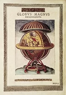
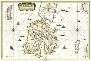
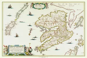
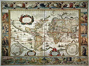
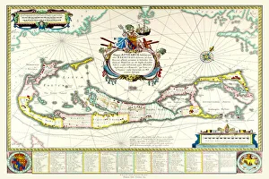
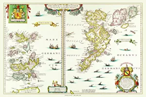
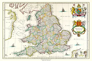
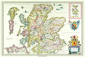
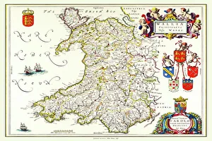
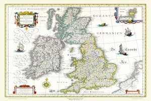
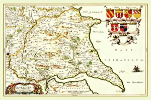
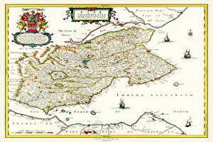
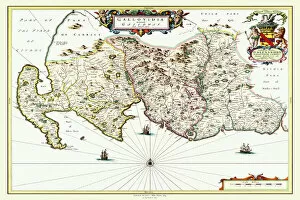
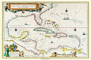
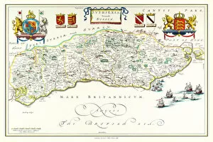
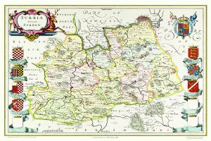
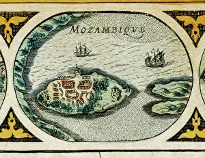
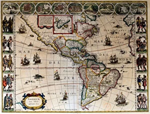
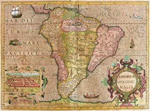
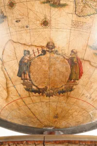
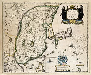
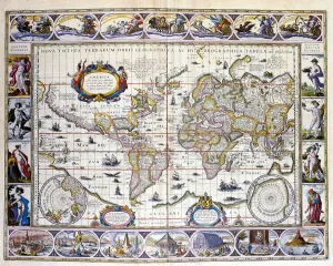
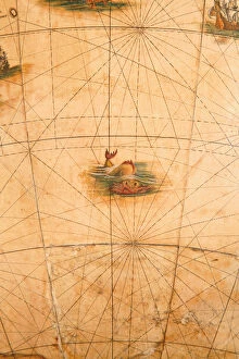
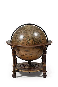
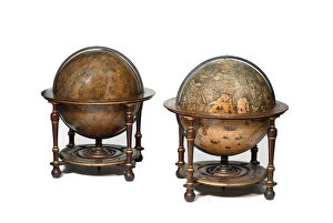
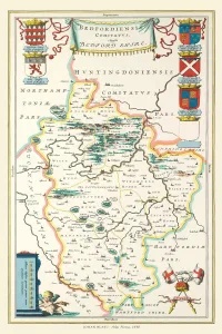
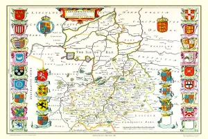
Willem Janszoon Blaeu, a prominent Dutch cartographer of the 17th century, left an enduring legacy in the realm of mapmaking with his meticulous craftsmanship and groundbreaking contributions. Born in Alkmaar, Netherlands, in 1571, Blaeu initially trained as a globe maker before establishing himself as a leading mapmaker and publisher in Amsterdam. Renowned for his attention to detail and commitment to accuracy, Blaeu's maps set the standard for cartographic excellence during the Dutch Golden Age.

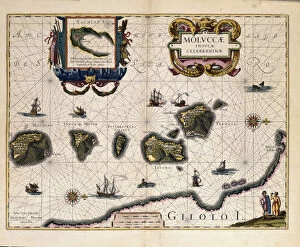
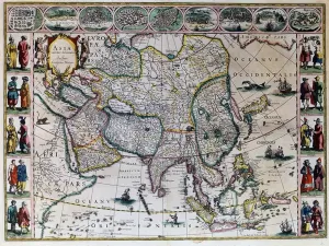
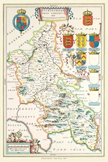
Blaeu's most notable work includes the production of atlases such as the "Atlas Novus" and the monumental "Atlas Maior." These atlases featured beautifully engraved maps that not only captured the geographical knowledge of the time but also showcased the artistry and sophistication of Dutch mapmaking. Blaeu's maps were prized for their aesthetic appeal and scientific precision, earning him recognition and patronage from royalty and scholars across Europe. His legacy endures through the continued study and appreciation of his maps, which remain prized artifacts of both historical cartography and artistic achievement.

151 Items

Background imageWillem Janszoon Blaeu Collection: BRAHE, Tycho (1546-1601). Danish astronomer

BRAHE, Tycho (1546-1601). Danish astronomer. Astronomical sphere. Illustration from the Atlas by Willem Blaeu. FRANCE. Paris. National Library

Background imageWillem Janszoon Blaeu Collection: Old Map of the Isle of Islay Scotland 1654 by Johan Blaeu from the Atlas Novus

Old Map of the Isle of Islay Scotland 1654 by Johan Blaeu from the Atlas Novus
This detailed and most attractive reproduction map of The Isle of Islay has been carefully art worked from a scan of an antique original

Background imageWillem Janszoon Blaeu Collection: Old Map of the Isle of Mull Scotland 1654 by Johan Blaue from the Atlas Novus

Old Map of the Isle of Mull Scotland 1654 by Johan Blaue from the Atlas Novus
This detailed and most attractive reproduction map of The Isle of Mull has been carefully art worked from a scan of an antique original

Background imageWillem Janszoon Blaeu Collection: WORLD MAP, 1635. By Willem Janszoon Blaeu, with two polar insets in the body of the map

WORLD MAP, 1635. By Willem Janszoon Blaeu, with two polar insets in the body of the map and border panels depicting the four elements, the seven known planets, the four seasons

Background imageWillem Janszoon Blaeu Collection: Old Map of The West Indies 1662 by Willem & Johan Blaue from the Theatrum Orbis Terrarum

Old Map of The West Indies 1662 by Willem & Johan Blaue from the Theatrum Orbis Terrarum
This detailed and most attractive reproduction map of The West Indies has been carefully art worked from a scan of an antique original

Background imageWillem Janszoon Blaeu Collection: Old Map of The Island of Bermuda 1635 by Willem & Johan Blaue from the Theatrum Orbis Terrarum

Old Map of The Island of Bermuda 1635 by Willem & Johan Blaue from the Theatrum Orbis Terrarum
This detailed and most attractive reproduction map of The Island of Bermuda has been carefully art worked from a scan of an antique original

Background imageWillem Janszoon Blaeu Collection: Old County Map of Bedfordshire 1648 by Johan Blaeu from the Atlas Novus

Old County Map of Bedfordshire 1648 by Johan Blaeu from the Atlas Novus
This detailed and most attractive reproduction map of Bedfordshire has been carefully art worked from a scan of an antique original

Background imageWillem Janszoon Blaeu Collection: Old Map of the Isles of Shetland and Orkney 1654 from the Atlas Novus

Old Map of the Isles of Shetland and Orkney 1654 from the Atlas Novus
This detailed and most attractive reproduction map of The Isles of Shetland and Orkney, has been carefully art worked from a scan of an antique original

Background imageWillem Janszoon Blaeu Collection: Old Map of England 1635 by Willem & Johan Blaeu from the Theatrum Orbis Terrarum

Old Map of England 1635 by Willem & Johan Blaeu from the Theatrum Orbis Terrarum
This detailed and most attractive reproduction map of England has been carefully art worked from a scan of an antique original

Background imageWillem Janszoon Blaeu Collection: Old Map of Scotland 1635 by Willem & Johan Blaeu from the Theatrum Orbis Terrarum

Old Map of Scotland 1635 by Willem & Johan Blaeu from the Theatrum Orbis Terrarum
This detailed and most attractive reproduction map of Scotland has been carefully art worked from a scan of an antique original

Background imageWillem Janszoon Blaeu Collection: Old Map of Teviotdale Scotland 1654 from the Atlas Novus

Old Map of Teviotdale Scotland 1654 from the Atlas Novus
This detailed and most attractive reproduction map of Teviotdale, Scotland, has been carefully art worked from a scan of an antique original

Background imageWillem Janszoon Blaeu Collection: Old Map of Wales 1648 by Johan Blaeu from the Atlas Novus

Old Map of Wales 1648 by Johan Blaeu from the Atlas Novus
This detailed and most attractive reproduction map of Wales has been carefully art worked from a scan of an antique original

Background imageWillem Janszoon Blaeu Collection: Old Map of The British Isles 1635 by Willem & Johan Blaeu from the Theatrum Orbis Terrarum

Old Map of The British Isles 1635 by Willem & Johan Blaeu from the Theatrum Orbis Terrarum
This detailed and most attractive reproduction map of The British Isles has been carefully art worked from a scan of an antique original

Background imageWillem Janszoon Blaeu Collection: Old Map of Lothian - Scottish Lowlands by Johan Blaeu from the Atlas Novus

Old Map of Lothian - Scottish Lowlands by Johan Blaeu from the Atlas Novus
This detailed and most attractive reproduction map of the Scottish Lowlands, known as Lothian, has been carefully art worked from a scan of an antique original

Background imageWillem Janszoon Blaeu Collection: Old County Map of the East Riding of Yorkshire 1648 by Johan Blaeu from the Atlas Novus

Old County Map of the East Riding of Yorkshire 1648 by Johan Blaeu from the Atlas Novus
This detailed and most attractive reproduction map of the East Riding of Yorkshire has been carefully art worked from a scan of an antique original

Background imageWillem Janszoon Blaeu Collection: Old County Map of Yorkshire 1648 by Johan Blaeu from the Atlas Novus

Old County Map of Yorkshire 1648 by Johan Blaeu from the Atlas Novus
This detailed and most attractive reproduction map of Yorkshire has been carefully art worked from a scan of an antique original

Background imageWillem Janszoon Blaeu Collection: Old County Map of Inverness-shire 1654 by Johan Blaeu from the Atlas Novus

Old County Map of Inverness-shire 1654 by Johan Blaeu from the Atlas Novus
This detailed and most attractive reproduction map of Inverness-shire has been carefully art worked from a scan of an antique original

Background imageWillem Janszoon Blaeu Collection: Old County Map of Fife 1654 by Johan Blaeu from the Atlas Novus

Old County Map of Fife 1654 by Johan Blaeu from the Atlas Novus
This detailed and most attractive reproduction map of Fife has been carefully art worked from a scan of an antique original

Background imageWillem Janszoon Blaeu Collection: Old County Map of Gloucestershire 1648 by Johan Blaeu from the Atlas Novus

Old County Map of Gloucestershire 1648 by Johan Blaeu from the Atlas Novus
This detailed and most attractive reproduction map of Gloucestershire has been carefully art worked from a scan of an antique original

Background imageWillem Janszoon Blaeu Collection: Old County Map of Kyle and Mid Ayrshire 1654 by johan Blaeu from the Atlas Novus

Old County Map of Kyle and Mid Ayrshire 1654 by johan Blaeu from the Atlas Novus
This detailed and most attractive reproduction map of Kyle and Mid Ayrshire has been carefully art worked from a scan of an antique original

Background imageWillem Janszoon Blaeu Collection: Old County Map of Aberdeen and Banff 1654 by Johan Blaeu from the Atlas Novus

Old County Map of Aberdeen and Banff 1654 by Johan Blaeu from the Atlas Novus
This detailed and most attractive reproduction map of Aberdeen and Banff has been carefully art worked from a scan of an antique original

Background imageWillem Janszoon Blaeu Collection: Old Map of Galloway Scotland 1654 by Johan Blaeu from the Atlas Novus

Old Map of Galloway Scotland 1654 by Johan Blaeu from the Atlas Novus
This detailed and most attractive reproduction map of Galloway has been carefully art worked from a scan of an antique original

Background imageWillem Janszoon Blaeu Collection: Old Map of Northern Scotland 1654 by Johan Blaeu from the Atlas Novus

Old Map of Northern Scotland 1654 by Johan Blaeu from the Atlas Novus
This detailed and most attractive reproduction map of Northern Scotland has been carefully art worked from a scan of an antique original

Background imageWillem Janszoon Blaeu Collection: Old Map of Ireland 1635 by Willem & Johan Blaeu from the Theatrum Orbis Terrarum

Old Map of Ireland 1635 by Willem & Johan Blaeu from the Theatrum Orbis Terrarum
This detailed and most attractive reproduction map of Ireland has been carefully art worked from a scan of an antique original

Background imageWillem Janszoon Blaeu Collection: Old Map of The Americas 1635 by Willem & Johan Blaue from the Theatrum Orbis Terrarum

Old Map of The Americas 1635 by Willem & Johan Blaue from the Theatrum Orbis Terrarum
This detailed and most attractive reproduction map of The Americas has been carefully art worked from a scan of an antique original

Background imageWillem Janszoon Blaeu Collection: Old County Map of Sussex 1648 by Johan Blaeu from the Atlas Novus

Old County Map of Sussex 1648 by Johan Blaeu from the Atlas Novus
This detailed and most attractive reproduction map of Sussex has been carefully art worked from a scan of an antique original

Background imageWillem Janszoon Blaeu Collection: Old County Map of Surrey 1648 by Johan Blaeu from the Atlas Novus

Old County Map of Surrey 1648 by Johan Blaeu from the Atlas Novus
This detailed and most attractive reproduction map of Surrey has been carefully art worked from a scan of an antique original

Background imageWillem Janszoon Blaeu Collection: Map of the surroundings of Zandvliet, 1642. Creator: Willem Blaeu

Map of the surroundings of Zandvliet, 1642. Creator: Willem Blaeu
Map of the surroundings of Zandvliet, 1642. The north on the left, the borders coloured, cities, buildings and flags indicated. At the top left Explanation of the symbols on the map

Background imageWillem Janszoon Blaeu Collection: Map of Brabant, 1631. Creator: Willem Blaeu

Map of Brabant, 1631. Creator: Willem Blaeu
Map of Brabant, 1631. Map of the Duchy of Brabant. At the bottom right the scale in German miles. Bottom left the title between sphinxes, above it the coat of arms and woman with staff

Background imageWillem Janszoon Blaeu Collection: Map of the Strait of Magellan, 1635-1664. Creator: Willem Blaeu

Map of the Strait of Magellan, 1635-1664. Creator: Willem Blaeu
Map of the Strait of Magellan, 1635-1664. At the top right a coat of arms

Background imageWillem Janszoon Blaeu Collection: Map of Brabant, 1635. Creator: Michael van Langren

Map of Brabant, 1635. Creator: Michael van Langren
Map of Brabant, 1635. Prima pars Brabantiae cuius caput Lovanivm'. Top right: a coat of arms; bottom right: title in a cartouche with King David playing the harp

Background imageWillem Janszoon Blaeu Collection: Map of the area between Bergen op Zoom and Steenbergen

Map of the area between Bergen op Zoom and Steenbergen, 1630. Tabula Bergarum ad Zomam Stenbergae'

Background imageWillem Janszoon Blaeu Collection: Geographic map of America. In 'Le theatre du monde ou le nouvel atlas

Geographic map of America. In "Le theatre du monde ou le nouvel atlas
JLJ4690395 Geographic map of America. In " Le theatre du monde ou le nouvel atlas Amsterdam" produced by Willem Janszoon Blaeu (1571-1638), 1635

Background imageWillem Janszoon Blaeu Collection: Map of South America (engraving, 1635)

Map of South America (engraving, 1635)
LRI4706249 Map of South America (engraving, 1635) by Blaeu, Willem (1571-1638); Museo Navale di Pegli, Genoa, Italy; (add.info.: Map of South America - Plate from " Theatrum orbis Terrarum)

Background imageWillem Janszoon Blaeu Collection: Large pair of library globes, the terrestrial 1645 / 48, the celestial after c

Large pair of library globes, the terrestrial 1645 / 48, the celestial after c
3482880 Large pair of library globes, the terrestrial 1645/48, the celestial after c.1630 (plaster, wood & engraved paper) by Blaeu

Background imageWillem Janszoon Blaeu Collection: Large pair of library globes, the terrestrial 1645 / 48, the celestial after c

Large pair of library globes, the terrestrial 1645 / 48, the celestial after c
3482878 Large pair of library globes, the terrestrial 1645/48, the celestial after c.1630 (plaster, wood & engraved paper) by Blaeu

Background imageWillem Janszoon Blaeu Collection: Large pair of library globes, the terrestrial 1645 / 48, the celestial after c

Large pair of library globes, the terrestrial 1645 / 48, the celestial after c
3482892 Large pair of library globes, the terrestrial 1645/48, the celestial after c.1630 (plaster, wood & engraved paper) by Blaeu

Background imageWillem Janszoon Blaeu Collection: Title Page for The Light of Navigation by William Iohnson

Title Page for The Light of Navigation by William Iohnson
498325 Title Page for The Light of Navigation by William Iohnson, published 1612 (letterpress and engraving) by English School

Background imageWillem Janszoon Blaeu Collection: Atlas Willem Janszoon Blaeu (1571 - 1638), 1617

Atlas Willem Janszoon Blaeu (1571 - 1638), 1617
GIA4699171 Atlas Willem Janszoon Blaeu (1571 - 1638), 1617

Background imageWillem Janszoon Blaeu Collection: Large pair of library globes, the terrestrial 1645 / 48, the celestial after c

Large pair of library globes, the terrestrial 1645 / 48, the celestial after c
3482891 Large pair of library globes, the terrestrial 1645/48, the celestial after c.1630 (plaster, wood & engraved paper) by Blaeu

Background imageWillem Janszoon Blaeu Collection: 'Representation of the City of London '

"Representation of the City of London "
AIS5357390 " Representation of the City of London " Detail of a world map in " The Theatre of the World " by Willem Janszoon Blaeu (1571-1638), 1645

Background imageWillem Janszoon Blaeu Collection: Large pair of library globes, the terrestrial 1645 / 48, the celestial after c

Large pair of library globes, the terrestrial 1645 / 48, the celestial after c
3482890 Large pair of library globes, the terrestrial 1645/48, the celestial after c.1630 (plaster, wood & engraved paper) by Blaeu

Background imageWillem Janszoon Blaeu Collection: Large pair of library globes, the terrestrial 1645 / 48, the celestial after c

Large pair of library globes, the terrestrial 1645 / 48, the celestial after c
3482882 Large pair of library globes, the terrestrial 1645/48, the celestial after c.1630 (plaster, wood & engraved paper) by Blaeu

Background imageWillem Janszoon Blaeu Collection: Measurement of the Earth. Detail of the atlas by Willem Janszoon Blaeu (1571-1638)

Measurement of the Earth. Detail of the atlas by Willem Janszoon Blaeu (1571-1638)
GIA4777406 Measurement of the Earth. Detail of the atlas by Willem Janszoon Blaeu (1571-1638). Amsterdam 1630. by Blaeu, Willem (1571-1638); Private Collection; (add.info.: Measurement of the Earth)

Background imageWillem Janszoon Blaeu Collection: Battle between two galleys and a caraque. Atlas by Willem Janszoon Blaeu (1571 - 1638)

Battle between two galleys and a caraque. Atlas by Willem Janszoon Blaeu (1571 - 1638)
GIA4756152 Battle between two galleys and a caraque. Atlas by Willem Janszoon Blaeu (1571 - 1638), 1617

Background imageWillem Janszoon Blaeu Collection: The theatre of the world or the new atlas Amsterdam. Geographic map of Asia by Willem

The theatre of the world or the new atlas Amsterdam. Geographic map of Asia by Willem
JLJ4688278 The theatre of the world or the new atlas Amsterdam. Geographic map of Asia by Willem Janszoon Blaeu (1571-1638), 1635

Background imageWillem Janszoon Blaeu Collection: The Rhinoceros, after 1620. Creator: Albrecht Durer

The Rhinoceros, after 1620. Creator: Albrecht Durer
The Rhinoceros, after 1620

Background imageWillem Janszoon Blaeu Collection: Old County Map of Buckinghamshire 1648 by Johan Blaeu from the Atlas Novus

Old County Map of Buckinghamshire 1648 by Johan Blaeu from the Atlas Novus
This detailed and most attractive reproduction map of Buckinghamshire has been carefully art worked from a scan of an antique original

Background imageWillem Janszoon Blaeu Collection: Old County Map of Cambridgeshire 1648 by Johan Blaeu from the Atlas Novus

Old County Map of Cambridgeshire 1648 by Johan Blaeu from the Atlas Novus
This detailed and most attractive reproduction map of Cambridgeshire has been carefully art worked from a scan of an antique original

Background imageWillem Janszoon Blaeu Collection: Old County Map of Sterlingshire 1654 by Johan Blaue from the Atlas Novus

Old County Map of Sterlingshire 1654 by Johan Blaue from the Atlas Novus
This detailed and most attractive reproduction map of Sterlingshire, Scotland, has been carefully art worked from a scan of an antique original

Background imageWillem Janszoon Blaeu Collection: Old County Map of Renfrewshire Scotland 1654 by Johan Blaue from the Atlas Novus

Old County Map of Renfrewshire Scotland 1654 by Johan Blaue from the Atlas Novus
This detailed and most attractive reproduction map of Renfrewshire, Scotland, has been carefully art worked from a scan of an antique original

Background imageWillem Janszoon Blaeu Collection: Old County Map of Oxfordshire 1648 by Johan Blaeu from the Atlas Novus

Old County Map of Oxfordshire 1648 by Johan Blaeu from the Atlas Novus
This detailed and most attractive reproduction map of Oxfordshire has been carefully art worked from a scan of an antique original

Background imageWillem Janszoon Blaeu Collection: Old County Map of Warwickshire 1648 by Johan Blaeu from the Atlas Novus

Old County Map of Warwickshire 1648 by Johan Blaeu from the Atlas Novus
This detailed and most attractive reproduction map of Warwickshire has been carefully art worked from a scan of an antique original

Background imageWillem Janszoon Blaeu Collection: Old County Map of Cumbria 1648 by Johan Blaeu from the Atlas Novus

Old County Map of Cumbria 1648 by Johan Blaeu from the Atlas Novus
This detailed and most attractive reproduction map of Cumbria has been carefully art worked from a scan of an antique original

Background imageWillem Janszoon Blaeu Collection: Old County Map of Durham 1648 by Johan Blaeu from the Atlas Novus

Old County Map of Durham 1648 by Johan Blaeu from the Atlas Novus
This detailed and most attractive reproduction map of Durham has been carefully art worked from a scan of an antique original

Background imageWillem Janszoon Blaeu Collection: Old County Map of Lancashire 1648 by Johan Blaeu from the Atlas Novus

Old County Map of Lancashire 1648 by Johan Blaeu from the Atlas Novus
This detailed and most attractive reproduction map of Lancashire has been carefully art worked from a scan of an antique original

Background imageWillem Janszoon Blaeu Collection: Old County Map of Derbyshire 1648 by Johan Blaeu from the Atlas Novus

Old County Map of Derbyshire 1648 by Johan Blaeu from the Atlas Novus
This detailed and most attractive reproduction map of Derbyshire has been carefully art worked from a scan of an antique original

Background imageWillem Janszoon Blaeu Collection: Old County Map of Cornwall 1648 by Johan Blaeu from the Atlas Novus

Old County Map of Cornwall 1648 by Johan Blaeu from the Atlas Novus
This detailed and most attractive reproduction map of Cornwall has been carefully art worked from a scan of an antique original

Background imageWillem Janszoon Blaeu Collection: Old County Map of Cheshire 1648 by Johan Blaeu from the Atlas Novus

Old County Map of Cheshire 1648 by Johan Blaeu from the Atlas Novus
This detailed and most attractive reproduction map of Cheshire has been carefully art worked from a scan of an antique original

Background imageWillem Janszoon Blaeu Collection: Old County Map of Devonshire 1648 by Johan Blaeu from the Atlas Novus

Old County Map of Devonshire 1648 by Johan Blaeu from the Atlas Novus
This detailed and most attractive reproduction map of Devonshire has been carefully art worked from a scan of an antique original

Background imageWillem Janszoon Blaeu Collection: Old County Map of Essex 1648 by Johan Blaeu from the Atlas Novus

Old County Map of Essex 1648 by Johan Blaeu from the Atlas Novus
This detailed and most attractive reproduction map of Essex has been carefully art worked from a scan of an antique original

Background imageWillem Janszoon Blaeu Collection: Old County Map of Hampshire 1648 by Johan Blaeu from the Atlas Novus

Old County Map of Hampshire 1648 by Johan Blaeu from the Atlas Novus
This detailed and most attractive reproduction map of Hampshire has been carefully art worked from a scan of an antique original

Background imageWillem Janszoon Blaeu Collection: Old County Map of Hertfordshire 1648 by Johan Blaeu from the Atlas Novus

Old County Map of Hertfordshire 1648 by Johan Blaeu from the Atlas Novus
This detailed and most attractive reproduction map of Hertfordshire has been carefully art worked from a scan of an antique original

Background imageWillem Janszoon Blaeu Collection: Old County Map of Kent 1648 by Johan Blaeu from the Atlas Novus

Old County Map of Kent 1648 by Johan Blaeu from the Atlas Novus
This detailed and most attractive reproduction map of Kent has been carefully art worked from a scan of an antique original

Background imageWillem Janszoon Blaeu Collection: Old County Map of Suffolk 1648 by Johan Blaeu from the Atlas Novus

Old County Map of Suffolk 1648 by Johan Blaeu from the Atlas Novus
This detailed and most attractive reproduction map of Suffolk has been carefully art worked from a scan of an antique original

Background imageWillem Janszoon Blaeu Collection: Old County Map of Wiltshire 1648 by Johan Blaeu from the Atlas Novus

Old County Map of Wiltshire 1648 by Johan Blaeu from the Atlas Novus
This detailed and most attractive reproduction map of Wiltshire has been carefully art worked from a scan of an antique original

Background imageWillem Janszoon Blaeu Collection: Old County Map of Shropshire 1648 by Johan Blaeu from the Atlas Novus

Old County Map of Shropshire 1648 by Johan Blaeu from the Atlas Novus
This detailed and most attractive reproduction map of Shropshire has been carefully art worked from a scan of an antique original

Background imageWillem Janszoon Blaeu Collection: Old County Map of Norfolk 1648 by Johan Blaeu from the Atlas Novus

Old County Map of Norfolk 1648 by Johan Blaeu from the Atlas Novus
This detailed and most attractive reproduction map of Norfolk has been carefully art worked from a scan of an antique original

Background imageWillem Janszoon Blaeu Collection: Old County Map of Somersetshire 1648 by Johan Blaeu from the Atlas Novus

Old County Map of Somersetshire 1648 by Johan Blaeu from the Atlas Novus
This detailed and most attractive reproduction map of Somersetshire has been carefully art worked from a scan of an antique original

Background imageWillem Janszoon Blaeu Collection: Old County Map of Middlesex 1648 by Johan Blaue from the Atlas Novus

Old County Map of Middlesex 1648 by Johan Blaue from the Atlas Novus
This detailed and most attractive reproduction map of Middlesex has been carefully art worked from a scan of an antique original

Background imageWillem Janszoon Blaeu Collection: Old County Map of Staffordshire 1648 by Johan Blaeu from the Atlas Novus

Old County Map of Staffordshire 1648 by Johan Blaeu from the Atlas Novus
This detailed and most attractive reproduction map of Staffordshire has been carefully art worked from a scan of an antique original

Background imageWillem Janszoon Blaeu Collection: Old County Map of Westmoreland 1648 by Johan Blaeu from the Atlas Novus

Old County Map of Westmoreland 1648 by Johan Blaeu from the Atlas Novus
This detailed and most attractive reproduction map of Westmoreland has been carefully art worked from a scan of an antique original

Background imageWillem Janszoon Blaeu Collection: Old County Map of Nottinghamshire 1648 by Johan Blaeu from the Atlas Novus

Old County Map of Nottinghamshire 1648 by Johan Blaeu from the Atlas Novus
This detailed and most attractive reproduction map of Nottinghamshire has been carefully art worked from a scan of an antique original

Background imageWillem Janszoon Blaeu Collection: DUTCH COMMERCE, 1612. The Light of Navigation

DUTCH COMMERCE, 1612. The Light of Navigation. Engraved frontispiece, 1612, to a book of sea charts by the Dutch geographer Willem Janszoon Blaeu

Background imageWillem Janszoon Blaeu Collection: Map of South-East Asia, including Indonesia

Map of South-East Asia, including Indonesia, India, Ceylon etc, published by Willem Janszoon Blaeu in 1635

Background imageWillem Janszoon Blaeu Collection: Large pair of library globes, the terrestrial 1645 / 48, the celestial after c

Large pair of library globes, the terrestrial 1645 / 48, the celestial after c
3482887 Large pair of library globes, the terrestrial 1645/48, the celestial after c.1630 (plaster, wood & engraved paper) by Blaeu

Background imageWillem Janszoon Blaeu Collection: Large pair of library globes, the terrestrial 1645 / 48, the celestial after c

Large pair of library globes, the terrestrial 1645 / 48, the celestial after c
3482886 Large pair of library globes, the terrestrial 1645/48, the celestial after c.1630 (plaster, wood & engraved paper) by Blaeu

Background imageWillem Janszoon Blaeu Collection: Large pair of library globes, the terrestrial 1645 / 48, the celestial after c

Large pair of library globes, the terrestrial 1645 / 48, the celestial after c
3482889 Large pair of library globes, the terrestrial 1645/48, the celestial after c.1630 (plaster, wood & engraved paper) by Blaeu

Background imageWillem Janszoon Blaeu Collection: Old County Map of Dunbartonshire

Old County Map of Dunbartonshire
This detailed and most attractive reproduction map of Dunbartonshire has been carefully art worked from a scan of an antique original

Background imageWillem Janszoon Blaeu Collection: Atlas Novus. Europe. Tartarians, 17th c

Atlas Novus. Europe. Tartarians, 17th c
BLAEU, Jan (1596-1673). Atlas Novus or Atlas Maior. 1635 - 1665. Europa recens descripta. Map of Europe published in Amsterdam in 1633. Detail depicting Tatar people. Etching. SPAIN. CATALONIA

Background imageWillem Janszoon Blaeu Collection: Atlas Novus, 17th c Map of the Caribbean

Atlas Novus, 17th c Map of the Caribbean
BLAEU, Jan (1596-1673). Atlas Novus or Atlas Maior. 1635 - 1665. Insulae Americanae in Oceano Septentrionali cum Terris Adiacentibus. Map of the Caribbean islands printed in Amsterdam circa 1645

Background imageWillem Janszoon Blaeu Collection: MAP OF AFRICA, 1630. Willem Blaeus ornamental map of Africa Newly Described

MAP OF AFRICA, 1630. Willem Blaeus ornamental map of Africa Newly Described

Background imageWillem Janszoon Blaeu Collection: Rugen (From: Theatrum Orbis Terrarum)

Rugen (From: Theatrum Orbis Terrarum)
Rugen (From: Theatrum Orbis Terrarum...), 1645. Found in the collection of the UCLA Library

Background imageWillem Janszoon Blaeu Collection: Map of Groningen, Netherlands, 17th century

Map of Groningen, Netherlands, 17th century. A map of the Dutch province of Groningen, published by Willem Blaeu after the original design by Barthold Wicheringe


All products are expertly crafted, using premium materials, tailored to your specifications and promptly shipped


© Copyright Media Storehouse, All Rights Reserved 2003 - 2025
Facebook     Pinterest     100% Payment Secure     Reviews IO