Home > Europe > United Kingdom > England > London > Royalty
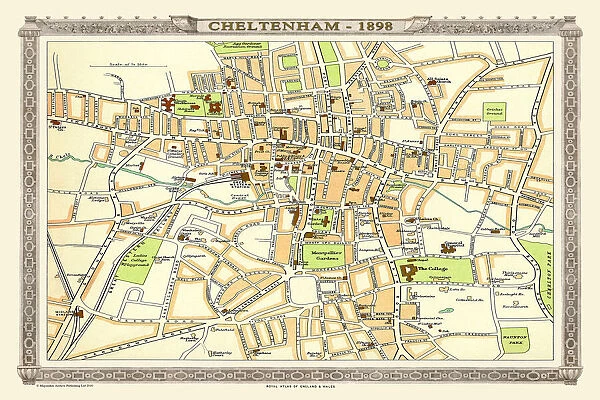
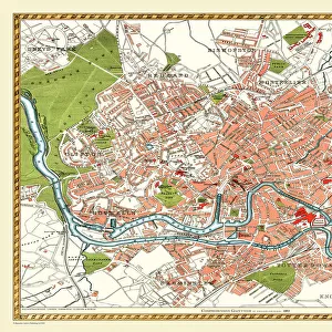
Old Map of Central Cheltenham 1898 from the Royal Atlas by Bartholomew
![]()

Wall Art and Photo Gifts from MapSeeker
Old Map of Central Cheltenham 1898 from the Royal Atlas by Bartholomew
A fine very detailed town plan of Cheltenham from 1898 remastered from an original contained within " The Royal Atlas of England and Wales" ; edited by J.G. Bartholomew, published by George Newnes, Limited, London
Welcome to the Mapseeker Image library and enter an historic gateway to one of the largest on-line collections of Historic Maps, Nostalgic Views, Vista's and Panorama's from a World gone by.
Media ID 20347634
Bartholomew Bartholomew Map Historic Map Old Town Plan Royal Atlas Royal Atlas Map Cheltenham
FEATURES IN THESE COLLECTIONS
> Arts
> Photorealistic artworks
> Detailed art pieces
> Masterful detailing in art
> Europe
> United Kingdom
> England
> London
> Royalty
> Europe
> United Kingdom
> England
> Maps
> Europe
> United Kingdom
> Wales
> Maps
> Europe
> United Kingdom
> Wales
> Posters
> Maps and Charts
> Related Images
> Maps and Charts
> Wales
> MapSeeker
> British Town And City Plans
> English & Welsh PORTFOLIO
EDITORS COMMENTS
This print showcases an exquisite piece of history - the "Old Map of Central Cheltenham 1898" from the renowned Royal Atlas by Bartholomew. Remastered with utmost care and attention to detail, this fine town plan offers a fascinating glimpse into the past. Transporting us back to the late 19th century, this map is a testament to the rich heritage and development of Cheltenham. Every street, building, and landmark is meticulously depicted, providing an invaluable resource for historians and enthusiasts alike. Originally featured in "The Royal Atlas of England and Wales" edited by J. G. Bartholomew and published by George Newnes Limited in London, this particular edition holds immense historical significance. It serves as a window into a time when maps were meticulously crafted works of art that showcased not only geographical information but also cultural nuances. As we explore this old town plan, we are reminded of Cheltenham's evolution over time - its bustling streets filled with horse-drawn carriages, charming Victorian architecture adorning every corner, and the vibrant energy that has shaped it into what it is today. Whether you are a resident seeking to connect with your city's roots or simply captivated by cartographic treasures like these, this historic map provides an enchanting journey through time. Let yourself be transported to 1898 as you delve into the intricacies of Cheltenham's past through this remarkable remastered print from MapSeeker.
MADE IN THE USA
Safe Shipping with 30 Day Money Back Guarantee
FREE PERSONALISATION*
We are proud to offer a range of customisation features including Personalised Captions, Color Filters and Picture Zoom Tools
SECURE PAYMENTS
We happily accept a wide range of payment options so you can pay for the things you need in the way that is most convenient for you
* Options may vary by product and licensing agreement. Zoomed Pictures can be adjusted in the Cart.

