Fraud Blocker Skip to main content

Home > Maps and Charts > World

World Collection (#5)

World maps and charts are visual representations of the Earth's surface, showing geographical features such as continents, oceans, countries, cities

6,633 Items

Background imageWorld Collection: Amsterdam city map 1895

Amsterdam city map 1895
Meyers Konversations-Lexikon. Ein Nachschlagewerk des allgemeinen Wissens, 5th edition 17 volumes Bibliographisches Institut - Leipzig 1895-1897

Background imageWorld Collection: North America political map 1895

North America political map 1895
Meyers Konversations-Lexikon. Ein Nachschlagewerk des allgemeinen Wissens, 5th edition 17 volumes Bibliographisches Institut - Leipzig 1895-1897

Background imageWorld Collection: Indiana USA map 1881

Indiana USA map 1881
Encyclopedia Britannica 9th Edition Vol XII Philadelphia j.M. Stoddart & Co 1881

Background imageWorld Collection: Illinois map 1881

Illinois map 1881
Encyclopedia Britannica 9th Edition Vol XII Philadelphia j.M. Stoddart & Co 1881

Background imageWorld Collection: Romania

Romania
Antique map of Romania

Background imageWorld Collection: Illustration of Biomes (climatic variation) on world map

Illustration of Biomes (climatic variation) on world map

Background imageWorld Collection: Fully lit Earth centered on the North Pole

Fully lit Earth centered on the North Pole

Background imageWorld Collection: A new and correct map of the world laid down according to the newest discoveries

A new and correct map of the world laid down according to the newest discoveries
XOS1765728 A new and correct map of the world laid down according to the newest discoveries and from the most exact observations, 1736 (hand coloured print) by Moll

Background imageWorld Collection: Continental Drift

Continental Drift
The world 380 million years ago during Lower Devonian Times, showing the three continents of Eur-America, Angara and Gondwanaland

Background imageWorld Collection: ROANOKE ISLAND, 1585. English settlers landing at Roanoke Island in 1585. Detail of a map, c1590

ROANOKE ISLAND, 1585. English settlers landing at Roanoke Island in 1585. Detail of a map, c1590

Background imageWorld Collection: WORLD MAP, 1ST CENTURY. World map based on the writings of Pomponius Mela

WORLD MAP, 1ST CENTURY. World map based on the writings of Pomponius Mela, Roman geographer, c43 A.D

Background imageWorld Collection: BRAZIL: MAP AND NATIVE INDIANS. Portuguese map of Brazil, 1565, depicting a family of native Indians

BRAZIL: MAP AND NATIVE INDIANS. Portuguese map of Brazil, 1565, depicting a family of native Indians, one of whom is harvesting brazilwood trees (probably Caesalpinia echinata or Sappan)

Background imageWorld Collection: VOYAGE OF THE ARGONAUTS. Voyage of the Argonauts according to Greek mythology

VOYAGE OF THE ARGONAUTS. Voyage of the Argonauts according to Greek mythology

Background imageWorld Collection: WORLD MAP, 17TH CENTURY. Nicols Visshers world map from Jan Janssons Novus Atlas, 1647-1662

WORLD MAP, 17TH CENTURY. Nicols Visshers world map from Jan Janssons Novus Atlas, 1647-1662, with scenes
WORLD MAP, 17TH CENTURY. Nicols Visshers world map from Jan Janssons " Novus Atlas, " 1647-1662, with scenes from classical mythology

Background imageWorld Collection: WORLD MAP, 1641. Engraved map of the world by Henricus Hondius, 1641

WORLD MAP, 1641. Engraved map of the world by Henricus Hondius, 1641

Background imageWorld Collection: MAP OF THE NEW WORLD, 1544. From Sebastian Munsters Cosmographia

MAP OF THE NEW WORLD, 1544. From Sebastian Munsters Cosmographia
MAP OF THE NEW WORLD, 1544. From Sebastian Munsters " Cosmographia."

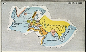
Background imageWorld Collection: WORLD MAP, c1300. Map, late 19th century, depicting the extent of knowledge of the worlds

WORLD MAP, c1300. Map, late 19th century, depicting the extent of knowledge of the worlds geography c1300, and including the route of Marco Polos return voyage from China in 1292

Background imageWorld Collection: Earth, topographic and bathymetric map

Earth, topographic and bathymetric map
Earth. Blue Marble: Next Generation cloud-free topographic and bathymetric map of the Earth in July 2004. Highlands and lowlands of the continents are shown as ridges and flat areas

Background imageWorld Collection: Toscanellis world map, 1474

Toscanellis world map, 1474
Toscanellis world map. This map was drawn by the Italian mathematician and astronomer Paolo Toscanelli (1397-1482) in 1474

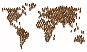
Background imageWorld Collection: Global overpopulation, conceptual artwork

Global overpopulation, conceptual artwork. Map of the world made out of babies, representing the overpopulation of the Earth. Overpopulation is thought to be a major cause of climate change

Background imageWorld Collection: Orteliuss world map, 1570

Orteliuss world map, 1570
Orteliuss world map. This world map is from the 1570 first edition of Theatrum orbis terrarum ( Theatre of the World ). Drawn by the Flemish mapmaker Abraham Ortelius (1527-1598)

Background imageWorld Collection: Orteliuss map of Portugal, 1570

Orteliuss map of Portugal, 1570
Orteliuss map of Portugal. This map is from the 1570 first edition of Theatrum orbis terrarum ( Theatre of the World ). Drawn by the Flemish mapmaker Abraham Ortelius (1527-1598)

Background imageWorld Collection: EXPL2A-00184

EXPL2A-00184
Part of the 1613 Samuel de Champlain map of New France. Hand-colored woodcut of a 19th-century reproduction of the original ma

Background imageWorld Collection: Cooks Tours to the Riviera, Italy, etc

Cooks Tours to the Riviera, Italy, etc
Poster or handbill advertising Cooks Tours to the Riviera, Italy, etc, using the London, Brighton and South Coast Railway to Newhaven and Dieppe, programme free from any office of Thomas Cook & Son

Background imageWorld Collection: First World War surveillance kite

First World War surveillance kite. US soldier being lifted up by a surveillance kite during the First World War (1914-1918)

Background imageWorld Collection: World Map / Pomponius Mela

World Map / Pomponius Mela
A world map according to Pomponius Mela, showing Europe, Africa, Asia, and the rest in the lower half

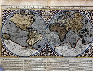
Background imageWorld Collection: World Map 1587

World Map 1587
Mercators projection, with parallel latitudinals, mentioning recent navigations such as Magellan

Background imageWorld Collection: Atlas 1587: Orbis Terrae Compendiosa Descriptio de Rumold Mercator (1546 / 48-1599)

Atlas 1587: Orbis Terrae Compendiosa Descriptio de Rumold Mercator (1546 / 48-1599), third son of Gerhard Kremer
GIA4699208 Atlas 1587: Orbis Terrae Compendiosa Descriptio de Rumold Mercator (1546/48-1599), third son of Gerhard Kremer, known as Gerardus Mercator

Background imageWorld Collection: British army medics bandaging a dogs paw in the trenches, World War I (litho)

British army medics bandaging a dogs paw in the trenches, World War I (litho)
7149431 British army medics bandaging a dogs paw in the trenches, World War I (litho) by Hatherell, William (1855-1928) (after); Private Collection; (add.info)

Background imageWorld Collection: The Roman Emperor Caligula entertaining his favourite horse, Incitatus, at supper (engraving)

The Roman Emperor Caligula entertaining his favourite horse, Incitatus, at supper (engraving)
7148832 The Roman Emperor Caligula entertaining his favourite horse, Incitatus, at supper (engraving) by English School, (19th century); Private Collection; (add.info)

Background imageWorld Collection: The Plum Pudding in Danger or State Epicures taking un Petit Souper, 1805 (engraving)

The Plum Pudding in Danger or State Epicures taking un Petit Souper, 1805 (engraving)
7088732 The Plum Pudding in Danger or State Epicures taking un Petit Souper, 1805 (engraving) by Gillray, James (1757-1815); Private Collection; (add.info)

Background imageWorld Collection: Map: City of Glasgow, drawn and engraved by G H Swanston, Edinburgh (colour litho)

Map: City of Glasgow, drawn and engraved by G H Swanston, Edinburgh (colour litho)
6004702 Map: City of Glasgow, drawn and engraved by G H Swanston, Edinburgh (colour litho) by English School, (19th century); Private Collection; (add.info.: City of Glasgow)

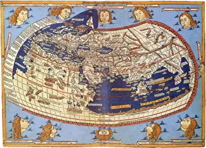
Background imageWorld Collection: Map of Ptolemy published in 1482

Map of Ptolemy published in 1482
GIA4812936 Map of Ptolemy published in 1482. by Unknown Artist, (15th century); Pinacoteca di Brera, Milan, Italy; (add.info.: Map of Ptolemy published in 1482.); eGiancarlo Costa; out of copyright

Background imageWorld Collection: View of the Island of Saint Helena, early 19th century

View of the Island of Saint Helena, early 19th century, taken from a recent English map. Handcoloured copperplate engraving by Andrea Bernieri after an illustration by Beaugean from Giulio Ferrarios

Background imageWorld Collection: American admiral Chester W Nimitz, Commander in Chief of the US Pacific Fleet, World War II

American admiral Chester W Nimitz, Commander in Chief of the US Pacific Fleet, World War II, 1941-1945 (photo)
6015170 American admiral Chester W Nimitz, Commander in Chief of the US Pacific Fleet, World War II, 1941-1945 (photo) by American Photographer (19th century) (after); Private Collection; (add.info)

Background imageWorld Collection: Antique Double-Hemisphere World Map, 1686 (coloured coloured engraving

Antique Double-Hemisphere World Map, 1686 (coloured coloured engraving
2630127 Antique Double-Hemisphere World Map, 1686 (coloured coloured engraving by Bormeester, Joachim (d.1702); Private Collection; (add.info)

Background imageWorld Collection: Map of Valencia, from Civitates Orbis Terrarum

Map of Valencia, from Civitates Orbis Terrarum
STC138966 Map of Valencia, from Civitates Orbis Terrarum by Georg Braun (1541-1622) and Frans Hogenberg (1535-90) c.1572-1617 (coloured engraving) by Hoefnagel

Background imageWorld Collection: Historical World Events map 2015 UK version

Historical World Events map 2015 UK version
A world map originally published in 2015, reproduced from the internationally famousCollins Bartholomew World Through Timehistoric cartographic archive

Background imageWorld Collection: Neri to Akra, c1915. Creator: Stanfords Geographical Establishment

Neri to Akra, c1915. Creator: Stanfords Geographical Establishment
Neri to Akra, c1915. Map showing the journey of British writer, soldier and diplomatic advisor Mark Sykes in Turkey, (at that time part of the Ottoman Empire)

Background imageWorld Collection: Advert for Asprey selection of household items 1937

Advert for Asprey selection of household items 1937
Selection of items from Asprey, Bond Street: Glass luminous World lamp, gentlemans pigskin compactus case with ivory fittings, miniature reproduction clock in walnut, brocade evening bag

Background imageWorld Collection: 1855, Colton Map of Minnesota, topography, cartography, geography, land, illustration

1855, Colton Map of Minnesota, topography, cartography, geography, land, illustration
1855, Colton Map of Minnesota

Background imageWorld Collection: 1750, Homann Heirs Map of Poland, topography, cartography, geography, land, illustration

1750, Homann Heirs Map of Poland, topography, cartography, geography, land, illustration
1750, Homann Heirs Map of Poland

Background imageWorld Collection: 1890, Bacon Travelers Pocket Map of London, England, topography, cartography

1890, Bacon Travelers Pocket Map of London, England, topography, cartography
1890, Bacon Travelers Pocket Map of London, England

Background imageWorld Collection: 1865, Spruner Map of Israel, Canaan, or Palestine in Ancient Times, topography, cartography

1865, Spruner Map of Israel, Canaan, or Palestine in Ancient Times, topography, cartography
1865, Spruner Map of Israel, Canaan, or Palestine in Ancient Times

Background imageWorld Collection: 1863, Cassells Dispatch Atlas Map of Taiwan, Formosa and the Hainan Coast of China

1863, Cassells Dispatch Atlas Map of Taiwan, Formosa and the Hainan Coast of China

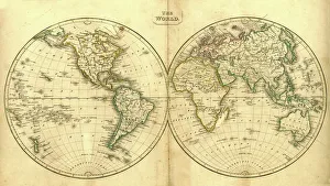
Background imageWorld Collection: World western hemispheres 1883

World western hemispheres 1883
Warrens Common School Geography

Background imageWorld Collection: Antique India Map

Antique India Map
India Map, - Antique style. Includes mountains and water bodies. High detail - vector illustration

Background imageWorld Collection: Antique Finland Map

Antique Finland Map
Finland Map, - Antique style. Includes mountains and water bodies. High detail - vector illustration

Background imageWorld Collection: Wilhelmshaven. Germany

Wilhelmshaven. Germany
Antique illustration of a Wilhelmshaven, Germany map

Background imageWorld Collection: Two of the pilots of the Coastal Command of the Royal Air Force who took part in

Two of the pilots of the Coastal Command of the Royal Air Force who took part in the location of the German oil tanker and supply vessel Altmark in neutral Norwegian waters during the Second World

Background imageWorld Collection: Historical World Events map 2017 UK version

Historical World Events map 2017 UK version
A world map originally published in 2017, reproduced from the internationally famousCollins Bartholomew World Through Timehistoric cartographic archive

Background imageWorld Collection: Historical World Events map 1951 UK version

Historical World Events map 1951 UK version
A world map originally published in 1951, reproduced from the internationally famousCollins Bartholomew World Through Timehistoric cartographic archive

Background imageWorld Collection: Illustration style Kyoto city map

Illustration style Kyoto city map
Kyoto city of world cultural heritage

Background imageWorld Collection: World Map Physical Vector

World Map Physical Vector

Background imageWorld Collection: WW1 - Royal Air Force - Pilots and Observers mark targets

WW1 - Royal Air Force - Pilots and Observers mark targets
WW1 - Royal Air Force - Pilots and Observers mark enemy german targets and positions. Date: circa 1918

Background imageWorld Collection: Factors governing an invasion by G. H. Davis

Factors governing an invasion by G. H. Davis
The situation of Britain face to face with a German north-west Europe: factors governing an invasion during the Second World War

Background imageWorld Collection: 1818, Pinkerton Map of Chile, John Pinkerton, 1758 - 1826, Scottish antiquarian, cartographer

1818, Pinkerton Map of Chile, John Pinkerton, 1758 - 1826, Scottish antiquarian, cartographer, UK

Background imageWorld Collection: 1706, De La Feuille Map of Europe, topography, cartography, geography, land, illustration

1706, De La Feuille Map of Europe, topography, cartography, geography, land, illustration
1706, De La Feuille Map of Europe

Background imageWorld Collection: 1784, Bocage Map of the City of Athens in Ancient Greece, topography, cartography

1784, Bocage Map of the City of Athens in Ancient Greece, topography, cartography
1784, Bocage Map of the City of Athens in Ancient Greece

Background imageWorld Collection: 1865, Spruner Map of the British Isles, England, Scotland, Ireland, topography, cartography

1865, Spruner Map of the British Isles, England, Scotland, Ireland, topography, cartography
1865, Spruner Map of the British Isles, England, Scotland, Ireland

Background imageWorld Collection: 1864, Johnson Map of Washington, Oregon, and Idaho, topography, cartography, geography

1864, Johnson Map of Washington, Oregon, and Idaho, topography, cartography, geography
1864, Johnson Map of Washington, Oregon, and Idaho

Background imageWorld Collection: 1839, Bradford Map of New York City, New York, topography, cartography, geography

1839, Bradford Map of New York City, New York, topography, cartography, geography
1839, Bradford Map of New York City, New York

Background imageWorld Collection: 1770, Bonne Map of China, Korea, Japan and Formosa, Rigobert Bonne 1727 - 1794, one

1770, Bonne Map of China, Korea, Japan and Formosa, Rigobert Bonne 1727 - 1794, one of the most important cartographers of the late 18th century

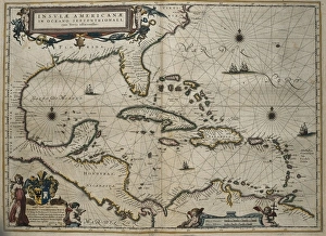
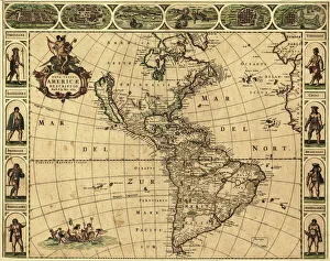
Background imageWorld Collection: 1683, Mortier Map of North America, the West Indies, and the Atlantic Ocean, topography

1683, Mortier Map of North America, the West Indies, and the Atlantic Ocean, topography
1683, Mortier Map of North America, the West Indies, and the Atlantic Ocean

Background imageWorld Collection: 1570, Ortelius Map of Asia, first edition, Abraham Ortelius, also Orthellius, 1527 - 1598

1570, Ortelius Map of Asia, first edition, Abraham Ortelius, also Orthellius, 1527 - 1598, Flemish, Netherlandish cartographer and geographer

Background imageWorld Collection: Australia Map Gotha, Justus Perthes, 1872, Atlas

Australia Map Gotha, Justus Perthes, 1872, Atlas. Perthes, Johan Georg Justus 1749 aa 1816, German publisher, was born in Rudolstadt in 1749

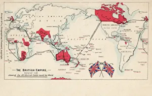
Background imageWorld Collection: British Empire throughout the World (coloured engraving)

British Empire throughout the World (coloured engraving)
XCF275033 British Empire throughout the World (coloured engraving) by English School, (19th century); Private Collection; English, out of copyright

Background imageWorld Collection: Marco Polo (1254-1324) from the Sala del Mappamondo (Hall of the World Maps)

Marco Polo (1254-1324) from the Sala del Mappamondo (Hall of the World Maps)
XIR184034 Marco Polo (1254-1324) from the Sala del Mappamondo (Hall of the World Maps) (fresco) by Varese, Antonio Giovanni de (16th century); Villa Farnese, Caprarola, Lazio, Italy; Italian

Background imageWorld Collection: Peru and the Amazon, detail from a world atlas, 1565 (vellum)

Peru and the Amazon, detail from a world atlas, 1565 (vellum)
XJL208771 Peru and the Amazon, detail from a world atlas, 1565 (vellum) by Homem, Diego (16th century); The National Library of Russia, St. Petersburg, Russia; Portuguese, out of copyright

Background imageWorld Collection: Columbus Voyages

Columbus Voyages
1889: A map of the four voyages of the Italian navigator, Christopher Columbus (1451 - 1506), from The Worlds Great Explorers, by J Scott Keltic, (London 1889). (Photo by Hulton Archive/Getty Images)

Background imageWorld Collection: General Alexei Brusilov

General Alexei Brusilov
Aleksei Brusilov (1853 1926), Russian general in World War One, looking at a map with a magnifying glass to aid him

Background imageWorld Collection: Orteliuss map of Holland, 1570

Orteliuss map of Holland, 1570
Orteliuss map of Holland. This map is from the 1570 first edition of Theatrum orbis terrarum ( Theatre of the World ). Drawn by the Flemish mapmaker Abraham Ortelius (1527-1598)

Background imageWorld Collection: World Map / Overland India

World Map / Overland India
The overland routes from England to India, compared with sea routes

Background imageWorld Collection: World Map / Leipzig Codex

World Map / Leipzig Codex
A German map of the world, showing various cities, rivers and seas

Background imageWorld Collection: MAPS / WORLD / 1827

MAPS / WORLD / 1827
World map

Background imageWorld Collection: Maps / World / Currents

Maps / World / Currents
World map of the ocean currents

Background imageWorld Collection: Brazil & Bras Portrait

Brazil & Bras Portrait
A map of Brazil with a portrait of its then president Venceslau Bras. Brazil had declared war on Germany in 1917 during World War One

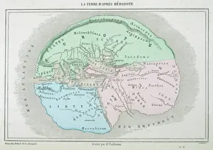
Background imageWorld Collection: Maps / World / Herodotus

Maps / World / Herodotus
The world as known to Herodotus

Background imageWorld Collection: Map of Australia with states, cities and flag

Map of Australia with states, cities and flag
Highly detailed vector map of Australia with states, capitals and big cities

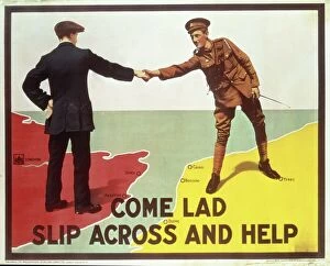
Background imageWorld Collection: British Military Recruitment Poster, WW1

British Military Recruitment Poster, WW1
Recruitment poster, Boys Come over here youre wanted. Colour lithograph published by the Parliamentary Recruiting Committee, Poster No 82, printed by David Allen and Sons Ltd, Harrow, Middlesex

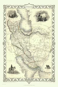
Background imageWorld Collection: 1818, Pinkerton Map of Persia, Iran, Afghanistan, John Pinkerton, 1758 - 1826, Scottish

1818, Pinkerton Map of Persia, Iran, Afghanistan, John Pinkerton, 1758 - 1826, Scottish antiquarian, cartographer, UK

Background imageWorld Collection: Map of Australia

Map of Australia
With an area of 7, 617, 930 km², Australia is slightly smaller than the continental United States (without Alaska) and is the sixth-largest country in the world

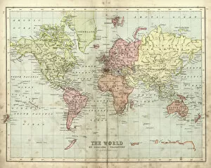
Background imageWorld Collection: Old map of the World Map, Published 1894

Old map of the World Map, Published 1894
Antique Illustration. Copyright has expired on this artwork. From my own archives, digitally restored

Background imageWorld Collection: Old Map of the World 1945

Old Map of the World 1945
WMY1945


All Professionally Made to Order for Quick Shipping


-

World Collection

World maps and charts are visual representations of the Earth's surface, showing geographical features such as continents, oceans, countries, cities, rivers and mountains. They have been used for centuries to aid navigation, exploration and education. Maps can be created using various techniques including satellite imagery or hand-drawn illustrations. Charts are graphical representations of data that help people understand complex information in a simplified manner. Examples include population growth rates or economic indicators by country. Both maps and charts are important tools for understanding our world and making informed decisions about global issues such as climate change or international trade policies.
+

Our beautiful Wall Art and Photo Gifts include Framed Prints, Photo Prints, Poster Prints, Canvas Prints, Jigsaw Puzzles, Metal Prints and so much more

The World collection from Media Storehouse is a stunning array of wall art and framed prints that showcase the beauty and diversity of our planet. Featuring an extensive range of maps, charts, and diagrams, our collection offers something for everyone – from vintage world maps to modern satellite imagery. Each print is carefully crafted using high-quality materials to ensure that it looks great in any setting. Whether you're looking for a piece to decorate your home or office, or simply want to add some visual interest to your space, the World collection has something for you. With its wide variety of styles and subjects, our collection is perfect for anyone who loves travel, geography, history or science. So why not explore the world from the comfort of your own home with one of these beautiful prints?
+

What are World (Maps and Charts) art prints?

World maps and charts art prints are high-quality reproductions of historical or contemporary maps and charts that depict the geography, topography, political boundaries, and other features of different regions of the world. These prints can be used for decorative purposes in homes, offices, schools, museums, libraries or any other setting where a visual representation of global locations is needed. World maps and charts art prints come in various sizes to suit different spaces and preferences. They may feature antique designs from centuries ago or modern interpretations with updated information on countries' borders and names. Some popular styles include vintage world maps with sepia tones or muted colors; colorful political maps highlighting specific regions such as Europe or Africa; nautical charts showing ocean depths and currents; or satellite images displaying terrain details. Whether you're a history buff looking to decorate your study room with an old-world map print or a traveler seeking inspiration for your next adventure destination, World Maps & Charts Art Prints offer something for everyone's taste.
+

What World (Maps and Charts) art prints can I buy from Media Storehouse?

We offer a wide range of World Maps and Charts art prints that are perfect for decorating your home or office. You can choose from vintage maps, antique charts, modern world maps, satellite images of the earth, and many more options. These art prints come in various sizes to suit your needs and preferences. The collection includes detailed maps of different countries and continents such as Europe, Africa, Asia, North America, South America among others. The prints also feature famous landmarks like the Eiffel Tower in Paris or the Statue of Liberty in New York City. Moreover, you can find educational charts on topics like geography or astronomy that are ideal for classrooms. Our World Maps and Charts art prints are printed using high-quality materials to ensure they last a long time without fading or losing their vibrancy. They make great gifts for anyone who loves travel or wants to learn more about our planet's geography.
+

How do I buy World (Maps and Charts) art prints?

To purchase World art prints from Media Storehouse, you can browse our extensive collection of high-quality images online. Once you have found the print that you would like to buy, simply add it to your cart and proceed to checkout. At this point, you will be prompted to enter your shipping and payment information. We offer a variety of sizes for their art prints, so be sure to select the size that best fits your needs. You may also have the option to choose between different paper types or finishes. Once your order has been processed, Media Storehouse will carefully package your print and ship it directly to your doorstep. Whether you are looking for a unique piece of wall decor or a thoughtful gift for someone special, World art prints from Media Storehouse are an excellent choice for anyone who loves geography or history.
+

How much do World (Maps and Charts) art prints cost?

We offer a wide range of World Maps and Charts art prints that are available at varying prices. The cost of our World Maps and Charts art prints depends on the size, quality, and type of print you choose. We have different options such as canvas prints, framed prints, photographic prints, and poster prints. Our World Maps and Charts art prints come in various sizes ranging from small to large formats. The price also varies depending on whether you want a black-and-white or colored print. Our collection features vintage maps as well as contemporary designs that cater to different tastes. We take pride in providing high-quality products at affordable prices without compromising on the quality of our artwork. You can be sure that every piece is carefully crafted with attention to detail using premium materials. The cost of our World Maps and Charts art prints is reasonable considering their quality and uniqueness. Whether you're looking for a statement piece for your home or office space or an educational tool for your classroom, we have something for everyone's budget.
+

How will my World (Maps and Charts) art prints be delivered to me?

We take great care in delivering your World art prints to you. We use a trusted courier service to ensure that your order arrives safely and on time. Your print will be carefully packaged in protective materials to prevent any damage during transit. We offer a range of delivery options for our customers, including standard shipping and express delivery for those who need their order sooner. Once your order has been dispatched, you will receive an email with tracking information so that you can keep track of its progress. Our team is committed to providing excellent customer service, so if you have any questions or concerns about the delivery of your World art prints, please do not hesitate to get in touch with us. We are always happy to help.
© Copyright Media Storehouse, All Rights Reserved 2003 - 2024
Facebook     Pinterest     100% Payment Secure     Reviews IO