Fraud Blocker Skip to main content

Home > Maps and Charts > Related Images

Related Images Collection (page 44)

49,976 items

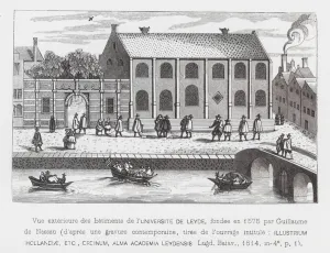
Background imageRelated Images Collection: University of Leiden, Netherlands, 1614 (engraving)

University of Leiden, Netherlands, 1614 (engraving)
7185766 University of Leiden, Netherlands, 1614 (engraving) by Dutch School, (17th century) (after); Private Collection; (add.info.: University of Leiden, founded in 1575 by William)

Background imageRelated Images Collection: Narrow streets less than 30 feet wide, City of London, 1939 (colour litho)

Narrow streets less than 30 feet wide, City of London, 1939 (colour litho)
7201423 Narrow streets less than 30 feet wide, City of London, 1939 (colour litho) by English School, (20th century); Private Collection; (add.info)

Background imageRelated Images Collection: British soldiers of the Life Guards at the Battle of Waterloo, 1815 (colour litho)

British soldiers of the Life Guards at the Battle of Waterloo, 1815 (colour litho)
7153967 British soldiers of the Life Guards at the Battle of Waterloo, 1815 (colour litho) by Stewart, J. A. (19th Century); Private Collection; (add.info)

Background imageRelated Images Collection: On the Allan Water, at Dunblane (b / w photo)

On the Allan Water, at Dunblane (b / w photo)
7198767 On the Allan Water, at Dunblane (b/w photo) by English Photographer, (19th century); Private Collection; (add.info.: On the Allan Water, at Dunblane)

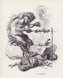
Background imageRelated Images Collection: Ogre cooking people for breakfast (litho)

Ogre cooking people for breakfast (litho)
7149264 Ogre cooking people for breakfast (litho) by Kley, Heinrich (1863-1945); Private Collection; (add.info.: Ogre cooking people for breakfast)

Background imageRelated Images Collection: Warrington Church, Lancashire (engraving)

Warrington Church, Lancashire (engraving)
7169858 Warrington Church, Lancashire (engraving) by English School, (19th century); Private Collection; (add.info.: Warrington Church, Lancashire)

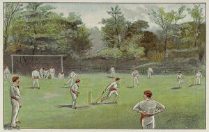
Background imageRelated Images Collection: Cricket field, Bournville, Birmingham (chromolitho)

Cricket field, Bournville, Birmingham (chromolitho)
7172124 Cricket field, Bournville, Birmingham (chromolitho) by English School, (19th century); Private Collection; (add.info.: Cricket field, Bournville, Birmingham)

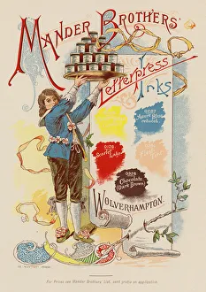
Background imageRelated Images Collection: Advertisement for Mander Brothers letterpress inks (colour litho)

Advertisement for Mander Brothers letterpress inks (colour litho)
7200706 Advertisement for Mander Brothers letterpress inks (colour litho) by English School, (19th century); Private Collection; (add.info.: Advertisement for Mander Brothers letterpress inks)

Background imageRelated Images Collection: Espoir II (Hope II). Peinture de Gustav Klimt (1862-1918), huile sur toile, or et collage, 1907-1908

Espoir II (Hope II). Peinture de Gustav Klimt (1862-1918), huile sur toile, or et collage, 1907-1908
FIA5377735 Espoir II (Hope II). Peinture de Gustav Klimt (1862-1918), huile sur toile, or et collage, 1907-1908. Art autrichien, debut 20e siecle. MOMA (Museum of Modern Art), New York (USA)

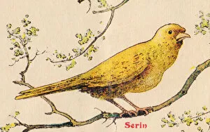
Background imageRelated Images Collection: ALPHABET OF BIRDS for... S: Serin, circa 1925 (illustration)

ALPHABET OF BIRDS for... S: Serin, circa 1925 (illustration)
7206958 ALPHABET OF BIRDS for... S: Serin, circa 1925 (illustration) by French School, (20th century); 25, 5x17, 10 cm; Private Collection; (add.info.: S: Serin, ALPHABET OF BIRDS for)

Background imageRelated Images Collection: Isle of Man: Harbour, Old Laxey (b / w photo)

Isle of Man: Harbour, Old Laxey (b / w photo)
7191437 Isle of Man: Harbour, Old Laxey (b/w photo) by English Photographer, (19th century); Private Collection; (add.info.: Harbour, Old Laxey)

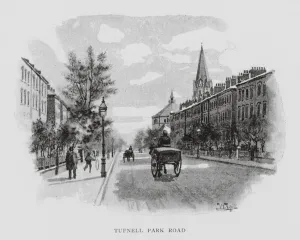
Background imageRelated Images Collection: Tufnell Park Road (litho)

Tufnell Park Road (litho)
7188632 Tufnell Park Road (litho) by Luker, William (1820-92); Private Collection; (add.info.: Tufnell Park Road. Illustration for London City Suburbs As They Are To-day by Percy Fitzgerald)

Background imageRelated Images Collection: Trick cyclist Diavolo performing a loop the loop at the Royal Aquarium, London (litho)

Trick cyclist Diavolo performing a loop the loop at the Royal Aquarium, London (litho)
7172759 Trick cyclist Diavolo performing a loop the loop at the Royal Aquarium, London (litho) by English School, (20th century); Private Collection; (add.info)

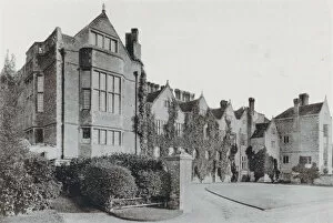
Background imageRelated Images Collection: Bramshill, Hampshire (b / w photo)

Bramshill, Hampshire (b / w photo)
7178862 Bramshill, Hampshire (b/w photo) by English Photographer, (19th century); Private Collection; (add.info.: Bramshill, Hampshire)

Background imageRelated Images Collection: Pamir, one of the last commercial sailing ships, off Sydney Heads, Australia (b / w photo)

Pamir, one of the last commercial sailing ships, off Sydney Heads, Australia (b / w photo)
7156948 Pamir, one of the last commercial sailing ships, off Sydney Heads, Australia (b/w photo) by Australian Photographer (20th century); Private Collection; (add.info.: Pamir)

Background imageRelated Images Collection: Hafod House, Cardiganshire (engraving)

Hafod House, Cardiganshire (engraving)
7159317 Hafod House, Cardiganshire (engraving) by Gastineau, Henry (1791-1876) (after); Private Collection; (add.info.: Hafod House, Cardiganshire)

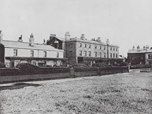
Background imageRelated Images Collection: Royal Hotel (b / w photo)

Royal Hotel (b / w photo)
7156859 Royal Hotel (b/w photo) by English Photographer, (19th century); Private Collection; (add.info.: Royal Hotel. Illustration for 12 Photographic Views of Waterloo [Merseyside])

Background imageRelated Images Collection: Map Room JLP01_08_077525

Map Room JLP01_08_077525
University of Nottingham, Sir Clive Grainger Building, University Park, Nottingham. The map room in a new building for the Faculty of Law and Social Sciences at the University of Nottingham

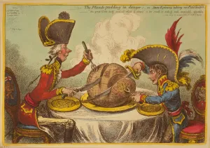
Background imageRelated Images Collection: The Plum Pudding in Danger or State Epicures taking un Petit Souper, 1805 (engraving)

The Plum Pudding in Danger or State Epicures taking un Petit Souper, 1805 (engraving)
7088732 The Plum Pudding in Danger or State Epicures taking un Petit Souper, 1805 (engraving) by Gillray, James (1757-1815); Private Collection; (add.info)

Background imageRelated Images Collection: Antique map of Mainz Germany 1896

Antique map of Mainz Germany 1896
Map of Mainz Germany 1896 Original edition from my own archives Source : Brockhaus 1896

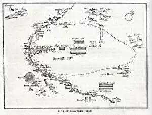
Background imageRelated Images Collection: Plan of Bosworth Field, Battle of Bosworth, near Leicester, 22 August 1485

Plan of Bosworth Field, Battle of Bosworth, near Leicester, 22 August 1485, towards the end of the Wars of the Roses (1455-1487). Date: 1485

Background imageRelated Images Collection: Map showing the principal world trade shipping routes, 1912 (colour litho)

Map showing the principal world trade shipping routes, 1912 (colour litho)
CHT277054 Map showing the principal world trade shipping routes, 1912 (colour litho) by French School, (20th century); Private Collection; (add.info)

Background imageRelated Images Collection: Anatomy of the Apis, No. XXVII, Leuckarts Zoological Wall Chart

Anatomy of the Apis, No. XXVII, Leuckarts Zoological Wall Chart
HMB306152 Anatomy of the Apis, No.XXVII, Leuckarts Zoological Wall Chart, 1877-98 (colour litho) by German School, (19th century); 137x101 cm; Humboldt-Universitaet, Berlin

Background imageRelated Images Collection: Map of the province of Mantova (Italy) (Engraving, 1717)

Map of the province of Mantova (Italy) (Engraving, 1717)
LRI4712986 Map of the province of Mantova (Italy) (Engraving, 1717) by Nolin, Jean-Baptiste (c.1657-1708); Private Collection; (add.info.: Map of the Duche of Mantua (Lombardy)

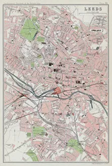
Background imageRelated Images Collection: Leeds (colour litho)

Leeds (colour litho)
3648442 Leeds (colour litho) by English School, (20th century); Private Collection; (add.info.: Leeds. Illustration for The Survey Gazetteer of the British Isles, Topographical)

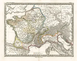
Background imageRelated Images Collection: Antique Map of Gaul

Antique Map of Gaul
Antique Map from 1862 of Gaul at the time of Julius Caesar. The Roman proconsul and general Julius Caesar pushed his army into Gaul in 58 BC

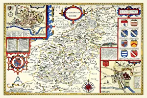
Background imageRelated Images Collection: Old County Map of Northamptonshire 1611 by John Speed

Old County Map of Northamptonshire 1611 by John Speed
A facimile of John Speeds historical map of Northamptonshire originally published for the " Theatre of the Empire of Great Britain"

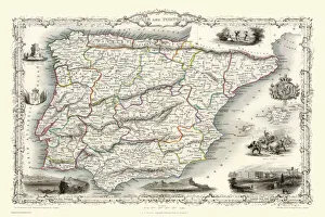
Background imageRelated Images Collection: Spain & Portugal 1851

Spain & Portugal 1851
A fine facimile artworked from an antique original map of Spain and Portugal, issued as part of the 1851 edition of John Tallis and Companys " The Illustrated Atlas

Background imageRelated Images Collection: A Phrenological Map Of The Human Brain

A Phrenological Map Of The Human Brain

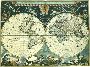
Background imageRelated Images Collection: Nova et Accuratissima Totius Terrarum

Nova et Accuratissima Totius Terrarum
Double Hemisphere Map 1662, Blaeu, Joan

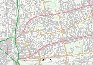
Background imageRelated Images Collection: Tower Hamlets E2 7 Map

Tower Hamlets E2 7 Map
Postcode Sector Map of Tower Hamlets E2 7

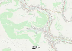
Background imageRelated Images Collection: Rhondda Cynon Taf CF40 2 Map

Rhondda Cynon Taf CF40 2 Map
Postcode Sector Map of Rhondda Cynon Taf CF40 2

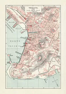
Background imageRelated Images Collection: Historical city map of Trieste, Italy, lithograph, published in 1897

Historical city map of Trieste, Italy, lithograph, published in 1897
Historical city map of Trieste, Italy (formerly Austria). Lithograph, published in 1897

Background imageRelated Images Collection: City map of Stuttgart, Baden-WAOErttemberg, Germany, lithograph, published in 1897

City map of Stuttgart, Baden-WAOErttemberg, Germany, lithograph, published in 1897
Historical city map of Stuttgart, capital of Baden-Wurttemberg in Germany. Lithograph, published in 1897

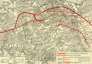
Background imageRelated Images Collection: positions in the Battle of Verdun, northern France, First World War, 1916, (c1920)

positions in the Battle of Verdun, northern France, First World War, 1916, (c1920)
French and German positions in the Battle of Verdun, northern France, First World War, 1916, (c1920). Solid red line indicates French

Background imageRelated Images Collection: Topographic map of Sardinia, Italy, wood engraving, published 1897

Topographic map of Sardinia, Italy, wood engraving, published 1897
Topographic map of Sardinia, Italy - second-largest island in the Mediterranean Sea. Wood engraving, published in 1897

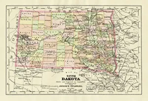
Background imageRelated Images Collection: Map of South Dakota 1894

Map of South Dakota 1894
Johnsons Universal Cyclopedia - Volume IV New York - A. J. Johnson Company 1894

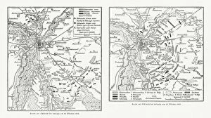
Background imageRelated Images Collection: Maps of Battle of Leipzig, Napolionic wars, 1813, published 1897

Maps of Battle of Leipzig, Napolionic wars, 1813, published 1897
Maps of the Battle of the Nations near Leipzig from 16 to 19 October 1813, Saxony, Germany. Wood engravings, published in 1897

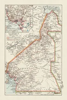
Background imageRelated Images Collection: Topographic map of Cameroon, lithograph, published in 1897

Topographic map of Cameroon, lithograph, published in 1897
Topographic map of Cameroon, during the German colonial era at the end of the 19th century. Lithograph, published in 1897

Background imageRelated Images Collection: Historical city map of Recife, Pernambuco, Brazil, wood engraving, published 1897

Historical city map of Recife, Pernambuco, Brazil, wood engraving, published 1897
Historical city map of Recife, Pernambuco, Brazil. Wood engraving, published in 1897

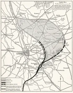
Background imageRelated Images Collection: Map Showing The Ypres Salient Before And After The Second Battle Of Ypres April And May 13 1915

Map Showing The Ypres Salient Before And After The Second Battle Of Ypres April And May 13 1915. From The Great World War A History Volume Iii, Published 1916

Background imageRelated Images Collection: Map Of Germany, Bohemia And Hungary, Circa. 1760. From 'Atlas De Toutes Les Parties Connues Du

Map Of Germany, Bohemia And Hungary, Circa. 1760. From "Atlas De Toutes Les Parties Connues Du Globe Terrestre
Map Of Germany, Bohemia And Hungary, Circa.1760. From " Atlas De Toutes Les Parties Connues Du Globe Terrestre " By Cartographer Rigobert Bonne. Published Geneva Circa. 1760

Background imageRelated Images Collection: Map Of The World Showing In Red The Extent Of The British Empire In 1901

Map Of The World Showing In Red The Extent Of The British Empire In 1901

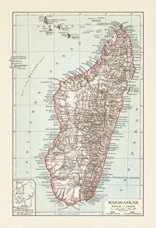
Background imageRelated Images Collection: Topografic map of Madagascar, lithograph, published in 1897

Topografic map of Madagascar, lithograph, published in 1897
Topografic map of Madagascar. Lithograph, published in 1897

Background imageRelated Images Collection: Map of the Battle of Jena and Auerstedt (AuerstAÔé¼dt) 1806

Map of the Battle of Jena and Auerstedt (AuerstAÔé¼dt) 1806
Illustration of a Map of the Battle of Jena and Auerstedt (AuerstAÔé¼dt) 1806

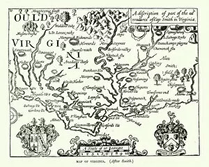
Background imageRelated Images Collection: Map of Virginia, 17th Century After Captain John Smith

Map of Virginia, 17th Century After Captain John Smith
Vintage engraving of a Map of Virginia, 17th Century After Captain John Smith

Background imageRelated Images Collection: Map - British Antarctic Expedition 1910-13. Track Chart of Main Southern Journey, 1913

Map - British Antarctic Expedition 1910-13. Track Chart of Main Southern Journey, 1913. The final expedition of British Antarctic explorer Captain Robert Falcon Scott (1868-1912)

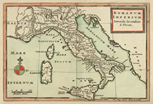
Background imageRelated Images Collection: Antique Map of Italy 1732

Antique Map of Italy 1732
Mediterranean Countries, Antique Maps, 91822666


All Professionally Made to Order for Quick Shipping


-

Why Choose Us?

We are a leading provider of Art Prints and Photo Gifts since 2003, working in partnership with a range of Sporting Clubs, Charities, Museums and Picture Libraries. A large share of profits from any of their images will go directly towards supporting that charity or club. Our archive of images is carefully curated to bring you a wide range of subjects, including landscapes, wildlife, architecture, and more. We ship from our partner labs in the UK, USA, EU (Netherlands) and Australia.
+

How do I place an order?

Ordering is quick & easy - Just follow 5 Simple Steps:
  1. Find your image: Use our search box or browse our online photo Collections to find the image you want.

  2. Choose your print format: Select your desired product and add it to your cart.

  3. Enter your details: If you're a returning customer, simply enter your email address and password, and we'll fill in your billing and shipping address details. All personal details are held securely and are fully GDPR compliant. As standard, we remove all Personally Identifiable Information after 12 months.

  4. Pay for your purchase: We use state-of-the-art security for online shopping and do not have access to your card details.

  5. Sit back and relax: We'll email you confirmation of your order and when it's dispatched. Registered customers can also track orders in the 'My Account' area.

+

How do I pay for an order?

You can pay for your order with most of the major credit and debit cards, or PayPal. For added security, major financial institutions process payment details separately and securely on our behalf. We do not have access to your online payment card details. Online payments are preferred however we do take phone orders. For UK customers only we accept cheques issued against a UK bank.
+

Is my data safe?

We take data security very seriously. We do not have access to your full card details and all payments are requested over a fully secure connection. Additionally, we fully comply with current European and GDPR legislation, and automatically remove all personal data after at most 12 months (unless you have an account with us and have signed in recently). We also have a strict opt-in policy and would never sell your personal details. Your data is only used to fulfill your order promptly and efficiently.
+

Is wall art ready to hang?

For quick and easy installation all wall art, including framed prints, canvas prints and metal prints are supplied with a ready to hang solution on the back. Generally, saw tooth hangers are applied as they allow wall art to hang flush against the wall. The serrated edge of the hanger prevents the frame from shifting or tilting when hung.
+

Are the photo prints fade resistant?

Yes, we use archival quality photo paper photographic paper for vivid reproduction Prints are an accurate representations of the original artwork, which is preserved for artistic character and authenticity. We guarantee they match previews shown on our web site