Fraud Blocker Skip to main content

Home > Maps and Charts > Related Images

Related Images Collection (page 100)

50,000 items

Background imageRelated Images Collection: S. Phelipe de Porto Bello, 1778 (print)

S. Phelipe de Porto Bello, 1778 (print)
7339126 S. Phelipe de Porto Bello, 1778 (print) by Surville, Luis de (fl.1777); 76.2x63.5 cm; National Maritime Museum, London

Background imageRelated Images Collection: Chart of the western Mediterrean showing the north African and Spanish coasts

Chart of the western Mediterrean showing the north African and Spanish coasts, 17th century (ink on vellum)
7339121 Chart of the western Mediterrean showing the north African and Spanish coasts, 17th century (ink on vellum) by Unknown Artist, (17th century); 151.8x274.3 cm; National Maritime Museum

Background imageRelated Images Collection: Chart of the Mediterrean, showing Italy and the north African coast, 17th century (ink on vellum)

Chart of the Mediterrean, showing Italy and the north African coast, 17th century (ink on vellum)
7339119 Chart of the Mediterrean, showing Italy and the north African coast, 17th century (ink on vellum) by Unknown Artist, (17th century); 76.2x106.7 cm; National Maritime Museum, London

Background imageRelated Images Collection: First World War: France, Propaganda map showing the photo of an Alsatian spinning wool for France

First World War: France, Propaganda map showing the photo of an Alsatian spinning wool for France, 1915
LUX4734477 First World War: France, Propaganda map showing the photo of an Alsatian spinning wool for France, 1915; (add.info.: First World War - War 14-18 (1914-1918) - World War I (WWI or WW1)

Background imageRelated Images Collection: First World War: Patriotic map showing soldiers from Africa and India in the aid of the allies

First World War: Patriotic map showing soldiers from Africa and India in the aid of the allies, 1916, Baker
LUX4744489 First World War: Patriotic map showing soldiers from Africa and India in the aid of the allies, 1916, Baker; (add.info.: World War I - War 14-18 (1914-1918) - World War I (WWI or WW1)

Background imageRelated Images Collection: First World War: Patriotic map showing a soldier taking his fiancee to see the cinema map entitled

First World War: Patriotic map showing a soldier taking his fiancee to see the cinema map entitled The Cinema
LUX4744472 First World War: Patriotic map showing a soldier taking his fiancee to see the cinema map entitled The Cinema d'Amour

Background imageRelated Images Collection: Italian patriotic map showing two fighting eagles titled l'ultimo volo, 1914

Italian patriotic map showing two fighting eagles titled l'ultimo volo, 1914
LUX4743844 Italian patriotic map showing two fighting eagles titled l'ultimo volo, 1914; (add.info.: Italian patriotic map showing two fighting eagles titled l'ultimo volo)

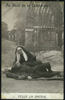
Background imageRelated Images Collection: Patriotic map showing a good sister to rescue a soldier wounds near the cathedrale of Reims in

Patriotic map showing a good sister to rescue a soldier wounds near the cathedrale of Reims in ruins map entitled Au
LUX4743817 Patriotic map showing a good sister to rescue a soldier wounds near the cathedrale of Reims in ruins map entitled Au seuil de la cathedrale pour la Patrie

Background imageRelated Images Collection: Patriotic map showing in a village of the Vosges a cure recomfort as a French soldier saying

Patriotic map showing in a village of the Vosges a cure recomfort as a French soldier saying the faith will lead our
LUX4743784 Patriotic map showing in a village of the Vosges a cure recomfort as a French soldier saying the faith will lead our blows

Background imageRelated Images Collection: First World War: Patriotic map showing a fight between the French and Germans in a village, 1915

First World War: Patriotic map showing a fight between the French and Germans in a village, 1915
LUX4744325 First World War: Patriotic map showing a fight between the French and Germans in a village, 1915, 'the resumption of the village'; (add.info)

Background imageRelated Images Collection: First World War: Patriotic Map of Allied Soldiers Fighting the Enemy, 1915, Baker, 'Towards Victory'

First World War: Patriotic Map of Allied Soldiers Fighting the Enemy, 1915, Baker, 'Towards Victory'
LUX4744324 First World War: Patriotic Map of Allied Soldiers Fighting the Enemy, 1915, Baker, 'Towards Victory'; (add.info.: World War I - War 14-18 (1914-1918) - World War I (WWI or WW1)

Background imageRelated Images Collection: First World War: Christmas Patriotic Map showing a child in a Bleriot plane thinking admiring over

First World War: Christmas Patriotic Map showing a child in a Bleriot plane thinking admiring over a dragon regiment
LUX4744256 First World War: Christmas Patriotic Map showing a child in a Bleriot plane thinking admiring over a dragon regiment

Background imageRelated Images Collection: Patriotic map showing four soldiers on leave retracing their engagement and titled 'Always

Patriotic map showing four soldiers on leave retracing their engagement and titled "Always and Still", 1916
LUX4743599 Patriotic map showing four soldiers on leave retracing their engagement and titled "Always and Still"

Background imageRelated Images Collection: Patriotic map showing a soldier in uniform in a trench protected by an angel

Patriotic map showing a soldier in uniform in a trench protected by an angel
LUX4743511 Patriotic map showing a soldier in uniform in a trench protected by an angel and titled "Angel of God please on my spousal"

Background imageRelated Images Collection: Patriotic map showing a little boy thinking of his brother who rests on the forehead behind a

Patriotic map showing a little boy thinking of his brother who rests on the forehead behind a barrel of bundles
LUX4743386 Patriotic map showing a little boy thinking of his brother who rests on the forehead behind a barrel of bundles and titled " Big Brother we are Proud of you"

Background imageRelated Images Collection: Patriotic map showing a war wounds heals by his wife and son disguises as a nurse who decorates

Patriotic map showing a war wounds heals by his wife and son disguises as a nurse who decorates him by saying "I
LUX4743341 Patriotic map showing a war wounds heals by his wife and son disguises as a nurse who decorates him by saying "I decorate you friend you deserve it"

Background imageRelated Images Collection: First World War: France, Patriotic Map showing a soldier in a flowery trench thinking about his

First World War: France, Patriotic Map showing a soldier in a flowery trench thinking about his fiancee while preparing
LUX4742598 First World War: France, Patriotic Map showing a soldier in a flowery trench thinking about his fiancee while preparing his soup

Background imageRelated Images Collection: First World War: France, Patriotic Map showing an American thinking of his fiancee ' keep my

First World War: France, Patriotic Map showing an American thinking of his fiancee " keep my though with you"
LUX4743174 First World War: France, Patriotic Map showing an American thinking of his fiancee " keep my though with you" keep my mind with you, 1917

Background imageRelated Images Collection: First World War: France, Patriotic Map showing a young woman indicating the direction of the front

First World War: France, Patriotic Map showing a young woman indicating the direction of the front has a soldier
LUX4742496 First World War: France, Patriotic Map showing a young woman indicating the direction of the front has a soldier, or he must surrender

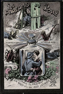
Background imageRelated Images Collection: First World War: France, Carte patriotique humoristique showing the different perfumes of hairy

First World War: France, Carte patriotique humoristique showing the different perfumes of hairy (old pipe)
LUX4742487 First World War: France, Carte patriotique humoristique showing the different perfumes of hairy (old pipe, cockroach...), 1918

Background imageRelated Images Collection: First World War: France, Patriotic Map showing a soldier contemplating traces of shells writing in

First World War: France, Patriotic Map showing a soldier contemplating traces of shells writing in the sky
LUX4742970 First World War: France, Patriotic Map showing a soldier contemplating traces of shells writing in the sky "Victory" and saying " this is no longer a dream

Background imageRelated Images Collection: First World War: France, Patriotic Map showing a soldier making the Military Salvation under a

First World War: France, Patriotic Map showing a soldier making the Military Salvation under a coin of 5 francs silver
LUX4742953 First World War: France, Patriotic Map showing a soldier making the Military Salvation under a coin of 5 francs silver

Background imageRelated Images Collection: First World War: France, Patriotic Map showing under scenes of combat from the front a graceful

First World War: France, Patriotic Map showing under scenes of combat from the front a graceful bouquet of thrush prote
LUX4742293 First World War: France, Patriotic Map showing under scenes of combat from the front a graceful bouquet of thrush prote happiness

Background imageRelated Images Collection: First World War: France, A child photograph glued to a patriotic map representing the flag of

First World War: France, A child photograph glued to a patriotic map representing the flag of allies including that of
LUX4742809 First World War: France, A child photograph glued to a patriotic map representing the flag of allies including that of Japan, 1914

Background imageRelated Images Collection: First World War: Patriotic map showing a swallow carrying in its beak a patritotic bouquet

First World War: Patriotic map showing a swallow carrying in its beak a patritotic bouquet surrounded by a tricolor
LUX4745073 First World War: Patriotic map showing a swallow carrying in its beak a patritotic bouquet surrounded by a tricolor ribbon

Background imageRelated Images Collection: First World War: Patriotic map showing an alpine hunter climbing a mountain with his luggage

First World War: Patriotic map showing an alpine hunter climbing a mountain with his luggage, 1915, 'climbing'
LUX4744987 First World War: Patriotic map showing an alpine hunter climbing a mountain with his luggage, 1915, 'climbing'; (add.info.: World War I - War 14-18 (1914-1918) - World War I (WWI or WW1)

Background imageRelated Images Collection: First World War: Patriotic map showing a bouquet of tricolor flower surrounded by angelot bearing

First World War: Patriotic map showing a bouquet of tricolor flower surrounded by angelot bearing the flags of
LUX4744965 First World War: Patriotic map showing a bouquet of tricolor flower surrounded by angelot bearing the flags of the allies

Background imageRelated Images Collection: First World War: Patriotic map showing the five flags of the allies with the commentary

First World War: Patriotic map showing the five flags of the allies with the commentary: 'They are also as many
LUX4744940 First World War: Patriotic map showing the five flags of the allies with the commentary: 'They are also as many, you will have to count with them'

Background imageRelated Images Collection: First World War: Patriotic map showing a photograph of the hotel of the church of

First World War: Patriotic map showing a photograph of the hotel of the church of Saint-Valery-en-Caux containing a
LUX4744898 First World War: Patriotic map showing a photograph of the hotel of the church of Saint-Valery-en-Caux containing a prayer for the Blessed Virgin and entitled: 'Memorial of the war 1914

Background imageRelated Images Collection: First World War: Patriotic Map showing an Alsatian and a Lorraine near the Lion of Belfort

First World War: Patriotic Map showing an Alsatian and a Lorraine near the Lion of Belfort Watching French Aircraft
LUX4744690 First World War: Patriotic Map showing an Alsatian and a Lorraine near the Lion of Belfort Watching French Aircraft Approaching and titled L'Alsace et la Lorraine aux oiseaux de France

Background imageRelated Images Collection: First World War: Patriotic map showing a young Alsatian and a young Lorraine coming out of an

First World War: Patriotic map showing a young Alsatian and a young Lorraine coming out of an Easter egg
LUX4744675 First World War: Patriotic map showing a young Alsatian and a young Lorraine coming out of an Easter egg and entitled Happy Easter

Background imageRelated Images Collection: First World War: Patriotic map showing in a medallion the portrait of a general Joffre in uniform

First World War: Patriotic map showing in a medallion the portrait of a general Joffre in uniform with his medals
LUX4745400 First World War: Patriotic map showing in a medallion the portrait of a general Joffre in uniform with his medals, entitled "Towards Victory"

Background imageRelated Images Collection: Pottery kiln, vertical and horizontal sections, 18th century

Pottery kiln, vertical and horizontal sections, 18th century. Copperplate engraving by Wilson Lowry after an
FLO4593602 Pottery kiln, vertical and horizontal sections, 18th century. Copperplate engraving by Wilson Lowry after an illustration by J

Background imageRelated Images Collection: Astronomical chart of the constellation of Orion. Copperplate engraving by Milton after a drawing

Astronomical chart of the constellation of Orion. Copperplate engraving by Milton after a drawing by L
FLO4594430 Astronomical chart of the constellation of Orion. Copperplate engraving by Milton after a drawing by L. Hebert from Abraham Rees' Cyclopedia or Universal Dictionary of Arts

Background imageRelated Images Collection: Astronomical chart of the Northern hemisphere. Copperplate engraving by Milton after a drawing by L

Astronomical chart of the Northern hemisphere. Copperplate engraving by Milton after a drawing by L
FLO4594211 Astronomical chart of the Northern hemisphere. Copperplate engraving by Milton after a drawing by L. Hebert from Abraham Rees' Cyclopedia or Universal Dictionary of Arts

Background imageRelated Images Collection: Astronomical chart of the Southern hemisphere. Copperplate engraving by Milton after a drawing by L

Astronomical chart of the Southern hemisphere. Copperplate engraving by Milton after a drawing by L
FLO4594202 Astronomical chart of the Southern hemisphere. Copperplate engraving by Milton after a drawing by L. Hebert from Abraham Rees' Cyclopedia or Universal Dictionary of Arts

Background imageRelated Images Collection: Plan and section of the great wheel of Jesse Ramsden (1735-1800)'s circular dividing engine, 1773

Plan and section of the great wheel of Jesse Ramsden (1735-1800)'s circular dividing engine, 1773
FLO4592322 Plan and section of the great wheel of Jesse Ramsden (1735-1800)'s circular dividing engine, 1773. Copperplate engraving by Wilson Lowry from Abraham Rees' Cyclopedia or Universal

Background imageRelated Images Collection: Plans and elevations for a furnace, early 19th century. Copperplate engraving by Wilson Lowry

Plans and elevations for a furnace, early 19th century. Copperplate engraving by Wilson Lowry after a drawing by John
FLO4591586 Plans and elevations for a furnace, early 19th century. Copperplate engraving by Wilson Lowry after a drawing by John Farey from Abraham Rees' Cyclopedia or Universal Dictionary of Arts

Background imageRelated Images Collection: Plans and views of a magnetic variation compassed, early 19th century

Plans and views of a magnetic variation compassed, early 19th century. Copperplate engraving by Wilson Lowry
FLO4591566 Plans and views of a magnetic variation compassed, early 19th century. Copperplate engraving by Wilson Lowry from Abraham Rees' Cyclopedia or Universal Dictionary of Arts

Background imageRelated Images Collection: Plans and views of a variety of magnetic compasse. Copperplate engraving by Wilson Lowry

Plans and views of a variety of magnetic compasse. Copperplate engraving by Wilson Lowry from Abraham Rees'
FLO4591536 Plans and views of a variety of magnetic compasse. Copperplate engraving by Wilson Lowry from Abraham Rees' Cyclopedia or Universal Dictionary of Arts, Sciences and Literature, Longman

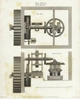
Background imageRelated Images Collection: Plan and elevation of an oil mill designed by John Smeaton, early 19th century

Plan and elevation of an oil mill designed by John Smeaton, early 19th century
FLO4590901 Plan and elevation of an oil mill designed by John Smeaton, early 19th century. Copperplate engraving by Wilson Lowry after a drawing by John Farey from Abraham Rees' Cyclopedia or

Background imageRelated Images Collection: Map of the Persian Empire under the regne of Darius I with the main satrapes

Map of the Persian Empire under the regne of Darius I with the main satrapes
NWI4855968 Map of the Persian Empire under the regne of Darius I with the main satrapes (administrative divisions of the Persian Empire), circa 500 BC

Background imageRelated Images Collection: South Africa when the country was a British colony, 1870s. Lithograph of the 19th century

South Africa when the country was a British colony, 1870s. Lithograph of the 19th century
NWI4855278 South Africa when the country was a British colony, 1870s. Lithograph of the 19th century.; (add.info.: South Africa when the country was a British colony, 1870s)

Background imageRelated Images Collection: The colonial territories of North America claimed by the Dutch in 1764, on the Atlantic coast

The colonial territories of North America claimed by the Dutch in 1764, on the Atlantic coast
NWI4854329 The colonial territories of North America claimed by the Dutch in 1764, on the Atlantic coast, New Holland (or New Belgium) with the cities of Jamestown and Plymouth.; (add.info)

Background imageRelated Images Collection: Geographic map of Russia under the rule of the tsars, 1870. 19th century lithography

Geographic map of Russia under the rule of the tsars, 1870. 19th century lithography
NWI4870820 Geographic map of Russia under the rule of the tsars, 1870. 19th century lithography.; (add.info.: Geographic map of Russia under the rule of the tsars, 1870)

Background imageRelated Images Collection: Map of the first regions of Spain. 19th century lithography

Map of the first regions of Spain. 19th century lithography
NWI4869751 Map of the first regions of Spain. 19th century lithography; (add.info.: Map of the first regions of Spain. 19th century lithography); Photo © North Wind Pictures

Background imageRelated Images Collection: Map of Ontario (Canada), circa 1870, with the Great Lakes: Huron, Erie and Ontario

Map of Ontario (Canada), circa 1870, with the Great Lakes: Huron, Erie and Ontario. Color lithography, 19th century
NWI4867568 Map of Ontario (Canada), circa 1870, with the Great Lakes: Huron, Erie and Ontario. Color lithography, 19th century.; (add.info.: Map of Ontario (Canada), circa 1870

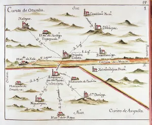
Background imageRelated Images Collection: ALZATE, Jose Antonio (1737-1799). Scientist and writer. Plan of the Archdiocese of Mexico

ALZATE, Jose Antonio (1737-1799). Scientist and writer. Plan of the Archdiocese of Mexico
CUL4864770 ALZATE, Jose Antonio (1737-1799). Scientist and writer. Plan of the Archdiocese of Mexico. Parish of Otumba (Otumba or Ozumba?) And Parish of Axapulco (Acapulco?). 1767


All Professionally Made to Order for Quick Shipping


-

Why Choose Us?

We are a leading provider of Art Prints and Photo Gifts since 2003, working in partnership with a range of Sporting Clubs, Charities, Museums and Picture Libraries. A large share of profits from any of their images will go directly towards supporting that charity or club. Our archive of images is carefully curated to bring you a wide range of subjects, including landscapes, wildlife, architecture, and more. We ship from our partner labs in the UK, USA, EU (Netherlands) and Australia.
+

How do I place an order?

Ordering is quick & easy - Just follow 5 Simple Steps:
  1. Find your image: Use our search box or browse our online photo Collections to find the image you want.

  2. Choose your print format: Select your desired product and add it to your cart.

  3. Enter your details: If you're a returning customer, simply enter your email address and password, and we'll fill in your billing and shipping address details. All personal details are held securely and are fully GDPR compliant. As standard, we remove all Personally Identifiable Information after 12 months.

  4. Pay for your purchase: We use state-of-the-art security for online shopping and do not have access to your card details.

  5. Sit back and relax: We'll email you confirmation of your order and when it's dispatched. Registered customers can also track orders in the 'My Account' area.

+

How do I pay for an order?

You can pay for your order with most of the major credit and debit cards, or PayPal. For added security, major financial institutions process payment details separately and securely on our behalf. We do not have access to your online payment card details. Online payments are preferred however we do take phone orders. For UK customers only we accept cheques issued against a UK bank.
+

Is my data safe?

We take data security very seriously. We do not have access to your full card details and all payments are requested over a fully secure connection. Additionally, we fully comply with current European and GDPR legislation, and automatically remove all personal data after at most 12 months (unless you have an account with us and have signed in recently). We also have a strict opt-in policy and would never sell your personal details. Your data is only used to fulfill your order promptly and efficiently.
+

Is wall art ready to hang?

For quick and easy installation all wall art, including framed prints, canvas prints and metal prints are supplied with a ready to hang solution on the back. Generally, saw tooth hangers are applied as they allow wall art to hang flush against the wall. The serrated edge of the hanger prevents the frame from shifting or tilting when hung.
+

Are the photo prints fade resistant?

Yes, we use archival quality photo paper photographic paper for vivid reproduction Prints are an accurate representations of the original artwork, which is preserved for artistic character and authenticity. We guarantee they match previews shown on our web site