Fraud Blocker Skip to main content

Home > Maps and Charts > Germany

Germany Collection (page 6)

Germany is a country located in central Europe with a population of over 83 million people and has a diverse landscape

6,586 items

Background imageGermany Collection: First World War: France, Postcard, photo studio of two soldiers in uniform with machine gun in a

First World War: France, Postcard, photo studio of two soldiers in uniform with machine gun in a green field
LUX4735869 First World War: France, Postcard, photo studio of two soldiers in uniform with machine gun in a green field and protected by France in helmet and flag

Background imageGermany Collection: First World War: France, Patriotic Map showing Napoleon 1st trampling the German flag saying

First World War: France, Patriotic Map showing Napoleon 1st trampling the German flag saying
LUX4741666 First World War: France, Patriotic Map showing Napoleon 1st trampling the German flag saying: I got your Rhine and we'll have it again

Background imageGermany Collection: First World War: France, Patriotic Map showing a young boy and a young girl and kepi

First World War: France, Patriotic Map showing a young boy and a young girl and kepi
LUX4738290 First World War: France, Patriotic Map showing a young boy and a young girl and kepi and Alsatian hat piercing a scarecrow wearing a German helmet

Background imageGermany Collection: First World War: France, Comedy patriotic map showing the German soldier leaving the clocks

First World War: France, Comedy patriotic map showing the German soldier leaving the clocks
LUX4737553 First World War: France, Comedy patriotic map showing the German soldier leaving the clocks and candlesticks flying to pick up a buche

Background imageGermany Collection: First World War: France, Patriotic Map showing the plane of the distruding triple agreement

First World War: France, Patriotic Map showing the plane of the distruding triple agreement and German Zeppelin, 1914
LUX4740514 First World War: France, Patriotic Map showing the plane of the distruding triple agreement and German Zeppelin

Background imageGermany Collection: First World War: France, Patriotic Map showing a caricature of Emperor William II in the form of a

First World War: France, Patriotic Map showing a caricature of Emperor William II in the form of a cow in a contest
LUX4739533 First World War: France, Patriotic Map showing a caricature of Emperor William II in the form of a cow in a contest entitled 'The Most Beautiful Cow in the World'

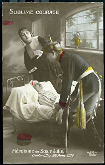
Background imageGermany Collection: First World War: France, Patriotic Map showing Sister Julie rescuing a wounded on August 24, 1914

First World War: France, Patriotic Map showing Sister Julie rescuing a wounded on August 24, 1914
LUX4738778 First World War: France, Patriotic Map showing Sister Julie rescuing a wounded on August 24, 1914, titled: 'sublime courage and heroism of Sister Julie'

Background imageGermany Collection: First World War: France, Patriotic Map showing William II in the grip of the Russian bear

First World War: France, Patriotic Map showing William II in the grip of the Russian bear
LUX4739416 First World War: France, Patriotic Map showing William II in the grip of the Russian bear, titled: 'No pity for the beards', 1914

Background imageGermany Collection: First World War: France, Patriotic Map showing a French horseman helped by Alsatians to fight

First World War: France, Patriotic Map showing a French horseman helped by Alsatians to fight the German enemy
LUX4741078 First World War: France, Patriotic Map showing a French horseman helped by Alsatians to fight the German enemy, titled: 'The Good Guide'

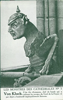
Background imageGermany Collection: First World War: France, Patriotic Map showing a gargoyle of cathedrale transforms into German

First World War: France, Patriotic Map showing a gargoyle of cathedrale transforms into German general entitled
LUX4738737 First World War: France, Patriotic Map showing a gargoyle of cathedrale transforms into German general entitled

Background imageGermany Collection: First World War: France, Patriotic Map showing a gargoyle of cathedrale transforms into German

First World War: France, Patriotic Map showing a gargoyle of cathedrale transforms into German general entitled
LUX4738719 First World War: France, Patriotic Map showing a gargoyle of cathedrale transforms into German general entitled

Background imageGermany Collection: First World War: France, Patriotic Map showing a German soldier in uniform going to a French

First World War: France, Patriotic Map showing a German soldier in uniform going to a French soldier for French bread
LUX4739224 First World War: France, Patriotic Map showing a German soldier in uniform going to a French soldier for French bread, titled: 'How we take the bosches'

Background imageGermany Collection: America borealis. Map of North American showing California as an island

America borealis. Map of North American showing California as an island, from Heinrich Scherer's Geographia
3432624 America borealis. Map of North American showing California as an island, from Heinrich Scherer's Geographia hierarchica, 1699 (colour litho) by German School

Background imageGermany Collection: Map of portion of the West Indies, from the Weimar Map of 1527, ascribed to Fernando Columbus

Map of portion of the West Indies, from the Weimar Map of 1527, ascribed to Fernando Columbus
2915343 Map of portion of the West Indies, from the Weimar Map of 1527, ascribed to Fernando Columbus. From the book Life of Christopher Columbus by Clements R

Background imageGermany Collection: 1881 German version of the World Map 1531, 1881

1881 German version of the World Map 1531, 1881
3507797 1881 German version of the World Map 1531, 1881; (add.info.: 1881 German version of the World Map 1531, by Oronce Fine (Orontius Finnaeus)

Background imageGermany Collection: Map illustrating the advance of the Russian Army of Invasion in the east of Germany (litho)

Map illustrating the advance of the Russian Army of Invasion in the east of Germany (litho)
3252895 Map illustrating the advance of the Russian Army of Invasion in the east of Germany (litho); Private Collection; (add.info)

Background imageGermany Collection: The War Map of Western Europe showings the entire zone of military operations in the Western

The War Map of Western Europe showings the entire zone of military operations in the Western campaign (litho)
3252857 The War Map of Western Europe showings the entire zone of military operations in the Western campaign (litho); Private Collection; (add.info.: The War Map of Western Europe)

Background imageGermany Collection: Mosaic of a bear wounded with a spear from the Casa dell'Orso, House of the Bear, VII.II.45

Mosaic of a bear wounded with a spear from the Casa dell'Orso, House of the Bear, VII.II.45
FLO4687099 Mosaic of a bear wounded with a spear from the Casa dell'Orso, House of the Bear, VII.II.45. Chromolithograph by Victor Steeger after an illustration by Geremia Discanno from Emile Presuhn

Background imageGermany Collection: Mural from the Casa di Arianna or House of Ariadne, Reg. VII, Ins. IV, No

Mural from the Casa di Arianna or House of Ariadne, Reg. VII, Ins. IV, No
FLO4687004 Mural from the Casa di Arianna or House of Ariadne, Reg. VII, Ins. IV, No. 51, and wallpaper from the House of Chlorus and Caprasia or Casa del Gallo II, Reg. IX, Ins. II, No. 10

Background imageGermany Collection: Decorated ceiling from the House of Chlorus and Caprasia or Casa del Gallo II, Reg. IX, Ins

Decorated ceiling from the House of Chlorus and Caprasia or Casa del Gallo II, Reg. IX, Ins. II, No. 10
FLO4687002 Decorated ceiling from the House of Chlorus and Caprasia or Casa del Gallo II, Reg. IX, Ins. II, No. 10. Chromolithograph by Victor Steeger after an illustration by Geremia Discanno

Background imageGermany Collection: Plaster cast of a man's body from the Via Stabiana, now in the Museum of Pompeii

Plaster cast of a man's body from the Via Stabiana, now in the Museum of Pompeii
FLO4687098 Plaster cast of a man's body from the Via Stabiana, now in the Museum of Pompeii. Chromolithograph by Victor Steeger after an illustration by Geremia Discanno from Emile Presuhn (1844-1878)

Background imageGermany Collection: Geographical map of Mount St. Peter, Maastricht, and the main entrance to the caves

Geographical map of Mount St. Peter, Maastricht, and the main entrance to the caves
FLO4574405 Geographical map of Mount St. Peter, Maastricht, and the main entrance to the caves. Handcoloured copperplate engraving from Bertuch's " Bilderbuch fur Kinder"

Background imageGermany Collection: Prehistoric men spear weapons on the lookout for a glyptodon

Prehistoric men spear weapons on the lookout for a glyptodon, a battleship mammal of the family Glyptodontidae
FLO4638984 Prehistoric men spear weapons on the lookout for a glyptodon, a battleship mammal of the family Glyptodontidae, apparent to the current armadillo

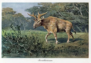
Background imageGermany Collection: Sivatherium, (bete of Shiva) genus is from the family of giraffides that was present from Africa

Sivatherium, (bete of Shiva) genus is from the family of giraffides that was present from Africa to South Asia
FLO4639730 Sivatherium, (bete of Shiva) genus is from the family of giraffides that was present from Africa to South Asia, especially in India

Background imageGermany Collection: An archegosaurus, on the banks of a river in the primary tropical jungle, ferns and pine trees

An archegosaurus, on the banks of a river in the primary tropical jungle, ferns and pine trees
FLO4639249 An archegosaurus, on the banks of a river in the primary tropical jungle, ferns and pine trees. Archegosaurus is a species of extinct amphibian that lived during the Asselian in

Background imageGermany Collection: The Steller's Rhytine, or sea cow, a marine herbivore mammal of the Arctic Ocean

The Steller's Rhytine, or sea cow, a marine herbivore mammal of the Arctic Ocean
FLO4639104 The Steller's Rhytine, or sea cow, a marine herbivore mammal of the Arctic Ocean, a species faint in the mid-18th century. Chromolithography, based on an illustration by F

Background imageGermany Collection: Rhamphorhynchus, a long-tailed pterosaur, fished by dredging water with its jaw beak

Rhamphorhynchus, a long-tailed pterosaur, fished by dredging water with its jaw beak. He lived in the Jurassic period
FLO4639627 Rhamphorhynchus, a long-tailed pterosaur, fished by dredging water with its jaw beak. He lived in the Jurassic period

Background imageGermany Collection: Kriegsschule / War School (colour litho)

Kriegsschule / War School (colour litho)
8666180 Kriegsschule / War School (colour litho) by Christophe (Colomb, Georges) (1856-1945); Private Collection; (add.info.: Kriegsschule)

Background imageGermany Collection: Rivers and canals of Germany (engraving)

Rivers and canals of Germany (engraving)
8663881 Rivers and canals of Germany (engraving) by German School, (19th century) (after); Private Collection; (add.info)

Background imageGermany Collection: Duchies of Burgundy and Alamannia, early 10th Century (coloured engraving)

Duchies of Burgundy and Alamannia, early 10th Century (coloured engraving)
8673045 Duchies of Burgundy and Alamannia, early 10th Century (coloured engraving) by Swiss School, (19th Century); Private Collection; (add.info.: Map of the Duchies of Burgundy and Alamannia)

Background imageGermany Collection: French emperor Napoleon 1st looking maps and elaborating strategy during Bautzen battle (Germany)

French emperor Napoleon 1st looking maps and elaborating strategy during Bautzen battle (Germany)
1758562 French emperor Napoleon 1st looking maps and elaborating strategy during Bautzen battle (Germany) in the night from may 20, 1813 to may 21, 1913

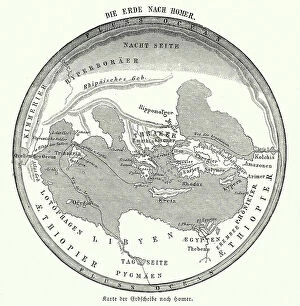
Background imageGermany Collection: Map of the Earth according to Homer (engraving)

Map of the Earth according to Homer (engraving)
8635074 Map of the Earth according to Homer (engraving) by German School, (19th century) (after); Private Collection; (add.info.: Map of the Earth according to the ancient Greek poet Homer)

Background imageGermany Collection: Wanderlust world map in spanish

Wanderlust world map in spanish
Rosana Laiz Blursbyai

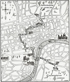
Background imageGermany Collection: Map showing the route of the demonstration at Copenhagen Fields, London

Map showing the route of the demonstration at Copenhagen Fields, London, England 21 April 1834 in protest against
5614428 Map showing the route of the demonstration at Copenhagen Fields, London, England 21 April 1834 in protest against the deportation of the Tolpuddle Martyrs; (add.info)

Background imageGermany Collection: WW2 Volga Tartar Volunteers armshield, c. 1939-45 (object)

WW2 Volga Tartar Volunteers armshield, c. 1939-45 (object)
7177607 WW2 Volga Tartar Volunteers armshield, c. 1939-45 (object); Private Collection; (add.info.: Volga Tartar Volunteers cloth armshield)

Background imageGermany Collection: Chart of Sicily, 1554 (vellum)

Chart of Sicily, 1554 (vellum)
7339643 Chart of Sicily, 1554 (vellum) by Agnese, Battista (c.1500-64); 26x40 cm; National Maritime Museum, London, UK; (add.info.: Creator)

Background imageGermany Collection: Chart of the English coast, Isle of Wight and Portsmouth harbour, 1693 (coloured engraving)

Chart of the English coast, Isle of Wight and Portsmouth harbour, 1693 (coloured engraving)
7339372 Chart of the English coast, Isle of Wight and Portsmouth harbour, 1693 (coloured engraving) by Jaillot, Alexis-Hubert (1632-1712); 64x97 cm; National Maritime Museum, London

Background imageGermany Collection: Map of Scotland, England, Ireland in 900 (Map of british islands, England)

Map of Scotland, England, Ireland in 900 (Map of british islands, England)
ELD4930071 Map of Scotland, England, Ireland in 900 (Map of british islands, England, Scotland and Ireland in 900) Plate from Houze's Universal Atlas

Background imageGermany Collection: Map of England, Ireland, Scotland and Isle of Man, 1100-1280 (Map of England, Ireland)

Map of England, Ireland, Scotland and Isle of Man, 1100-1280 (Map of England, Ireland, Scotland and island of Man)
ELD4928123 Map of England, Ireland, Scotland and Isle of Man, 1100-1280 (Map of England, Ireland, Scotland and island of Man, 1100 - 1280) Engraving from " Atlas Universel" by Houze

Background imageGermany Collection: Map ' Hamburg and the surrounding in the year 1070 ', 1866 (engraving)

Map " Hamburg and the surrounding in the year 1070 ", 1866 (engraving)
UTD4919047 Map " Hamburg and the surrounding in the year 1070 ", 1866 (engraving); (add.info.: Germany, Hamburg, map " Hamburg and the surrounding in the year 1070 ")

Background imageGermany Collection: Italy, Temple of Hera former called Temple of Poseidon, in Paestum illustration

Italy, Temple of Hera former called Temple of Poseidon, in Paestum illustration
UTD4921792 Italy, Temple of Hera former called Temple of Poseidon, in Paestum illustration from : " Kunsthistorische Bilderbogen " (Art history image gallery), first part, published by E

Background imageGermany Collection: Map of Germania following Treaty of Verdun in 843 dividing the Charlemagne Empire into three parts

Map of Germania following Treaty of Verdun in 843 dividing the Charlemagne Empire into three parts among the sons of
ELD4924537 Map of Germania following Treaty of Verdun in 843 dividing the Charlemagne Empire into three parts among the sons of Louis the Pious: the Western Francie

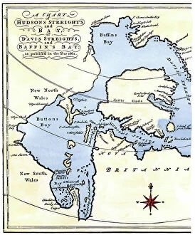
Background imageGermany Collection: Map of Hudson Bay and Detroit in the Arctic in Canada, 1662. From the travels of Henry Hudson

Map of Hudson Bay and Detroit in the Arctic in Canada, 1662. From the travels of Henry Hudson (1570-1611)
NWI4851002 Map of Hudson Bay and Detroit in the Arctic in Canada, 1662. From the travels of Henry Hudson (1570-1611), English explorer

Background imageGermany Collection: Map of the United States in 1819 showing the territory under occupation of the Spanish

Map of the United States in 1819 showing the territory under occupation of the Spanish
NWI4846207 Map of the United States in 1819 showing the territory under occupation of the Spanish and English colonial populations

Background imageGermany Collection: Map illustrating the conflicts between Spain and Great Britain disputing the borders of the States

Map illustrating the conflicts between Spain and Great Britain disputing the borders of the States of America
NWI4846409 Map illustrating the conflicts between Spain and Great Britain disputing the borders of the States of America, 1810-1812

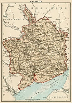
Background imageGermany Collection: Map of the Earl of Monmouth (England), circa 1870. 19th century lithography

Map of the Earl of Monmouth (England), circa 1870. 19th century lithography
NWI4875183 Map of the Earl of Monmouth (England), circa 1870. 19th century lithography.; (add.info.: Map of the Earl of Monmouth (England), circa 1870

Background imageGermany Collection: Map of the Earl of Lincolnshire (England), circa 1870. 19th century lithography

Map of the Earl of Lincolnshire (England), circa 1870. 19th century lithography
NWI4875140 Map of the Earl of Lincolnshire (England), circa 1870. 19th century lithography.; (add.info.: Map of the Earl of Lincolnshire (England), circa 1870

Background imageGermany Collection: Map of the Earl of Hereford (England), circa 1870. 19th century lithography

Map of the Earl of Hereford (England), circa 1870. 19th century lithography
NWI4874937 Map of the Earl of Hereford (England), circa 1870. 19th century lithography.; (add.info.: Map of the Earl of Hereford (England), circa 1870


All Professionally Made to Order for Quick Shipping


-

Germany Collection

Germany is a country located in central Europe with a population of over 83 million people and has a diverse landscape, ranging from the Alps in the south to the North Sea and Baltic Sea coasts in the north. The country is known for its strong economy, which is driven by industries such as automotive manufacturing, engineering, and pharmaceuticals. It also has a rich cultural history, with famous composers like Beethoven and Bach hailing from the country. Its capital city Berlin is renowned for its vibrant art scene and historical landmarks such as the Brandenburg Gate.
+

Our beautiful pictures are available as Framed Prints, Photos, Wall Art and Photo Gifts

The Germany collection from Media Storehouse offers a wide selection of wall art and framed prints that showcase the beauty, history, and culture of Germany. Our collection features an array of maps and charts that depict the country's geography, landmarks, cities, regions, and historical events. From vintage maps to modern designs, our collection caters to different tastes and preferences. Some of the popular items in our collection include antique city plans of Berlin or Munich; topographic maps of Bavaria or Black Forest; political maps showing Germany's borders over time; charts illustrating Germanic tribes' migration patterns during ancient times. These artworks are available in various sizes and formats such as canvas prints or traditional frames. They make great decorations for homes, offices or public spaces like museums or libraries. The Germany collection is a must-see for anyone interested in exploring the rich heritage of this fascinating country through visual art.
+

What are Germany (Maps and Charts) art prints?

Germany art prints are high-quality reproductions of historical maps and charts depicting various regions, cities, and landmarks in Germany. These prints showcase the intricate details of the original maps and charts, including topography, street names, buildings, rivers, and other geographical features. These art prints are perfect for history enthusiasts who want to explore Germany's rich cultural heritage or for those who simply appreciate beautiful cartographic artwork. They can be used as decorative pieces in homes or offices or as educational tools in schools and libraries. We offer a wide range of Germany art prints that cater to different tastes and preferences. You can choose from vintage-style sepia-toned maps to colorful contemporary designs that highlight specific areas or themes such as wine regions or cycling routes. These art prints provide a unique way to experience Germany's geography and history while adding aesthetic value to any space.
+

What Germany (Maps and Charts) art prints can I buy from Media Storehouse?

We offer a wide range of Germany maps and charts art prints that you can purchase. These include vintage maps, city plans, topographical charts, and historical atlases. You can choose from different styles and sizes to suit your preferences. One popular option is the antique map of Germany created by cartographer Gerard Mercator in 1595. This beautifully detailed map shows the country's regions, cities, rivers, and mountains as they were known during the Renaissance period. Another interesting print is the Berlin Wall Map which depicts the infamous wall that divided East and West Berlin during the Cold War era. The map includes details on checkpoints, watchtowers, escape tunnels and other features related to this historic event. Whether you are looking for a decorative piece for your home or office or an educational resource for teaching purposes, we have a variety of Germany maps and charts art prints available to suit your needs.
+

How do I buy Germany (Maps and Charts) art prints?

To buy Germany art prints from Media Storehouse, you can browse our extensive collection of high-quality prints online. Simply search for the specific artwork or artist you are interested in, or filter by category to find maps and charts related to Germany. Once you have found a print that catches your eye, select the size and format that best suits your needs. We offer a range of options for printing on different materials such as canvas, photographic paper, and fine art paper. You can also choose to have your print framed or unframed depending on your preference. Once you have made your selection, simply add it to your cart and proceed to checkout. Payment is easy with various payment methods available including credit card payments. Buying Germany art prints from Media Storehouse is a straightforward process that allows you to easily access beautiful artworks at affordable prices.
+

How much do Germany (Maps and Charts) art prints cost?

We offer a wide range of Germany art prints at varying prices. Our collection includes vintage maps, historical charts, and modern interpretations of the country's geography. The cost of each print depends on several factors such as size, framing options, and printing material. We understand that every customer has unique preferences when it comes to purchasing art prints. That is why we have made sure to provide a diverse selection that caters to different tastes and budgets. Whether you are looking for an affordable poster or a high-quality canvas print, we have something for everyone. Our Germany art prints make great additions to any home or office space. They are not only aesthetically pleasing but also educational pieces that can spark interesting conversations about history and geography. So if you're interested in adding some German-inspired artwork to your collection, be sure to check out our selection today.
+

How will my Germany (Maps and Charts) art prints be delivered to me?

Your Germany art prints will be delivered to you in a safe and secure manner by our trusted delivery partners. We take great care to ensure that your artwork is packaged with the utmost care, so it arrives at your doorstep in pristine condition. Depending on the size of your order, we may use different shipping methods such as standard post or courier services. We understand how important it is for you to receive your artwork promptly, which is why we work hard to dispatch all orders as quickly as possible. Once dispatched, you will receive an email notification containing tracking information so that you can keep track of your package's progress. We are committed to providing our customers with high-quality products and exceptional service. If for any reason you are not completely satisfied with your purchase, please do not hesitate to contact us so that we can resolve any issues promptly.