Home > Europe > United Kingdom > England > Cleveland
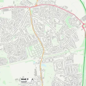
Warrington WA2 9 Map

![]()
Wall Art and Photo Gifts from Map Marketing
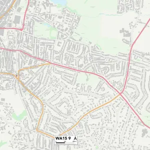
Warrington WA2 9 Map
Postcode Sector Map of Warrington WA2 9
Media ID 19982728
Appleby Road Beatty Avenue Birch Avenue Borrowdale Avenue Bowness Avenue Bruce Avenue Burton Road Byron Court Cheviot Avenue Chiltern Avenue Chiltern Crescent Chiltern Road Cleveland Road Clive Avenue Clough Avenue Cotswold Road Dean Crescent Ennerdale Avenue Festival Avenue Fisher Avenue Hunter Avenue Keats Grove Kendal Avenue Keswick Avenue Kipling Avenue Kirkstone Avenue Lee Court Longford Loweswater Close Mardale Avenue Marina Drive Mendip Avenue Neville Avenue Northway Osborne Avenue Park Road Patterdale Avenue Penrith Avenue Pentland Avenue Pentland Place Primrose Close Ruskin Avenue Sandy Lane School Road Sinclair Avenue St Stephens Avenue Tennyson Drive The Coppins Warren Road Warrington Woodcote Close Hughes Avenue Hulme
FEATURES IN THESE COLLECTIONS
> Europe
> United Kingdom
> England
> Cleveland
> Map Marketing
> Postcode Sector Maps
> WA - Warrington
> Maps and Charts
> Related Images
MADE IN THE USA
Safe Shipping with 30 Day Money Back Guarantee
FREE PERSONALISATION*
We are proud to offer a range of customisation features including Personalised Captions, Color Filters and Picture Zoom Tools
SECURE PAYMENTS
We happily accept a wide range of payment options so you can pay for the things you need in the way that is most convenient for you
* Options may vary by product and licensing agreement. Zoomed Pictures can be adjusted in the Cart.