Home > Europe > United Kingdom > England > London > Sights > Richmond Park
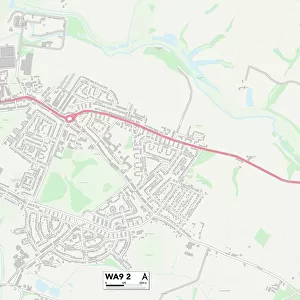
St. Helens WA12 8 Map

![]()
Wall Art and Photo Gifts from Map Marketing
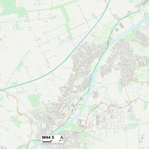
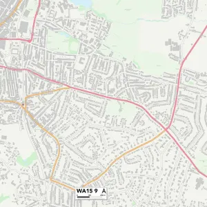
St. Helens WA12 8 Map
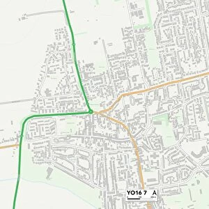
Postcode Sector Map of St. Helens WA12 8
Media ID 19979838
Acorn Street Adams Close Alder Street Alfred Street Ash Avenue Bedale Close Beech Close Cedar Gardens Cedar Street Central Way Cheshire Close Church Drive Connaught Drive Conway Drive Coronation Drive Crabtree Close Devonshire Gardens Elm Avenue Farm Way Glover Street Greenwood Drive Grosvenor Court Grosvenor Gardens Hawthorn Avenue Helens Holly Avenue Ivy Avenue Kenilworth Gardens Kingsway Larch Avenue Laurel Avenue Leamington Avenue Malden Road Maple Avenue Mill Lane Mill Meadow Norman Avenue Oak Avenue Park Road South Park View Pine Avenue Poplar Avenue Raleigh Close Richmond Gardens Roman Close Rydal Street Stephenson Road Sycamore Avenue The Close Valley View Vulcan Close Warwick Avenue Welbeck Avenue Whitefield Avenue Windsor Avenue Woburn Avenue Woodstock Avenue Wargrave
FEATURES IN THESE COLLECTIONS
> Animals
> Insects
> Beetle
> Fireflies
> Arts
> Artists
> D
> Alfred
> Related Images
> Arts
> Artists
> R
> Roman Roman
> Arts
> Portraits
> Pop art gallery
> Street art portraits
> Europe
> United Kingdom
> England
> Cheshire
> Mere
> Europe
> United Kingdom
> England
> Cheshire
> Newton
> Europe
> United Kingdom
> England
> Cheshire
> Related Images
> Europe
> United Kingdom
> England
> London
> Sights
> Richmond Park
> Map Marketing
> Postcode Sector Maps
> WA - Warrington
> Maps and Charts
> Related Images
MADE IN THE USA
Safe Shipping with 30 Day Money Back Guarantee
FREE PERSONALISATION*
We are proud to offer a range of customisation features including Personalised Captions, Color Filters and Picture Zoom Tools
SECURE PAYMENTS
We happily accept a wide range of payment options so you can pay for the things you need in the way that is most convenient for you
* Options may vary by product and licensing agreement. Zoomed Pictures can be adjusted in the Cart.