Home > Europe > United Kingdom > England > Staffordshire > Stoke on Trent
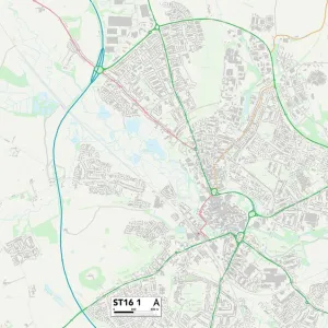
Staffordshire ST16 2 Map

![]()
Wall Art and Photo Gifts from Map Marketing
Staffordshire ST16 2 Map
Postcode Sector Map of Staffordshire ST16 2
Media ID 19981952
Blackberry Lane Bridge Street Broad Street Bull Hill Castle Hill Castle Street Castle View Chapel Street Church Lane Derby Street Earl Street Friars Road Glover Street Greyfriars Leys Close Martin Street Mill Bank Mill Street Mount Street North Place Nursery Lane Peel Street Pilgrim Street Princes Street Railway Street Rosewood Gardens Snow Hill South Street Spruce Way St Martins Place St Marys Gate St Marys Grove St Marys Place Stafford Street Staffordshire Station Road Victoria Road Water Street Castletown Stafford
FEATURES IN THESE COLLECTIONS
> Africa
> Chad
> Related Images
> Animals
> Mammals
> Muridae
> Water Mouse
> Arts
> Portraits
> Pop art gallery
> Street art portraits
> Europe
> United Kingdom
> England
> Staffordshire
> Related Images
> Europe
> United Kingdom
> England
> Staffordshire
> Salt
> Europe
> United Kingdom
> England
> Staffordshire
> Stafford
> Europe
> United Kingdom
> England
> Staffordshire
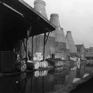
> Stoke on Trent
> Map Marketing
> Postcode Sector Maps
> ST - Stoke-on-Trent
> Maps and Charts
> Related Images
> North America
> Saint Martin
> Maps
> Popular Themes
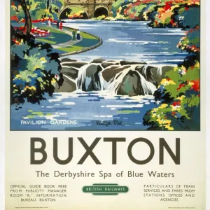
> Railway Posters
MADE IN THE USA
Safe Shipping with 30 Day Money Back Guarantee
FREE PERSONALISATION*
We are proud to offer a range of customisation features including Personalised Captions, Color Filters and Picture Zoom Tools
SECURE PAYMENTS
We happily accept a wide range of payment options so you can pay for the things you need in the way that is most convenient for you
* Options may vary by product and licensing agreement. Zoomed Pictures can be adjusted in the Cart.