Home > Europe > United Kingdom > England > London > Sights > Mile End Park
Eastleigh SO32 3 Map

![]()
Wall Art and Photo Gifts from Map Marketing
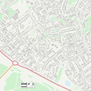
Eastleigh SO32 3 Map
Postcode Sector Map of Eastleigh SO32 3
Media ID 19982180
Allens Lane Chalk Hill Chapel Road Chestnut Rise Church Lane Cut Throat Lane Eastleigh Forester Road Frys Lane Green Lane Heath Road High Street Hill Rise Kiln Hill Liberty Road Long Road Mill Lane Millside New Road Oxford Lane Park Lane Plough Lane Pound Lane Rectory Lane School Hill Shoe Lane South Hill Southend Station Road Stocks Lane The Butts The Courtyard The Driftway The Park Union Lane Waltham Close West Street Wickham Road Cole Hill Exton
FEATURES IN THESE COLLECTIONS
> Animals
> Farm
> Sheep
> Related Images
> Animals
> Mammals
> Bovidae
> Sheep
> Animals
> Mammals
> Muridae
> Heath Mouse
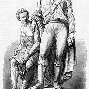
> Arts
> Portraits
> Pop art gallery
> Street art portraits
> Europe
> United Kingdom
> England
> London
> Sights
> Mile End Park
> Europe
> United Kingdom
> Scotland
> Fife
> St Andrews
> Map Marketing
> Postcode Sector Maps
> SO - Southampton
> Maps and Charts
> Related Images
> North America
> United States of America
> New York
> New York
> Bridges
> Union Street Bridge
> Popular Themes
> Sheep
MADE IN THE USA
Safe Shipping with 30 Day Money Back Guarantee
FREE PERSONALISATION*
We are proud to offer a range of customisation features including Personalised Captions, Color Filters and Picture Zoom Tools
SECURE PAYMENTS
We happily accept a wide range of payment options so you can pay for the things you need in the way that is most convenient for you
* Options may vary by product and licensing agreement. Zoomed Pictures can be adjusted in the Cart.