Home > Animals > Fishes > L > Ling
Norfolk NR12 7 Map

![]()
Wall Art and Photo Gifts from Map Marketing
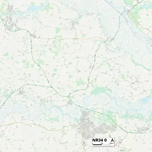
Norfolk NR12 7 Map
Postcode Sector Map of Norfolk NR12 7
Media ID 19976294
Addison Close All Saints Close Anchor Street Ashley Drive Buxton Road Chapel Lane Church Close Church Lane Church Road Church Street College Close Court Hill Glebe Way Green Lane Hall Lane High Street Highfield Way Kings Road Mill Road Norfolk Norwich Road Post Office Road Pound Hill Primrose Lane Quarry Road Rectory Close Rectory Road School Road Shirley Close St James St Johns Close St Margarets Close St Marys Court Station Road The Grove The Hill The Maltings The Street Westbourne Road Wroxham Road Coltishall Havergate
FEATURES IN THESE COLLECTIONS
> Animals
> Mammals
> Muridae
> Heath Mouse
> Animals
> Mammals
> Muridae
> Ling
> Arts
> Artists
> B
> James Bard
> Arts
> Artists
> B
> James Bayes
> Arts
> Artists
> F
> John Field
> Arts
> Artists
> H
> James Heath
> Arts
> Artists
> H
> John Hillers
> Arts
> Artists
> H
> John Hills
> Arts
> Artists
> H
> Robert Hancock
> Map Marketing
> Postcode Sector Maps
> NR - Norwich
MADE IN THE USA
Safe Shipping with 30 Day Money Back Guarantee
FREE PERSONALISATION*
We are proud to offer a range of customisation features including Personalised Captions, Color Filters and Picture Zoom Tools
SECURE PAYMENTS
We happily accept a wide range of payment options so you can pay for the things you need in the way that is most convenient for you
* Options may vary by product and licensing agreement. Zoomed Pictures can be adjusted in the Cart.