Home > Europe > United Kingdom > England > London > Sights > Victoria Park
Kirklees WF12 9 Map

![]()
Wall Art and Photo Gifts from Map Marketing
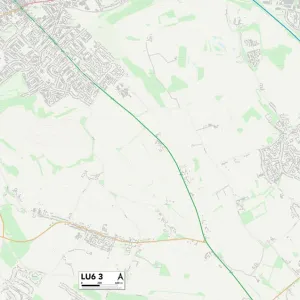
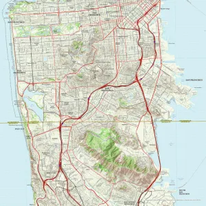
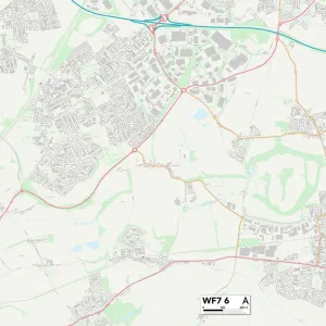
Kirklees WF12 9 Map
Postcode Sector Map of Kirklees WF12 9
Media ID 19980744
Ashfield Brewery Lane Caledonian Road Carlton Terrace Chapel Street Cowper Street Cross Street Dale Street Douglas Street Edward Close Eyre Street Falcon Road Forge Lane Greenwood Street Grosvenor Street Hill Crest Road Kimberley Street King Edward Street Kirklees Lock Street Manor Close Navigation Road North View Nursery Grove Nursery Street Orchard Croft Orchard Street Park Avenue Park Road Park View Pavilion Close Pentland Road Savile Road Scarborough Street Selbourne Road South Street South View St Marys Place Station Road The Sidings Thornhill Road Thornton Road Tudor Way Vicarage Road Victoria Drive Victoria Road Warren Street Water Lane Waverley Street West Street Wharf Close Wharf Street Centenary Square
FEATURES IN THESE COLLECTIONS
> Animals
> Birds
> Accipitriformes
> Accipitridae
> Black Falcon
> Animals
> Birds
> Accipitriformes
> Falcons
> Black Falcon
> Animals
> Mammals
> Muridae
> House Mouse
> Animals
> Mammals
> Muridae
> Water Mouse
> Arts
> Portraits
> Pop art gallery
> Street art portraits
> Europe
> United Kingdom
> England
> London
> Sights
> Victoria Park
> Europe
> United Kingdom
> Scotland
> Dumfries and Galloway
> Thornhill
> Europe
> United Kingdom
> Scotland
> West Lothian
> East Calder
> Map Marketing
> Postcode Sector Maps
> WF - Wakefield
> Maps and Charts
> Related Images
> Popular Themes
> North Island
MADE IN THE USA
Safe Shipping with 30 Day Money Back Guarantee
FREE PERSONALISATION*
We are proud to offer a range of customisation features including Personalised Captions, Color Filters and Picture Zoom Tools
SECURE PAYMENTS
We happily accept a wide range of payment options so you can pay for the things you need in the way that is most convenient for you
* Options may vary by product and licensing agreement. Zoomed Pictures can be adjusted in the Cart.