Home > Europe > United Kingdom > England > Birmingham > Area > Sarehole
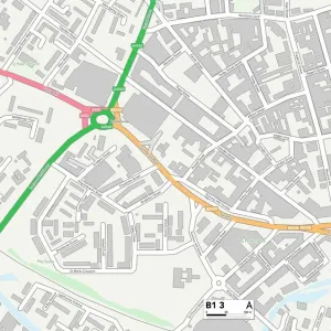
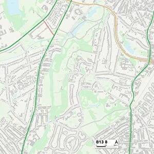
Birmingham B13 8 Map

![]()
Wall Art and Photo Gifts from Map Marketing
Birmingham B13 8 Map
Postcode Sector Map of Birmingham B13 8
Media ID 19965289
Alcester Road Amesbury Road Augusta Road Birmingham Boundary Drive Chantry Road Derwent Grove Elizabeth Road Farquhar Road Hill Crest Road King Edward Road Leighton Road Moorcroft Road Mount Close Park Hill Park Road Russell Road Salisbury Close Salisbury Road Sandhurst Road Sovereign Way St Annes Court St Johns Close Sutherland Drive The Hollow Trafalgar Road Tudor Road Woodbridge Road Yew Tree Road
FEATURES IN THESE COLLECTIONS
> Arts
> Artists
> H
> John Hillers
> Arts
> Artists
> H
> John Hills
> Arts
> Artists
> R
> John Russell
> Europe
> United Kingdom
> England
> Birmingham
> Area
> Moor Green
> Europe
> United Kingdom
> England
> Birmingham
> Area
> Sarehole
> Europe
> United Kingdom
> England
> Birmingham
> Area
> Tudor Hill
> Europe
> United Kingdom
> England
> London
> Politics
> John Russell
> Europe
> United Kingdom
> Scotland
> Sutherland
> Map Marketing
> Postcode Sector Maps
> B - Birmingham
> Maps and Charts
> Related Images
MADE IN THE USA
Safe Shipping with 30 Day Money Back Guarantee
FREE PERSONALISATION*
We are proud to offer a range of customisation features including Personalised Captions, Color Filters and Picture Zoom Tools
SECURE PAYMENTS
We happily accept a wide range of payment options so you can pay for the things you need in the way that is most convenient for you
* Options may vary by product and licensing agreement. Zoomed Pictures can be adjusted in the Cart.