Home > Europe > United Kingdom > Scotland > Dumfries and Galloway > Thornhill
Southampton SO19 6 Map

![]()
Wall Art and Photo Gifts from Map Marketing
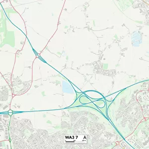
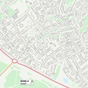
Southampton SO19 6 Map
Postcode Sector Map of Southampton SO19 6
Media ID 19981636
Alandale Road Baxter Road Boswell Close Burgoyne Road Burns Road Byron Road Campion Road Carey Road Chaucer Road Cowper Road Dryden Road Ellis Road Fern Close Flint Close Gilpin Close Herrick Close Hightown Linacre Road Lindsay Road Lydgate Close Lydgate Road Marston Road Murray Close Napier Road Proctor Close Shelley Road Sheridan Close So19 Southampton Spalding Road Spencer Road Spruce Drive The Terrace Thornhill Tunstall Road Vaughan Close Warburton Close
FEATURES IN THESE COLLECTIONS
> Arts
> Portraits
> Pop art gallery
> Street art portraits
> Europe
> United Kingdom
> Scotland
> Dumfries and Galloway
> Thornhill
> Europe
> United Kingdom
> Wales
> Flintshire
> Flint
> Map Marketing
> Postcode Sector Maps
> SO - Southampton
> Maps and Charts
> Related Images
MADE IN THE USA
Safe Shipping with 30 Day Money Back Guarantee
FREE PERSONALISATION*
We are proud to offer a range of customisation features including Personalised Captions, Color Filters and Picture Zoom Tools
SECURE PAYMENTS
We happily accept a wide range of payment options so you can pay for the things you need in the way that is most convenient for you
* Options may vary by product and licensing agreement. Zoomed Pictures can be adjusted in the Cart.