Home > North America > United States of America > New York > New York > Maps
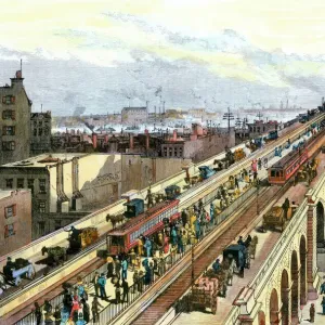
1866, Johnson Map of New York City and Brooklyn, topography, cartography, geography

![]()
Wall Art and Photo Gifts from Liszt Collection
1866, Johnson Map of New York City and Brooklyn, topography, cartography, geography
1866, Johnson Map of New York City and Brooklyn
Liszt Collection of nineteenth-century engravings and images to browse and enjoy
Media ID 14007967
© Artokoloro Quint Lox Limited
1866 Antique Map Atlas Chart Geographic Latitude Longitude Mappa Mundi Old Antique Plan Old Antique View Old Map Ols Antique Map Rare Old Maps Topo
FEATURES IN THESE COLLECTIONS
> Maps and Charts
> Early Maps
> Maps and Charts
> World
> North America
> United States of America
> New York
> New York
> Brooklyn
> Related Images
> North America
> United States of America
> New York
> New York
> Maps
EDITORS COMMENTS
This print showcases the remarkable 1866 Johnson Map of New York City and Brooklyn, a true masterpiece in topography, cartography, and geography. With meticulous detail and precision, this vintage map takes us back to a bygone era when exploration and discovery were at their peak. The intricate lines on this ancient piece of art form a mesmerizing grid that reveals the latitude and longitude coordinates of this bustling metropolis. Every street, river, park, and landmark is delicately illustrated with historical accuracy, offering an invaluable glimpse into the city's rich past. As we gaze upon this decorative relic from history, we are transported to a time when navigation relied solely on paper maps like these. The aged texture adds charm to its already fascinating appeal while reminding us of the countless journeys undertaken using such precious tools. This rare old map not only serves as a window into New York City's evolution but also offers insight into how our world was perceived centuries ago. It stands as a testament to human curiosity about our surroundings and serves as an ode to the pioneers who meticulously documented every corner of our planet. Whether you're an avid collector or simply appreciate the beauty of historical artifacts, this Johnson Map print is sure to captivate your imagination with its blend of artistry and geographic significance.
MADE IN THE USA
Safe Shipping with 30 Day Money Back Guarantee
FREE PERSONALISATION*
We are proud to offer a range of customisation features including Personalised Captions, Color Filters and Picture Zoom Tools
SECURE PAYMENTS
We happily accept a wide range of payment options so you can pay for the things you need in the way that is most convenient for you
* Options may vary by product and licensing agreement. Zoomed Pictures can be adjusted in the Cart.