Home > Europe > Belgium > Maps
1866, Johnson Map of Holland and Belgium, topography, cartography, geography, land

![]()
Wall Art and Photo Gifts from Liszt Collection
1866, Johnson Map of Holland and Belgium, topography, cartography, geography, land
1866, Johnson Map of Holland and Belgium
Liszt Collection of nineteenth-century engravings and images to browse and enjoy
Media ID 14007958
© Artokoloro Quint Lox Limited
1866 Antique Map Atlas Chart Geographic Latitude Longitude Mappa Mundi Old Antique Plan Old Antique View Old Map Ols Antique Map Rare Old Maps Topo
FEATURES IN THESE COLLECTIONS
> Maps and Charts
> Early Maps
> Maps and Charts
> World
EDITORS COMMENTS
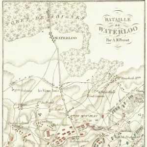
This print showcases the exquisite 1866 Johnson Map of Holland and Belgium, a true masterpiece in the realms of topography, cartography, and geography. With meticulous attention to detail, this vintage map offers a glimpse into the land's rich history and ancient allure. The illustration is an impeccable representation of these enchanting regions, with its intricate geographic features beautifully depicted. The carefully crafted topo lines provide a comprehensive understanding of the terrain, while the precise grid coordinates reveal latitude and longitude coordinates for accurate navigation. As one delves into this historic artifact, they are transported back in time to an era when exploration and discovery were at their peak. This rare old map serves as a window to bygone times, evoking a sense of wonder about our world's past. Printed on aged paper that exudes authenticity and charm, this decorative piece adds an artistic touch to any space it graces. Its historical significance cannot be overstated; it is both educational and visually stunning. Whether you are an avid traveler or simply appreciate fine artistry, this Johnson Map print invites you on a journey through time and space. It captures not only the essence of Holland and Belgium but also sparks curiosity about other regions yet unexplored. A treasure for collectors or history enthusiasts alike!
MADE IN THE USA
Safe Shipping with 30 Day Money Back Guarantee
FREE PERSONALISATION*
We are proud to offer a range of customisation features including Personalised Captions, Color Filters and Picture Zoom Tools
SECURE PAYMENTS
We happily accept a wide range of payment options so you can pay for the things you need in the way that is most convenient for you
* Options may vary by product and licensing agreement. Zoomed Pictures can be adjusted in the Cart.