Home > North America > United States of America > New York > New York > Maps
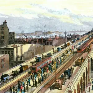
1865, Johnson Map of New York City and Brooklyn, topography, cartography, geography

![]()
Wall Art and Photo Gifts from Liszt Collection
1865, Johnson Map of New York City and Brooklyn, topography, cartography, geography
1865, Johnson Map of New York City and Brooklyn
Liszt Collection of nineteenth-century engravings and images to browse and enjoy
Media ID 14007908
© Artokoloro Quint Lox Limited
Antique Map Atlas Chart Geographic Latitude Longitude Mappa Mundi Old Antique Plan Old Antique View Old Map Ols Antique Map Rare Old Maps Topo
FEATURES IN THESE COLLECTIONS
> Maps and Charts
> Early Maps
> Maps and Charts
> World
> North America
> United States of America
> New York
> New York
> Brooklyn
> Related Images
> North America
> United States of America
> New York
> New York
> Maps
EDITORS COMMENTS
This print showcases the remarkable 1865 Johnson Map of New York City and Brooklyn, a true masterpiece in topography, cartography, and geography. With its intricate details and precise measurements, this vintage map takes us back to a bygone era when exploration and discovery were at their peak. The artistry behind this ancient relic is evident in its meticulous depiction of landforms, illustrated with utmost precision. Every contour and elevation is beautifully captured, making it an invaluable resource for historians and geographers alike. Its grid system based on latitude and longitude adds another layer of sophistication to this geometric marvel. As we gaze upon this decorative piece of history, we are transported to a time when navigation relied heavily on such maps. The aged appearance evokes a sense of nostalgia while reminding us of the rich heritage that lies beneath our feet. This rare old map serves as a window into the past—a visual representation of how New York City and Brooklyn once appeared. It invites us to explore these regions as they were over a century ago—an invitation that sparks curiosity about the changes that have shaped these iconic cities since then. Whether you are an avid collector or simply appreciate historical artifacts, this antique map from the Liszt Collection offers an opportunity to delve into the fascinating world of cartography while celebrating the beauty found within our own backyard.
MADE IN THE USA
Safe Shipping with 30 Day Money Back Guarantee
FREE PERSONALISATION*
We are proud to offer a range of customisation features including Personalised Captions, Color Filters and Picture Zoom Tools
SECURE PAYMENTS
We happily accept a wide range of payment options so you can pay for the things you need in the way that is most convenient for you
* Options may vary by product and licensing agreement. Zoomed Pictures can be adjusted in the Cart.