Jigsaw Puzzle : New York / Street Plan


![]()
Jigsaw Puzzles from Mary Evans Picture Library
New York / Street Plan
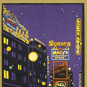
New York: street plan, showing the rivers, roads and public transport options
Mary Evans Picture Library makes available wonderful images created for people to enjoy over the centuries
Media ID 608044
© Mary Evans Picture Library 2015 - https://copyrighthub.org/s0/hub1/creation/maryevans/MaryEvansPictureID/10111336
Options Plan Rivers Roads 1895
Jigsaw Puzzle (1014 Pieces)
Discover the captivating world of New York City with our latest addition to the Media Storehouse Jigsaw Puzzles collection. This exquisite puzzle, featuring the "New York / Street Plan" image from Mary Evans Picture Library, invites you on a journey through the iconic streets of the Big Apple. Navigate the intricate network of roads, rivers, and public transport options that make New York the vibrant and dynamic metropolis it is. The intricately detailed map, sourced from Mary Evans Prints Online, offers a fresh perspective on the city's layout, making this puzzle an essential addition to any puzzle enthusiast's collection. Assemble the pieces and immerse yourself in the rich history and culture of New York City. The Media Storehouse Jigsaw Puzzles are designed to provide hours of enjoyable challenge and relaxation, perfect for all ages and skill levels. Experience the thrill of putting together the intricate details of this captivating puzzle, and unveil the beauty of New York City in a whole new way. Order your "New York / Street Plan" puzzle today and start your adventure!
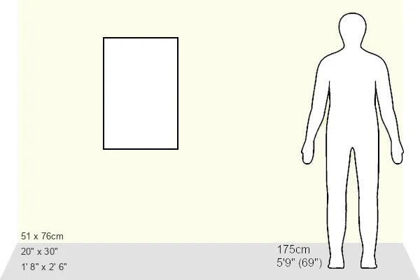
Made in the USA, 1014-piece puzzles measure 20" x 30" (50.8 x 76.2 cm). Every puzzle is meticulously printed on glossy photo paper, which has a strong 1.33 mm thickness. Delivered in a black storage cardboard box, these puzzles are both stylish and practical. (Note: puzzles contain small parts and are not suitable for children under 3 years of age.)
Jigsaw Puzzles are an ideal gift for any occasion
Estimated Product Size is 50.8cm x 76cm (20" x 29.9")
These are individually made so all sizes are approximate
Artwork printed orientated as per the preview above, with portrait (vertical) orientation to match the source image.
EDITORS COMMENTS
This vintage print from Mary Evans Picture Library captures the intricate street plan of New York City in 1895. The detailed map showcases the bustling city streets, rivers, roads, and various public transport options available at that time. It provides a fascinating glimpse into the historical layout of one of America's most iconic cities.
The image exudes a sense of nostalgia, transporting viewers back to a bygone era when horse-drawn carriages and early forms of public transportation crisscrossed the urban landscape. The meticulous attention to detail in this street plan offers a unique perspective on how New Yorkers navigated their way through the bustling metropolis over a century ago.
From Broadway to Fifth Avenue, this snapshot of history reveals the evolution of New York City's infrastructure and transportation network. It serves as a reminder of how far the city has come since its humble beginnings as a Dutch trading post in the 17th century.
Whether you're a history buff or simply appreciate vintage maps, this print is sure to spark your curiosity about New York City's past. Hang it on your wall or display it proudly in your home to add an air of sophistication and intrigue to any room.
MADE IN THE USA
Safe Shipping with 30 Day Money Back Guarantee
FREE PERSONALISATION*
We are proud to offer a range of customisation features including Personalised Captions, Color Filters and Picture Zoom Tools
SECURE PAYMENTS
We happily accept a wide range of payment options so you can pay for the things you need in the way that is most convenient for you
* Options may vary by product and licensing agreement. Zoomed Pictures can be adjusted in the Cart.