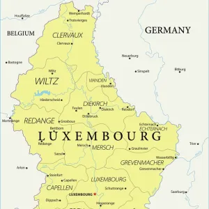
Jigsaw Puzzle > Europe > Luxembourg > Maps
Jigsaw Puzzle : Map of South Germany and Bavaria, c1872. Creator: Unknown


![]()
Jigsaw Puzzles from Heritage Images
Map of South Germany and Bavaria, c1872. Creator: Unknown
Map of South Germany and Bavaria, c1872. The territories colored green form part of the North German Confederation. Also showing Luxembourg, part of Prussia, the Palatinate of Bavaria, Hesse, Baden, Hohenzollern and Wurtemberg. From " The Franco-Prussian War: its causes, incidents and consequences", Volume I, by Captain H M Hozier. [William Mackenzie, London, 1872]
Heritage Images features heritage image collections
Media ID 19780437
© The Print Collector/Heritage Images
1870 1871 Baden Bavaria Franco Prussian War H M Hozier Henry Montague Henry Montague Hozier Hesse Hohenzollern Hozier Luxembourg Mackenzie North German Confederation Prussia Sir Henry Montagu Hozier State William Mackenzie Wurttemberg
Jigsaw Puzzle (520 Pieces)
Discover the rich history of South Germany and Bavaria with our captivating jigsaw puzzle from Media Storehouse. This intricately detailed puzzle, featuring an 1872 map from Heritage Images, invites you on a journey through time. Explore the territories of the North German Confederation, Prussia, the Palatinate of Bavaria, Hesse, and Baden, as well as Luxembourg. Solve the puzzle pieces to reveal the vibrant colors and intricate borders of this historical map, a perfect addition to any home or office. Unknown creator adds to the puzzle's allure, making each piece a piece of history in your hands.
Made in the USA, 520-piece puzzles measure 16" x 20" (40.6 x 50.8 cm). Every puzzle is meticulously printed on glossy photo paper, which has a strong 1.33 mm thickness. Delivered in a black storage cardboard box, these puzzles are both stylish and practical. (Note: puzzles contain small parts and are not suitable for children under 3 years of age.)
Jigsaw Puzzles are an ideal gift for any occasion
Estimated Product Size is 50.8cm x 40.5cm (20" x 15.9")
These are individually made so all sizes are approximate
Artwork printed orientated as per the preview above, with landscape (horizontal) or portrait (vertical) orientation to match the source image.
FEATURES IN THESE COLLECTIONS
> Europe
> Luxembourg
> Maps
> Europe
> Luxembourg
> Posters
> Europe
> Luxembourg
> Related Images
> Maps and Charts
> Luxembourg
> Maps and Charts
> Related Images
EDITORS COMMENTS
This print showcases a detailed map of South Germany and Bavaria from the year 1872. Created by an unknown artist, this historical artifact offers a glimpse into the political landscape of that era. The territories colored in green represent regions that were part of the North German Confederation during this time period. In addition to South Germany and Bavaria, the map also includes Luxembourg, which was under Prussian control at the time, as well as other significant states such as Hesse, Baden, Hohenzollern, and Wurtemberg. The image is sourced from "The Franco-Prussian War: its causes, incidents and consequences", Volume I written by Captain H. M. Hozier in 1872. Published by William Mackenzie in London, this book provides valuable insights into one of Europe's most significant conflicts during the late 19th century. With its vibrant colors and intricate details, this print serves as a reminder of how borders have evolved over time due to wars and geopolitical changes. It allows us to reflect on the complex history of these regions while appreciating their beauty through artistry.
MADE IN THE USA
Safe Shipping with 30 Day Money Back Guarantee
FREE PERSONALISATION*
We are proud to offer a range of customisation features including Personalised Captions, Color Filters and Picture Zoom Tools
SECURE PAYMENTS
We happily accept a wide range of payment options so you can pay for the things you need in the way that is most convenient for you
* Options may vary by product and licensing agreement. Zoomed Pictures can be adjusted in the Cart.