Home > North America > Canada > Maps
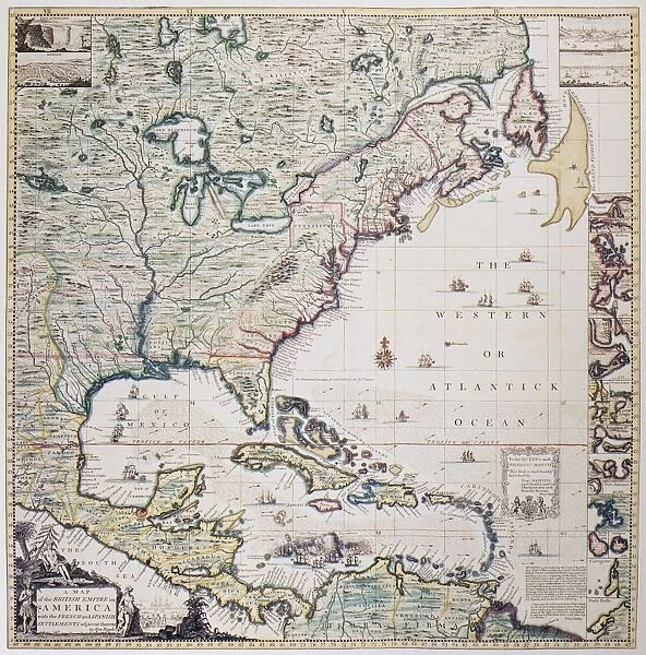
MAP OF AMERICA, 1733. Map by Henry Popple, engraved by William Henry Toms, of Eastern America, 1733
![]()

Wall Art and Photo Gifts from Granger
MAP OF AMERICA, 1733. Map by Henry Popple, engraved by William Henry Toms, of Eastern America, 1733
Granger holds millions of images spanning more than 25,000 years of world history, from before the Stone Age to the dawn of the Space Age
Media ID 7563687
1733 Atlantic Ocean British Canada Caribbean Caribbean Sea Central America Colonial Colony Eastern Henry Latin America Popple Toms Will I Am
FEATURES IN THESE COLLECTIONS
> Maps and Charts
> Early Maps
> North America
> Canada
> Maps
MAP OF AMERICA, 1733 - A Glimpse into the Early Colonial Era
EDITORS COMMENTS
. This print showcases a remarkable piece of history - a meticulously detailed map of Eastern America from 1733. Created by Henry Popple and engraved by William Henry Toms, this map offers an intriguing glimpse into the early days of British colonization in America. Spanning across North and Central America, as well as parts of the Caribbean and Latin America, this map provides a comprehensive view of the vast territories under British influence during that time. The intricate engravings depict geographical features such as rivers, mountains, and coastlines with astonishing accuracy. As we delve deeper into this historical artifact, it becomes evident how crucial maps were for explorers, traders, and settlers alike. This particular map served not only navigational purposes but also played a significant role in shaping colonial expansion strategies. The Map of America serves as a testament to the ambition and curiosity that drove explorers to venture into unknown lands. It reminds us of the complex web woven by European powers during their quest for dominance over new territories. With its rich details and elegant craftsmanship captured through engraving techniques mastered by Toms himself, this print invites us to appreciate both its artistic beauty and historical significance. Let it transport you back to an era when discovery was paramount and dreams knew no bounds – an era that laid the foundation for modern-day nations across two continents.
MADE IN THE USA
Safe Shipping with 30 Day Money Back Guarantee
FREE PERSONALISATION*
We are proud to offer a range of customisation features including Personalised Captions, Color Filters and Picture Zoom Tools
SECURE PAYMENTS
We happily accept a wide range of payment options so you can pay for the things you need in the way that is most convenient for you
* Options may vary by product and licensing agreement. Zoomed Pictures can be adjusted in the Cart.


