Fraud Blocker Skip to main content

Geography Collection (page 319)

"Exploring the Rich Tapestry of Geography: From Ancient Maps to Modern Wonders" The Al-Idrisi's world map from 1154 takes us back in time

Background imageGeography Collection: Chinese compass, 18th century manuscript

Chinese compass, 18th century manuscript. This diagram and its accompanying text describe the Chinese compass of 24 points (left)

Background imageGeography Collection: Hot springs at Yellowstone National Park

Hot springs at Yellowstone National Park. Panorama of the Grand Prismatic Spring in Midway Geyser Basin, Yellowstone National Park, Wyoming. This is the largest hot spring in the U.S

Background imageGeography Collection: Cormorant, 17th century artwork

Cormorant, 17th century artwork
Cormorant on a coast in China, 17th century artwork. Cormorants are coastal seabirds that feed on fish, and are found worldwide

Background imageGeography Collection: Chinese text, 18th century manuscript

Chinese text, 18th century manuscript. The columns show Chinese characters and names for various words, translated into Latin

Background imageGeography Collection: John Ogilby, Scottish translator

John Ogilby, Scottish translator
John Ogilby (1600-1676), Scottish translator and cartographer. Ogilbys early career was as lord deputy and tutor in Ireland for the Earl of Strafford

Background imageGeography Collection: Hernan Cortes, Spanish conquistador

Hernan Cortes, Spanish conquistador
Hernan Cortes (1485-1547), Spanish explorer and conquistador. Cortes crossed the Atlantic to seek his fortune in Hispaniola and later Cuba. In 1519, he led an expedition to the mainland

Background imageGeography Collection: Siamil coral reefs, Malaysia

Siamil coral reefs, Malaysia
Siamil coral reefs. These extensive coral reefs are a popular scuba diving location. They surround the shores of the oceanic island of Siamil, which is found in the Celebes Sea, Malaysia

Background imageGeography Collection: Giraffe, 16th century artwork

Giraffe, 16th century artwork. Captive giraffe being led on a rein. The giraffe is native to sub-Saharan Africa, though captive specimens had been brought to Italy in Roman times

Background imageGeography Collection: Rhone glacier, Switzerland

Rhone glacier, Switzerland
Rhone glacier in the Swiss Alps, panoramic view. A new glacial lake (green) is forming as a result of the glacier melting. Photographed in 2008

Background imageGeography Collection: Morteratsch glacier, Switzerland

Morteratsch glacier, Switzerland
Morteratsch glacier in Grisons, Switzerland, panoramic view. Photographed in 1985. See C003/1269 for this glacier in 2007

Background imageGeography Collection: Vredefort crater, satellite image

Vredefort crater, satellite image. The Vredefort meteor impact crater (semi-circular, lower centre) is the largest, and second-oldest, known impact crater on Earth

Background imageGeography Collection: High tide line

High tide line. Wave washing over debris at the high tide line, or strandline, on a beach

Background imageGeography Collection: Mount Unzen, satellite image

Mount Unzen, satellite image. Satellite image showing part of the island of Kyushu with Mount Unzen at centre. Water is blue, vegetation is green, cloud, snow and ice are white

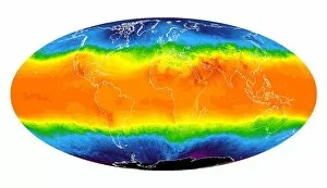
Background imageGeography Collection: Global temperatures, April 2003

Global temperatures, April 2003. Infrared satellite map of worldwide surface and cloud temperatures in April 2003. The colour-coded map shows temperatures in degrees Celsius

Background imageGeography Collection: Folded rock

Folded rock in the face of Sichelkamm, a mountain in northeastern Switzerland

Background imageGeography Collection: Compass and dividers on a map

Compass and dividers on a map
Navigational compass and dividers (also called a measuring compass, lower left) on a map

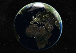
Background imageGeography Collection: Europe at night, satellite image

Europe at night, satellite image
Europe at night. Satellite image of the Earth seen at 00:00 (midnight) GMT (UTC), centred on Europe. City lights (yellow) in dark areas show areas of dense population

Background imageGeography Collection: Global consumerism, conceptual artwork

Global consumerism, conceptual artwork
Global consumerism, conceptual computer artwork. Globe inside a shopping trolley. This could represent global consumerism, like shopping on the internet

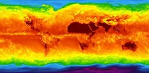
Background imageGeography Collection: Global temperatures, May 2009

Global temperatures, May 2009. Infrared satellite map of average daytime air temperatures at 3000 metres elevation worldwide in May 2009

Background imageGeography Collection: Nikolai Przhevalsky, Russian explorer

Nikolai Przhevalsky, Russian explorer
Nikolai Przhevalsky (1839-1888), Russian explorer, geographer and student of Central Asia. Przhevalsky, from a noble Polish family

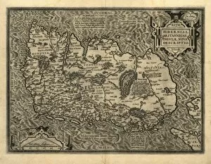
Background imageGeography Collection: Orteliuss map of Ireland, 1598

Orteliuss map of Ireland, 1598
Orteliuss map of Ireland, from an atlas of 1598. North is at right. This map is titled: Hiberniae, Britannicae Insulae Nova Descriptio (A new depiction of Ireland, a British Isle)

Background imageGeography Collection: Orteliuss map of Denmark, 1570

Orteliuss map of Denmark, 1570
Orteliuss map of Denmark. This map is from the 1570 first edition of Theatrum orbis terrarum ( Theatre of the World ). Drawn by the Flemish mapmaker Abraham Ortelius (1527-1598)

Background imageGeography Collection: Volcanic lakes, New Zealand

Volcanic lakes, New Zealand
Volcanic lakes. These are the Emerald Lakes in Tongariro National Park, on New Zealands North Island. The Tongariro National Park is the oldest national park in New Zealand

Background imageGeography Collection: Orteliuss map of European Russia, 1570

Orteliuss map of European Russia, 1570
Orteliuss map of European Russia. This map is from the 1570 first edition of Theatrum orbis terrarum ( Theatre of the World )

Background imageGeography Collection: Columbia River Gorge, USA

Columbia River Gorge, USA
Columbia River Gorge, Oregon, USA. This gorge, gouged from the rock by the Columbia River, is 130 kilometres long. The gorge passes through the mountains of the Cascade Range from the eastern side to

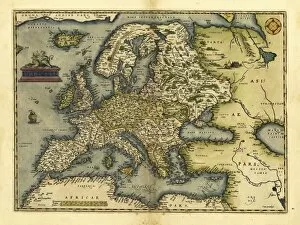
Background imageGeography Collection: Orteliuss map of Europe, 1570

Orteliuss map of Europe, 1570. This map is from the 1570 first edition of Theatrum orbis terrarum ( Theatre of the World )

Background imageGeography Collection: Crater Lake, USA

Crater Lake, USA
Crater Lake, Oregon, USA. This lake formed around 6900 years ago, following the collapse of a large volcano. The lake itself is around 600 metres deep

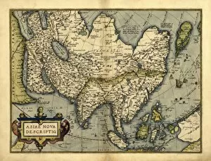
Background imageGeography Collection: Orteliuss map of Asia, 1570

Orteliuss map of Asia, 1570
Orteliuss map of Asia. This map is from the 1570 first edition of Theatrum orbis terrarum ( Theatre of the World ). Drawn by the Flemish mapmaker Abraham Ortelius (1527-1598)

Background imageGeography Collection: Orteliuss map of France, 1570

Orteliuss map of France, 1570
Orteliuss map of France. This map is from the 1570 first edition of Theatrum orbis terrarum ( Theatre of the World ). Drawn by the Flemish mapmaker Abraham Ortelius (1527-1598)

Background imageGeography Collection: Siberian landscape

Siberian landscape. Snowy and icy landscape of trees, a river, lake and mountains. Photographed in November at Gorny Altai, in the Altai Krai region of Russia

Background imageGeography Collection: Orteliuss map of Austria, 1570

Orteliuss map of Austria, 1570
Orteliuss map of Austria. This map is from the 1570 first edition of Theatrum orbis terrarum ( Theatre of the World ). Drawn by the Flemish mapmaker Abraham Ortelius (1527-1598)

Background imageGeography Collection: Orteliuss map of Switzerland, 1570

Orteliuss map of Switzerland, 1570
Orteliuss map of Switzerland. This map is from the 1570 first edition of Theatrum orbis terrarum ( Theatre of the World )

Background imageGeography Collection: Orteliuss map of Northern Europe, 1570

Orteliuss map of Northern Europe, 1570
Orteliuss map of Northern Europe. This map is from the 1570 first edition of Theatrum orbis terrarum ( Theatre of the World )

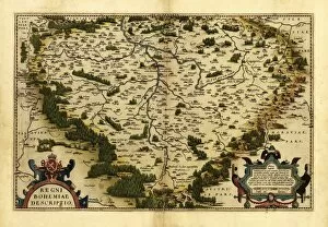
Background imageGeography Collection: Orteliuss map of Bohemia, 1570

Orteliuss map of Bohemia, 1570
Orteliuss map of Bohemia. This map is from the 1570 first edition of Theatrum orbis terrarum ( Theatre of the World ). Drawn by the Flemish mapmaker Abraham Ortelius (1527-1598)

Background imageGeography Collection: Blue Marble image of Earth (2010)

Blue Marble image of Earth (2010)
Blue Marble image of Earth. Composite satellite image of Earths eastern hemisphere, centred on India. North is at top. This image is one of a set released in March 2010 using Blue Marble

Background imageGeography Collection: Jupiter in Scorpius over a beach

Jupiter in Scorpius over a beach. The planet Jupiter (centre), in the constellation Scorpius, is reflected in the sea. Jupiter is the largest planet in the solar system

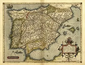
Background imageGeography Collection: Orteliuss map of Iberian Peninsula, 1570

Orteliuss map of Iberian Peninsula, 1570
Orteliuss map of Iberian Peninsula. This map is from the 1570 first edition of Theatrum orbis terrarum ( Theatre of the World )

Background imageGeography Collection: Orteliuss map of Africa, 1570

Orteliuss map of Africa, 1570
Orteliuss map of Africa. This map is from the 1570 first edition of Theatrum orbis terrarum ( Theatre of the World ). Drawn by the Flemish mapmaker Abraham Ortelius (1527-1598)

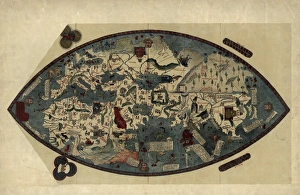
Background imageGeography Collection: Genoese world map, 1450

Genoese world map, 1450
Genoese world map. This world map was drawn in around 1450, possibly by the Italian mathematician, astronomer, and geographer Paolo dal Pozzo Toscanelli (1397-1482)

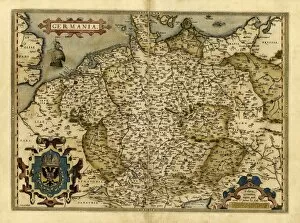
Background imageGeography Collection: Orteliuss map of Germany, 1570

Orteliuss map of Germany, 1570
Orteliuss map of Germany. This map is from the 1570 first edition of Theatrum orbis terrarum ( Theatre of the World ). Drawn by the Flemish mapmaker Abraham Ortelius (1527-1598)

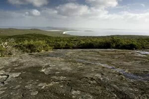
Background imageGeography Collection: Torndirrup National Park, Australia

Torndirrup National Park, Australia
Ancient pre-cambrian granite domes, with wind stunted vegetation in the Torndirrup National Park, Albany, looking up the Vancouver Peninsula into King George Sound, western Australia

Background imageGeography Collection: Low tide at night

Low tide at night. Exposed sand shows the patterns made by the ebb and flow of the tide. The pools left behind are reflecting the moon light

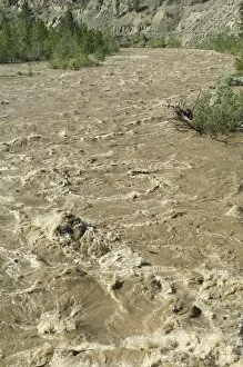
Background imageGeography Collection: Spring flood, Nicola River, Canada

Spring flood, Nicola River, Canada. This torrent of water has formed due to a sudden increase in temperature that caused a faster-than-normal melting of the winter snow in the Coast Mountains of

Background imageGeography Collection: Water flow around boulder

Water flow around boulder, time-exposure image. Gentle waters and river currents flowing over and around a large boulder. Photographed in early summer on the Nicola River, British Columbia, Canada

Background imageGeography Collection: Salt encrustations by the Dead Sea

Salt encrustations by the Dead Sea, Israel. The Dead Sea is the lowest elevation on the Earths surface on dry land and one of the worlds saltiest bodies of water, with 33.7 per cent salinity

Background imageGeography Collection: Sunset

Sunset. Montage image of the sun setting on the horizon, creating a mirage of the sun melting at its lower edge

Background imageGeography Collection: The Old Man of Storr, Isle of Skye

The Old Man of Storr, Isle of Skye, Scotland, after a winter snow storm. This set of eroded basalt rock pinnacles is located high up on a rocky hill known as the Storr

Background imageGeography Collection: Juniper tree

Juniper tree (Juniperis sp.) growing by sandstone rocks. Photographed in the Arches National Park, Utah, USA


All Professionally Made to Order for Quick Shipping

"Exploring the Rich Tapestry of Geography: From Ancient Maps to Modern Wonders" The Al-Idrisi's world map from 1154 takes us back in time, showcasing the early understanding and its importance in navigation. Derwent Water, with Blencathra standing tall behind it, offers a breathtaking view of nature's wonders in the Lake District, Cumbria, England. Jacopo de Barbari's Map of Venice in 1500 allows us to delve into the intricate layout of this enchanting city built on water. An antique map of Tasmania reveals how explorers once charted unknown territories and expanded our knowledge about distant lands. The V & A waterfront and Table Mountain create an awe-inspiring backdrop for Cape Town, South Africa – a testament to geography shaping stunning landscapes. Continental drift after 250 million years shows us that our planet is constantly evolving, reminding us of the dynamic forces at work beneath Earth's surface. Malham Cove stands as a geological marvel within Yorkshire Dales National Park, captivating visitors with its limestone formations carved by natural processes over millennia. Whole Earth (Blue Marble 2000) provides a mesmerizing image capturing our beautiful planet from space – highlighting both its vastness and interconnectedness through geography. The British Empire world map from the 19th century reflects an era when geographical exploration played a significant role in expanding colonial influence across continents. James Craig's Map of New Town Edinburgh from 1768 showcases meticulous topography planning that shaped one of Scotland's most iconic cities even today. Anglo-Saxon 10th-century world map gives insight into early European perceptions and interpretations regarding global geography during medieval times In summary, these diverse hints remind us that geography is not just about maps but also encompasses breathtaking landscapes, historical perspectives on human exploration and settlement, and the ever-changing nature of our planet.