Fraud Blocker Skip to main content

Continent Collection (page 3)

"Exploring the Vastness: A Journey through Continents" Al-Idrisi's World Map, 1154: Unveiling the ancient knowledge of continents and their boundaries

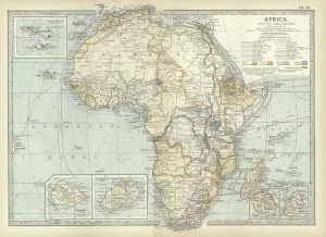
Background imageContinent Collection: Map of colonial Africa, c.1900 (engraving)

Map of colonial Africa, c.1900 (engraving)
533053 Map of colonial Africa, c.1900 (engraving); (add.info.: Map of colonial Africa, with insets of Ascension Island, St)

Background imageContinent Collection: Map of Australia and Tasmania. c1902 (engraving)

Map of Australia and Tasmania. c1902 (engraving)
533041 Map of Australia and Tasmania. c1902 (engraving); (add.info.: Map showing Australia with insets of Melbourne and Port Phillip, Tasmania, and Sydney and Vicinity, circa 1902)

Background imageContinent Collection: Allegory of modern celebrated travelers. Illustration of 1880 (Engraving)

Allegory of modern celebrated travelers. Illustration of 1880 (Engraving)
AIS5394665 Allegory of modern celebrated travelers. Illustration of 1880 (Engraving); Private Collection; © Lorio / Iberfoto

Background imageContinent Collection: Alaska (colour litho)

Alaska (colour litho)
5213929 Alaska (colour litho) by Pinchon, Joseph Porphyre (1871-1953); Private Collection; (add.info.: Alaska. Illustration for L'Epanouissement du Monde (Blonder La Rougery)

Background imageContinent Collection: Etats-Unis (colour litho)

Etats-Unis (colour litho)
5213926 Etats-Unis (colour litho) by Pinchon, Joseph Porphyre (1871-1953); Private Collection; (add.info.: Etats-Unis. Illustration for L'Epanouissement du Monde (Blonder La Rougery)

Background imageContinent Collection: Afrique Centrale (colour litho)

Afrique Centrale (colour litho)
5213924 Afrique Centrale (colour litho) by Pinchon, Joseph Porphyre (1871-1953); Private Collection; (add.info.: Afrique Centrale)

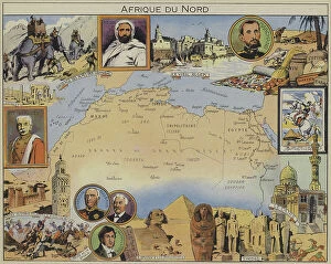
Background imageContinent Collection: Afrique du Nord (colour litho)

Afrique du Nord (colour litho)
5213923 Afrique du Nord (colour litho) by Pinchon, Joseph Porphyre (1871-1953); Private Collection; (add.info.: Afrique du Nord)

Background imageContinent Collection: Essor Scientifique de l'Europe (colour litho)

Essor Scientifique de l'Europe (colour litho)
5213918 Essor Scientifique de l'Europe (colour litho) by Pinchon, Joseph Porphyre (1871-1953); Private Collection; (add.info.: Essor Scientifique de l'Europe)

Background imageContinent Collection: Mediterranee (colour litho)

Mediterranee (colour litho)
5213917 Mediterranee (colour litho) by Pinchon, Joseph Porphyre (1871-1953); Private Collection; (add.info.: Mediterranee)

Background imageContinent Collection: Europe (colour litho)

Europe (colour litho)
5213916 Europe (colour litho) by Pinchon, Joseph Porphyre (1871-1953); Private Collection; (add.info.: Europe. Illustration for L'Epanouissement du Monde (Blonder La Rougery)

Background imageContinent Collection: Argentine (colour litho)

Argentine (colour litho)
5213935 Argentine (colour litho) by Pinchon, Joseph Porphyre (1871-1953); Private Collection; (add.info.: Argentine. Illustration for L'Epanouissement du Monde (Blonder La Rougery)

Background imageContinent Collection: Antilles (colour litho)

Antilles (colour litho)
5213930 Antilles (colour litho) by Pinchon, Joseph Porphyre (1871-1953); Private Collection; (add.info.: Antilles. Illustration for L'Epanouissement du Monde (Blonder La Rougery)

Background imageContinent Collection: Asie Centrale et Siberie (colour litho)

Asie Centrale et Siberie (colour litho)
5213920 Asie Centrale et Siberie (colour litho) by Pinchon, Joseph Porphyre (1871-1953); Private Collection; (add.info.: Asie Centrale et Siberie)

Background imageContinent Collection: Orient (colour litho)

Orient (colour litho)
5213919 Orient (colour litho) by Pinchon, Joseph Porphyre (1871-1953); Private Collection; (add.info.: Orient. Illustration for L'Epanouissement du Monde (Blonder La Rougery)

Background imageContinent Collection: Inhabitants of Limerick distraught as the Irish forces leave

Inhabitants of Limerick distraught as the Irish forces leave
5312092 Inhabitants of Limerick distraught as the Irish forces leave; (add.info.: Engraving depicting inhabitants of Limerick distraught as the Irish forces leave Limerick after making their final)

Background imageContinent Collection: World map for kids

World map for kids
Jota de jai

Background imageContinent Collection: Bresil (colour litho)

Bresil (colour litho)
5213934 Bresil (colour litho) by Pinchon, Joseph Porphyre (1871-1953); Private Collection; (add.info.: Bresil. Illustration for L'Epanouissement du Monde (Blonder La Rougery)

Background imageContinent Collection: Mexique (colour litho)

Mexique (colour litho)
5213932 Mexique (colour litho) by Pinchon, Joseph Porphyre (1871-1953); Private Collection; (add.info.: Mexique. Illustration for L'Epanouissement du Monde (Blonder La Rougery)

Background imageContinent Collection: Chine et Japon (colour litho)

Chine et Japon (colour litho)
5213921 Chine et Japon (colour litho) by Pinchon, Joseph Porphyre (1871-1953); Private Collection; (add.info.: Chine et Japon)

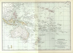
Background imageContinent Collection: Map of Oceania, c.1900 (engraving)

Map of Oceania, c.1900 (engraving)
533039 Map of Oceania, c.1900 (engraving); (add.info.: Map of Oceanica (Oceania): Australia, New Zealand, Polynesia, Melanesia, and Hawaiian Islands, circa 1902

Background imageContinent Collection: Haciendo Planes

Haciendo Planes
Javier Senosiain

Background imageContinent Collection: DDE-90200093

DDE-90200093
Asia, Indonesia, Sulawesi, Sulawesi crested black macaque, Macaca nigra, self-portrait created after camera set-up on a tripod with cable release by photographer, also known as monkey selfie'

Background imageContinent Collection: Vive Le Sport! Go by rail... Advert for SNCF French Railways

Vive Le Sport! Go by rail... Advert for SNCF French Railways. Date: 1954

Background imageContinent Collection: Old Map of The Americas 1635 by Willem & Johan Blaue from the Theatrum Orbis Terrarum

Old Map of The Americas 1635 by Willem & Johan Blaue from the Theatrum Orbis Terrarum
This detailed and most attractive reproduction map of The Americas has been carefully art worked from a scan of an antique original

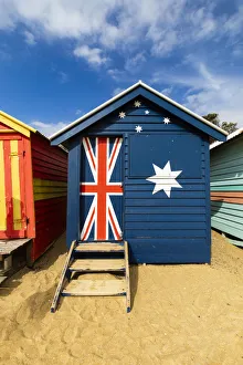
Background imageContinent Collection: The colourful Brighton Bathing Boxes located on Middle Brighton Beach, Brighton

The colourful Brighton Bathing Boxes located on Middle Brighton Beach, Brighton, Melbourne, Victoria, Australia

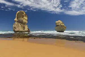
Background imageContinent Collection: Gibson Beach near the 12 Apostles on the Great Ocean Road, Princetown, Victoria

Gibson Beach near the 12 Apostles on the Great Ocean Road, Princetown, Victoria, Australia

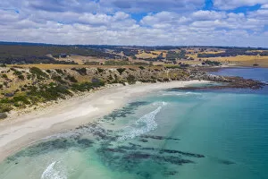
Background imageContinent Collection: Stokes Bay, Kangaroo Island, South Australia, Australia

Stokes Bay, Kangaroo Island, South Australia, Australia

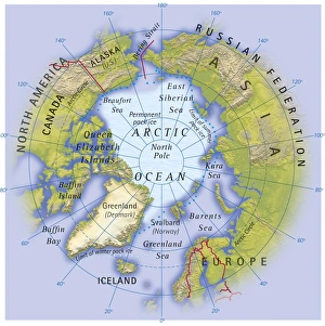
Background imageContinent Collection: Digital illustration of map showing position of Arctic Ocean and surrounding continents

Digital illustration of map showing position of Arctic Ocean and surrounding continents

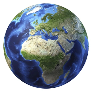
Background imageContinent Collection: 3D rendering of planet Earth, centered on Africa and Europe

3D rendering of planet Earth, centered on Africa and Europe
3D rendering of planet Earth with clouds, centered on Africa and Europe

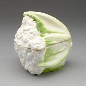
Background imageContinent Collection: Cauliflower Tureen, Chelsea, c. 1755

Cauliflower Tureen, Chelsea, c. 1755

Background imageContinent Collection: Seal, Chelsea, 1750/70

Seal, Chelsea, 1750/70

Background imageContinent Collection: Globe North Pole, True Colour Satellite Image. Cloudless true colour satellite image of the Earth, c

Globe North Pole, True Colour Satellite Image. Cloudless true colour satellite image of the Earth, centred on the Arctic or north polar region

Background imageContinent Collection: French Railway News - Service Streamlined since War

French Railway News - Service Streamlined since War. Date: 1952

Background imageContinent Collection: Yokohama and Tokyo

Yokohama and Tokyo
Old illustration map of Yokohama and Tokyo

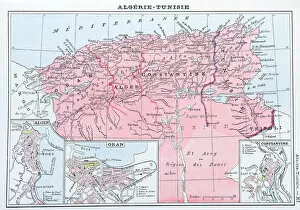
Background imageContinent Collection: Antique map of Algeria and Tunisia

Antique map of Algeria and Tunisia

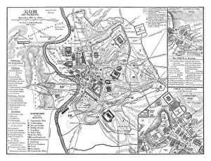
Background imageContinent Collection: Old map showing Rome arround 1st century BC

Old map showing Rome arround 1st century BC
Old map showing Rome circa 1st century bc Original edition from my own archives Source : Illustriertes Konversations Lexikon 1878

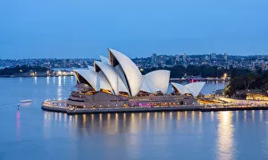
Background imageContinent Collection: Sydney Opera House at dusk, Sydney, New South Wales, Australia

Sydney Opera House at dusk, Sydney, New South Wales, Australia

Background imageContinent Collection: Uluru (Ayers Rock), Uluru-Kata Tjuta National Park, Northern Territory, Central Australia

Uluru (Ayers Rock), Uluru-Kata Tjuta National Park, Northern Territory, Central Australia, Australia

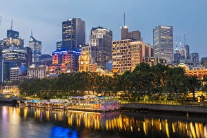
Background imageContinent Collection: Cityscape at dusk, Melbourne, Victoria, Australia

Cityscape at dusk, Melbourne, Victoria, Australia

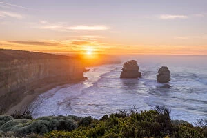
Background imageContinent Collection: Gibosns Beach, Twelve Apostles Marine National Park near Port Campbell

Gibosns Beach, Twelve Apostles Marine National Park near Port Campbell, Great Ocean Road, Victoria, Australia

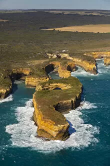
Background imageContinent Collection: Mutton Bird Island, Twelve Apostles Marine National Park near Port Campbell

Mutton Bird Island, Twelve Apostles Marine National Park near Port Campbell, Great Ocean Road, Victoria, Australia

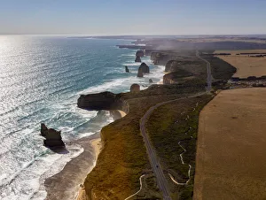
Background imageContinent Collection: Twelve Apostles Marine National Park near Port Campbell, Great Ocean Road, Victoria

Twelve Apostles Marine National Park near Port Campbell, Great Ocean Road, Victoria, Australia

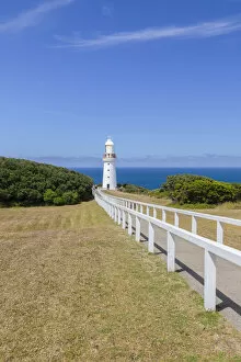
Background imageContinent Collection: Cape Otway Lightstation, Great Otway National Park, Great Ocean Road, Victoria, Australia

Cape Otway Lightstation, Great Otway National Park, Great Ocean Road, Victoria, Australia

Background imageContinent Collection: Pennington Bay, Kangaroo Island, South Australia, Australia

Pennington Bay, Kangaroo Island, South Australia, Australia

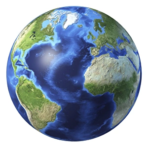
Background imageContinent Collection: 3D rendering of planet Earth centered on Atlantic Ocean

3D rendering of planet Earth centered on Atlantic Ocean
3D rendering of planet Earth with clouds, centered on the Atlantic Ocean, with North America, South America, Africa and Europe partially visible

Background imageContinent Collection: Africa, artwork

Africa, artwork
Africa, computer artwork

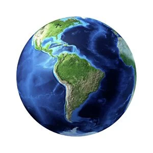
Background imageContinent Collection: South America, artwork

South America, artwork
South America, computer artwork

Background imageContinent Collection: Atlantic Ocean, artwork

Atlantic Ocean, artwork
Atlantic Ocean, computer artwork


All Professionally Made to Order for Quick Shipping

"Exploring the Vastness: A Journey through Continents" Al-Idrisi's World Map, 1154: Unveiling the ancient knowledge of continents and their boundaries. Continental Drift after 250 Million Years: Witnessing the ever-changing face of our planet over millions of years. Europe at Night - Satellite Image: Illuminating the vibrant tapestry of cities and civilizations under a starry sky. Europe at Night: A captivating nocturnal view showcasing the continent's bustling energy and urban landscapes. 17th Century World Map: Tracing the evolving perception of continents through historical cartography. Whole Earth at Night - Satellite Image: Glimpsing humanity's interconnectedness as lights twinkle across continents in unison. Our "Little Contemptibles, " 1914: Reflecting on bravery and resilience amidst global conflicts that shaped continents' destinies. 16th Century World Map: Discovering early explorers' visions as they unveiled new lands and expanded continental horizons. Earth from Space - Satellite Image: Beholding our magnificent home from afar, where continents blend seamlessly into one unified entity. Oronce Fine's World Map, 1531: Marveling at an intricate masterpiece that laid foundations for understanding vast continental expanses. Map of the Word with Lines Marking Boundaries of Tectonic Plates : Unraveling nature's hidden forces shaping continents throughout time The Devilfish in Egyptian Waters – An American cartoon from 1882 depicting John Bull (England) as the octopus of imperialism grabbing land on every continent .