Fraud Blocker Skip to main content

Continent Collection (page 9)

"Exploring the Vastness: A Journey through Continents" Al-Idrisi's World Map, 1154: Unveiling the ancient knowledge of continents and their boundaries

Background imageContinent Collection: Two Hemispheres of the Earth Facing Each Other, 1959 (colour litho)

Two Hemispheres of the Earth Facing Each Other, 1959 (colour litho)
2630055 Two Hemispheres of the Earth Facing Each Other, 1959 (colour litho) by American School, (20th century); Private Collection; Photo eGraphicaArtis; American, out of copyright

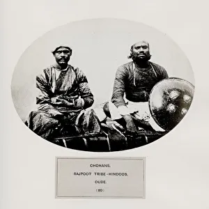
Background imageContinent Collection: Chohans, Rajpoot tribe Hindoos. Oude

Chohans, Rajpoot tribe Hindoos. Oude
The People of India: A Series of Photographic Illustrations, with Descriptive Letterpress, of the Races and Tribes of Hindustan - published in the 1860s under order of the Viceroy

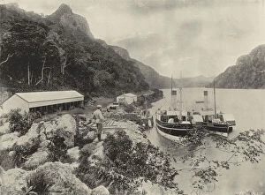
Background imageContinent Collection: St Johns River, Old Jetty and Warehouses (b / w photo)

St Johns River, Old Jetty and Warehouses (b / w photo)
3092356 St Johns River, Old Jetty and Warehouses (b/w photo) by English Photographer, (19th century); Private Collection; (add.info.: St Johns River, Old Jetty and Warehouses)

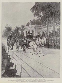
Background imageContinent Collection: The Queens Journey to the Continent, Her Majestys Arrival at Nice (litho)

The Queens Journey to the Continent, Her Majestys Arrival at Nice (litho)
1598618 The Queens Journey to the Continent, Her Majestys Arrival at Nice (litho) by Forestier, Amedee (1854-1930) (after); Private Collection; (add.info.: The Queens Journey to the Continent)

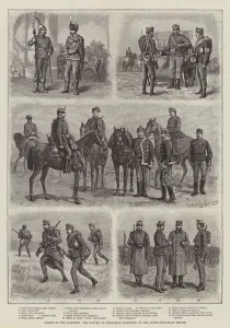
Background imageContinent Collection: Armies of the Continent, the Honved, or Hungarian Landwehr, of the Austro-Hungarian Empire

Armies of the Continent, the Honved, or Hungarian Landwehr, of the Austro-Hungarian Empire (engraving)
1595285 Armies of the Continent, the Honved, or Hungarian Landwehr, of the Austro-Hungarian Empire (engraving) by Schonberg

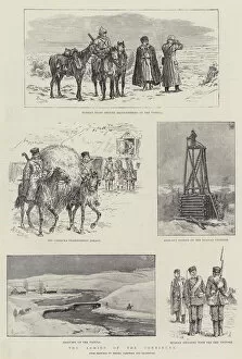
Background imageContinent Collection: The Armies of the Continent, Russian Dragoons on the March between Ivanowitz and Skala

The Armies of the Continent, Russian Dragoons on the March between Ivanowitz and Skala (Austrian Frontier) (engraving)
1595219 The Armies of the Continent, Russian Dragoons on the March between Ivanowitz and Skala (Austrian Frontier) (engraving) by Schonberg

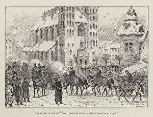
Background imageContinent Collection: The Armies of the Continent, Austrian Military Stores arriving at Cracow (engraving)

The Armies of the Continent, Austrian Military Stores arriving at Cracow (engraving)
1595093 The Armies of the Continent, Austrian Military Stores arriving at Cracow (engraving) by Schonberg, Johann Nepomuk (1780-1863) (after); Private Collection; (add.info)

Background imageContinent Collection: The Armies of the Continent (engraving)

The Armies of the Continent (engraving)
1595033 The Armies of the Continent (engraving) by Woodville, Richard Caton II (1856-1927) (after); Private Collection; (add.info.: The Armies of the Continent)

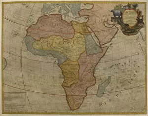
Background imageContinent Collection: Map of Africa, published in 1700, Paris (colour engraving)

Map of Africa, published in 1700, Paris (colour engraving)
REV345805 Map of Africa, published in 1700, Paris (colour engraving) by Delisle, Guillaume (1675-1726) (after); Private Collection; (add.info.: Guillaume de L Isle)

Background imageContinent Collection: Map showing the world trade shipping routes, cartography by Pierre Duval (1619-83

Map showing the world trade shipping routes, cartography by Pierre Duval (1619-83
REV345800 Map showing the world trade shipping routes, cartography by Pierre Duval (1619-83) published in 1686, Paris (colour engraving) by French School

Background imageContinent Collection: Music sheet cover for At the Cafe Continental by Will Grosz and Jimmy Kennedy

Music sheet cover for At the Cafe Continental by Will Grosz and Jimmy Kennedy. Illustration features a continental cafe with various patrons seated at outdoor tables

Background imageContinent Collection: Map of Africa, from Atlas Minor, published in Augsburg

Map of Africa, from Atlas Minor, published in Augsburg
CHT247760 Map of Africa, from Atlas Minor, published in Augsburg, first half of eighteenth century (engraving) by Seutter, Georg MatthAaus (1678-1757); Bibliotheque des Arts Decoratifs, Paris

Background imageContinent Collection: Gibraltar (engraving)

Gibraltar (engraving)
5219028 Gibraltar (engraving) by English School, (19th century); Private Collection; (add.info.: Gibraltar. Illustration for Continental Travels Pictorially Described)

Background imageContinent Collection: St Peter s, Rome (engraving)

St Peter s, Rome (engraving)
5219013 St Peter s, Rome (engraving) by English School, (19th century); Private Collection; (add.info.: St Peter s, Rome. Illustration for Continental Travels Pictorially Described)

Background imageContinent Collection: Augsburg (engraving)

Augsburg (engraving)
5219009 Augsburg (engraving) by English School, (19th century); Private Collection; (add.info.: Augsburg. Illustration for Continental Travels Pictorially Described)

Background imageContinent Collection: Berlin, Schiller Platz (engraving)

Berlin, Schiller Platz (engraving)
5219008 Berlin, Schiller Platz (engraving) by English School, (19th century); Private Collection; (add.info.: Berlin, Schiller Platz)

Background imageContinent Collection: 986455

986455

Background imageContinent Collection: Map of Asia, 1786 (hand-coloured engraving)

Map of Asia, 1786 (hand-coloured engraving)
986319 Map of Asia, 1786 (hand-coloured engraving) by Desnos, Louis-Charles (c.1725-c.1800); 100x119 cm; Private Collection; (add.info.: Map of Asia; L Asie.... Louis-Charles Desnos (c.1725-c.1800)

Background imageContinent Collection: Map of North America (coloured engraving)

Map of North America (coloured engraving)
6014076 Map of North America (coloured engraving) by American School, (19th century); Private Collection; (add.info.: Map of North America)

Background imageContinent Collection: French Railway News - Paris-Dijon Speed-up

French Railway News - Paris-Dijon Speed-up - Electrification shortens the journey, knocking an hour off the old timetable. 1951

Background imageContinent Collection: French Railway News - more Couchettes put into service

French Railway News - more Couchettes put into service. 1951

Background imageContinent Collection: Off to the Continent? - British Railways Cross-Channel

Off to the Continent? - British Railways Cross-Channel Services Date: 1956

Background imageContinent Collection: Crossing to France? Travel with British Railways

Crossing to France? Travel with British Railways. Date: 1953

Background imageContinent Collection: Winter Sports - travel to Europe with British Railways

Winter Sports - travel to Europe with British Railways 1954

Background imageContinent Collection: Map of the Americas, published by Homann, 1746 (colour engraving)

Map of the Americas, published by Homann, 1746 (colour engraving)
STC214678 Map of the Americas, published by Homann, 1746 (colour engraving) by Boehm, A. Gottlieb (fl.1746); Private Collection; The Stapleton Collection; German, out of copyright

Background imageContinent Collection: Allegory of Africa (oil on canvas)

Allegory of Africa (oil on canvas)
LMG128873 Allegory of Africa (oil on canvas) by Solimena, Francesco (1657-1747); 94x73 cm; Leeds Museums and Art Galleries (Temple Newsam House) UK; (add.info)

Background imageContinent Collection: Mungo Park (litho)

Mungo Park (litho)
815809 Mungo Park (litho) by English School, (19th century); Private Collection; (add.info.: Mungo Park (1771-1806). Scottish explorer of African continent

Background imageContinent Collection: Rc C 2487 Map of the World, designed by Sebastien Cabot (c. 1476-1557), 1544 (engraving)

Rc C 2487 Map of the World, designed by Sebastien Cabot (c. 1476-1557), 1544 (engraving)
REV131216 Rc C 2487 Map of the World, designed by Sebastien Cabot (c.1476-1557), 1544 (engraving) by French School, (16th century); 124x216 cm; Bibliotheque Nationale, Paris, France; French

Background imageContinent Collection: Map of North Africa and West Africa, published in Strasbourg in 1522 (coloured engraving)

Map of North Africa and West Africa, published in Strasbourg in 1522 (coloured engraving)
CHT169411 Map of North Africa and West Africa, published in Strasbourg in 1522 (coloured engraving) by Ptolemy (Claudius Ptolemaeus of Alexandria)(c.90-168)(after); Bibliotheque des Arts Decoratifs

Background imageContinent Collection: Eastern Hemisphere, from a Series of World Maps published by John Tallis & Co

Eastern Hemisphere, from a Series of World Maps published by John Tallis & Co
STC190611 Eastern Hemisphere, from a Series of World Maps published by John Tallis & Co. New York & London, 1850s (engraving) by Rapkin

Background imageContinent Collection: Amerigo Vespucci navigating by the stars on his 3rd voyage (colour litho)

Amerigo Vespucci navigating by the stars on his 3rd voyage (colour litho)
CHT174193 Amerigo Vespucci navigating by the stars on his 3rd voyage (colour litho) by French School; Private Collection; (add.info.: Amerigo Vespucci (1454-1512)

Background imageContinent Collection: Map of Europe, illustration from Le Magasin Pittoresque

Map of Europe, illustration from Le Magasin Pittoresque
CHT230813 Map of Europe, illustration from Le Magasin Pittoresque, 1849 (engraving) (b/w photo) by French School, (19th century); Bibliotheque des Arts Decoratifs, Paris

Background imageContinent Collection: Map of South America, published in 1700, Paris (colour engraving)

Map of South America, published in 1700, Paris (colour engraving)
REV345803 Map of South America, published in 1700, Paris (colour engraving) by Delisle, Guillaume (1675-1726) (after); Private Collection; (add.info.: Guillaume de L Isle)

Background imageContinent Collection: Map of Africa, circa 1820

Map of Africa, circa 1820. Handcoloured copperplate engraving from Giulio Ferrrarios Costumes Antique and Modern of All Peoples (Il Costume Antico e Moderno di Tutti i Popoli), Florence, 1842

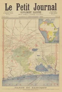
Background imageContinent Collection: Map of Dahomey (colour litho)

Map of Dahomey (colour litho)
2818321 Map of Dahomey (colour litho) by French School, (19th century); Private Collection; (add.info.: Map of Dahomey. Carte du Dahomey)

Background imageContinent Collection: Outbreak of WWII English tourists at Dieppe

Outbreak of WWII English tourists at Dieppe
A large number of English tourists were caught on the Continent when war broke out in September 1939. Photograph shows crowds on the quayside at Dieppe trying to gain passage back to Britain

Background imageContinent Collection: Poster, South Eastern & Chatham Railway, ferry crossings

Poster, South Eastern & Chatham Railway, ferry crossings from Calais to Dover and from Boulogne to Folkestone. circa 1901

Background imageContinent Collection: Peoples of Europe (chromolitho)

Peoples of Europe (chromolitho)
2782788 Peoples of Europe (chromolitho) by European School, (19th century); Private Collection; (add.info.: Peoples of Europe. Liebig card, published in late 19th or early 20th century)

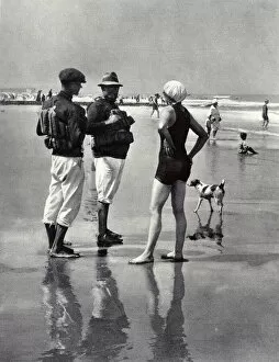
Background imageContinent Collection: Life Savers on a Continental beach

Life Savers on a Continental beach
Life savers stationed on an unidentified Continental beach in 1923. Any adventurous swimmer who dared to swim out a little further than what was deemed perfectly safe was forcibly rescued often with

Background imageContinent Collection: Europe (chromolitho)

Europe (chromolitho)
973908 Europe (chromolitho) by European School, (19th century); Private Collection; (add.info.: Europe. Educational card, late 19th or early 20th century.); © Look and Learn

Background imageContinent Collection: The Armies of the Continent (engraving)

The Armies of the Continent (engraving)
1595141 The Armies of the Continent (engraving) by Schonberg, Johann Nepomuk (1780-1863) (after); Private Collection; (add.info.: The Armies of the Continent)

Background imageContinent Collection: Armies of the Continent, Austrian Infantry Practice with the New Mannlicher Repeating Rifle

Armies of the Continent, Austrian Infantry Practice with the New Mannlicher Repeating Rifle (engraving)
1595095 Armies of the Continent, Austrian Infantry Practice with the New Mannlicher Repeating Rifle (engraving) by Schonberg

Background imageContinent Collection: The Armies of the Continent (litho)

The Armies of the Continent (litho)
1595083 The Armies of the Continent (litho) by Schonberg, Johann Nepomuk (1780-1863) (after); Private Collection; (add.info.: The Armies of the Continent)

Background imageContinent Collection: Armies of the Continent, the Austro-Hungarian Army (engraving)

Armies of the Continent, the Austro-Hungarian Army (engraving)
1595040 Armies of the Continent, the Austro-Hungarian Army (engraving) by English School, (19th century); Private Collection; (add.info.: Armies of the Continent, the Austro-Hungarian Army)

Background imageContinent Collection: The Armies of the Continent, Russian Cavalry (engraving)

The Armies of the Continent, Russian Cavalry (engraving)
1591624 The Armies of the Continent, Russian Cavalry (engraving) by Woodville, Richard Caton II (1856-1927) (after); Private Collection; (add.info.: The Armies of the Continent, Russian Cavalry)

Background imageContinent Collection: An Errand of Consolation (engraving)

An Errand of Consolation (engraving)
1598577 An Errand of Consolation (engraving) by Woodville, Richard Caton II (1856-1927) (after); Private Collection; (add.info.: An Errand of Consolation)

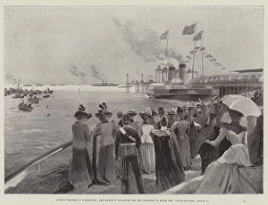
Background imageContinent Collection: Queens Weather at Folkestone, Her Majestys Departure for the Continent on Board the 'Calais-Douvres

Queens Weather at Folkestone, Her Majestys Departure for the Continent on Board the "Calais-Douvres
1598632 Queens Weather at Folkestone, Her Majestys Departure for the Continent on Board the " Calais-Douvres, " 11 March (engraving) by Wright


All Professionally Made to Order for Quick Shipping

"Exploring the Vastness: A Journey through Continents" Al-Idrisi's World Map, 1154: Unveiling the ancient knowledge of continents and their boundaries. Continental Drift after 250 Million Years: Witnessing the ever-changing face of our planet over millions of years. Europe at Night - Satellite Image: Illuminating the vibrant tapestry of cities and civilizations under a starry sky. Europe at Night: A captivating nocturnal view showcasing the continent's bustling energy and urban landscapes. 17th Century World Map: Tracing the evolving perception of continents through historical cartography. Whole Earth at Night - Satellite Image: Glimpsing humanity's interconnectedness as lights twinkle across continents in unison. Our "Little Contemptibles, " 1914: Reflecting on bravery and resilience amidst global conflicts that shaped continents' destinies. 16th Century World Map: Discovering early explorers' visions as they unveiled new lands and expanded continental horizons. Earth from Space - Satellite Image: Beholding our magnificent home from afar, where continents blend seamlessly into one unified entity. Oronce Fine's World Map, 1531: Marveling at an intricate masterpiece that laid foundations for understanding vast continental expanses. Map of the Word with Lines Marking Boundaries of Tectonic Plates : Unraveling nature's hidden forces shaping continents throughout time The Devilfish in Egyptian Waters – An American cartoon from 1882 depicting John Bull (England) as the octopus of imperialism grabbing land on every continent .