Fraud Blocker Skip to main content

Cartographic Collection (page 39)

"Unveiling the World Through Cartographic Masterpieces" Step back in time and embark on a journey through history with these captivating cartographic treasures

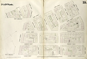
Background imageCartographic Collection: Plate 35: Map bounded by Spring Street, Laurens Street, Canal Street, West Broadway

Plate 35: Map bounded by Spring Street, Laurens Street, Canal Street, West Broadway, Beach Street, St. Johns Lane, Laight Street, Canal Street, Varick Street

Background imageCartographic Collection: Plate 37: Map bounded by Spring Street, Varick Street, Vestry Street, West Street

Plate 37: Map bounded by Spring Street, Varick Street, Vestry Street, West Street. 1852, 1854, William Perris, New York, N.Y. USA

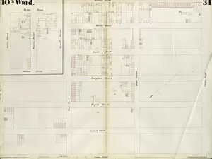
Background imageCartographic Collection: Plate 31: Map bounded by Spring Street, Mercer Street, Canal Street, Laurens Street

Plate 31: Map bounded by Spring Street, Mercer Street, Canal Street, Laurens Street. 1852, 1854, William Perris, New York, N.Y. USA

Background imageCartographic Collection: Plate 29: Map bounded by Canal Street, Centre Street, Leonard Street, West Broadway

Plate 29: Map bounded by Canal Street, Centre Street, Leonard Street, West Broadway. 1852, 1854, William Perris, New York, N.Y. USA

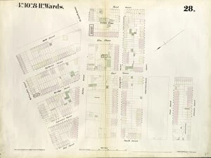
Background imageCartographic Collection: Plate 28: Map bounded by Leonard Street, Centre Street, Chambers Street, Broadway

Plate 28: Map bounded by Leonard Street, Centre Street, Chambers Street, Broadway, Reade Street, West Broadway. 1852, 1854, William Perris, New York, N.Y. USA

Background imageCartographic Collection: Plate 27: Map bounded by Houston Street, Bowery, Broome Street, Elm Street, Prince Street

Plate 27: Map bounded by Houston Street, Bowery, Broome Street, Elm Street, Prince Street, Crosby Street. 1852, 1854, William Perris, New York, N.Y. USA

Background imageCartographic Collection: Plate 35: Map bounded by William Street, Richards Street, Elizabeth Street, Conover

Plate 35: Map bounded by William Street, Richards Street, Elizabeth Street, Conover Street. 1855, William Perris, Brooklyn, New York, N.Y. USA

Background imageCartographic Collection: Plate 36: Maps Covering Various Areas. 1855, William Perris, Brooklyn, New York, N
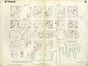
Plate 36: Maps Covering Various Areas. 1855, William Perris, Brooklyn, New York, N.Y. USA

Background imageCartographic Collection: Plate 32: Map bounded by Degraw Street, Smith Street, Third Place, Clinton Street

Plate 32: Map bounded by Degraw Street, Smith Street, Third Place, Clinton Street. 1855, William Perris, Brooklyn, New York, N.Y. USA

Background imageCartographic Collection: Plate 34: Map bounded by Carroll Street, Columbia Street, Rapelye Street, Henry Street

Plate 34: Map bounded by Carroll Street, Columbia Street, Rapelye Street, Henry Street, Luquer Street, Commerce Street, Richards Street, William Street, Van Brunt Street

Background imageCartographic Collection: Plate 33: Map bounded by Third Place, Smith Street, Bush Street, Clinton Street

Plate 33: Map bounded by Third Place, Smith Street, Bush Street, Clinton Street, Hamilton Avenue, Henry Street. 1855, William Perris, Brooklyn, New York, N.Y. USA

Background imageCartographic Collection: Plate 29: Map bounded by Joralemon Street, Fulton Street, Smith Street, Atlantic Avenue

Plate 29: Map bounded by Joralemon Street, Fulton Street, Smith Street, Atlantic Avenue, Hoyt Street, Bergen Street, Court Street. 1855, William Perris, Brooklyn, New York, N.Y. USA

Background imageCartographic Collection: Plate 31: Map bounded by Warren Street, Nevins Street, Union Street, Hoyt Street

Plate 31: Map bounded by Warren Street, Nevins Street, Union Street, Hoyt Street. 1855, William Perris, Brooklyn, New York, N.Y. USA

Background imageCartographic Collection: Plate 30: Map bounded by Bergen Steet, Hoyt Street, Degraw Street, Court Street. 1855

Plate 30: Map bounded by Bergen Steet, Hoyt Street, Degraw Street, Court Street. 1855, William Perris, Brooklyn, New York, N.Y. USA

Background imageCartographic Collection: Plate 26: Map bounded by Schermerhorn Street, Powers Street, Fulton Avenue, Lafayette

Plate 26: Map bounded by Schermerhorn Street, Powers Street, Fulton Avenue, Lafayette Street, Raymond Street, 4th Avenue, Wyckoff Street, Hoyt Street. 1855, William Perris, Brooklyn, New York, N.Y

Background imageCartographic Collection: Plate 28: Map bounded by Willoughby Street, Gold Street, Fulton Avenue, Bond Street

Plate 28: Map bounded by Willoughby Street, Gold Street, Fulton Avenue, Bond Street, Schermerhorn Street, Hoyt Street, Jay Street. 1855, William Perris, Brooklyn, New York, N.Y. USA

Background imageCartographic Collection: Plate 25: Map bounded by Willoughby Street, Raymond Street, Lafayette Avenue, Flatbush

Plate 25: Map bounded by Willoughby Street, Raymond Street, Lafayette Avenue, Flatbush Avenue, Powers Street, Schermerhorn Street, Bond Street, Fulton Avenue, Gold Street

Background imageCartographic Collection: Plate 23: Map bounded by Lafayette Avenue, Cumberland Street, Atlantic Avenue, 4th Avenue

Plate 23: Map bounded by Lafayette Avenue, Cumberland Street, Atlantic Avenue, 4th Avenue, Raymond Street. 1855, William Perris, Brooklyn, New York, N.Y. USA

Background imageCartographic Collection: Plate 24: Map bounded by Myrtle Avenue, Cumberland Street, Lafayette Avenue, Raymond

Plate 24: Map bounded by Myrtle Avenue, Cumberland Street, Lafayette Avenue, Raymond Street. 1855, William Perris, Brooklyn, New York, N.Y. USA

Background imageCartographic Collection: Plate 22: Map bounded by Myrtle Avenue, Clinton Street, Lafayette Avenue, Cumberland

Plate 22: Map bounded by Myrtle Avenue, Clinton Street, Lafayette Avenue, Cumberland Street. 1855, William Perris, Brooklyn, New York, N.Y. USA

Background imageCartographic Collection: Part of Sections 3, & 5 : Plate 67

Part of Sections 3, & 5 : Plate 67

Background imageCartographic Collection: Part of Section 4 : Plate 71

Part of Section 4 : Plate 71

Background imageCartographic Collection: Part of Section 3 : Plate 60

Part of Section 3 : Plate 60

Background imageCartographic Collection: Part of Section 3 : Plate 53

Part of Section 3 : Plate 53

Background imageCartographic Collection: Part of Sections 3, 4 & 5 : Plate 66

Part of Sections 3, 4 & 5 : Plate 66

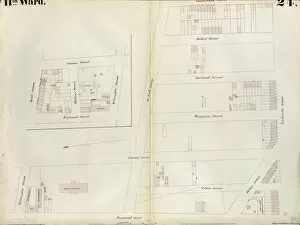
Background imageCartographic Collection: Plate 52: Bounded by Hudson River Piers 63-72, W

Plate 52: Bounded by Hudson River Piers 63-72, W. 32nd Street, Eleventh Avenue and 32nd Street

Background imageCartographic Collection: Part of Section 3 : Plate 57

Part of Section 3 : Plate 57

Background imageCartographic Collection: Part of Section 3 : Plate 56

Part of Section 3 : Plate 56

Background imageCartographic Collection: Part of Section 3 : Plate 55

Part of Section 3 : Plate 55

Background imageCartographic Collection: Plate 51: Bounded by E. 26th Street, East River Piers 74-70, Exterior Street, E

Plate 51: Bounded by E. 26th Street, East River Piers 74-70, Exterior Street, E. 20th Street, and Second Avenue

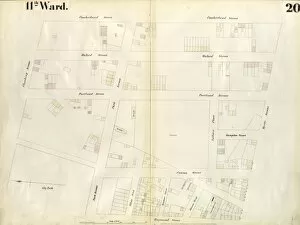
Background imageCartographic Collection: Plate 20: Map bounded by Flushing Avenue, Cumberland Street, Myrtle Avenue, Raymond

Plate 20: Map bounded by Flushing Avenue, Cumberland Street, Myrtle Avenue, Raymond Street, Park Avenue, Navy Street. 1855, William Perris, Brooklyn, New York, N.Y. USA

Background imageCartographic Collection: Plate 19: Map bounded by Concord Street, Navy Street, Park Avenue, Raymond Street

Plate 19: Map bounded by Concord Street, Navy Street, Park Avenue, Raymond Street, Willoughby Street, Duffield Street. 1855, William Perris, Brooklyn, New York, N.Y. USA

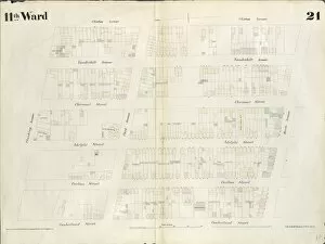
Background imageCartographic Collection: Plate 21: Map bounded by Flushing Avenue, Clinton Avenue, Myrtle Avenue, Cumberland

Plate 21: Map bounded by Flushing Avenue, Clinton Avenue, Myrtle Avenue, Cumberland Street. 1855, William Perris, Brooklyn, New York, N.Y. USA

Background imageCartographic Collection: Plate 6: Map bounded by Poplar Street, Henry Street. 1855, William Perris, Brooklyn

Plate 6: Map bounded by Poplar Street, Henry Street. 1855, William Perris, Brooklyn, New York, N.Y. USA

Background imageCartographic Collection: Plate 10: Map bounded by Hamilton Avenue, Van Brunt Street, Clinton Wharf, Buttermilk

Plate 10: Map bounded by Hamilton Avenue, Van Brunt Street, Clinton Wharf, Buttermilk Channel. 1855, William Perris, Brooklyn, New York, N.Y. USA

Background imageCartographic Collection: Plate 4: Map bounded by East River, Bridge Street, York Street, Main Street. 1855

Plate 4: Map bounded by East River, Bridge Street, York Street, Main Street. 1855, William Perris, Brooklyn, New York, N.Y. USA

Background imageCartographic Collection: Plate 2: Map bounded by South 8th Street, 1st Street, Division Street, Devoe Street

Plate 2: Map bounded by South 8th Street, 1st Street, Division Street, Devoe Street, Union Avenue, Ainslie Street, 1st Street, 9th Street, Smith Street, Messerole Street, Scholl Street

Background imageCartographic Collection: Plate 3: Map bounded by East River, Brooklyn Navy Yard, York Street, Bridge Street

Plate 3: Map bounded by East River, Brooklyn Navy Yard, York Street, Bridge Street. 1855, William Perris, Brooklyn, New York, N.Y. USA

Background imageCartographic Collection: Plate 1: Map bounded by North 12th Street, 1st Street, North 5th Street, Wythe Street

Plate 1: Map bounded by North 12th Street, 1st Street, North 5th Street, Wythe Street, North 3rd Street, 1st Street, South 7th Street, East River. 1855, William Perris, Brooklyn, New York, N.Y. USA

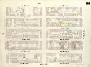
Background imageCartographic Collection: Plate 85: Map bounded by West 27th Street, Sixth Avenue, West 22nd Street, Eighth Avenue

Plate 85: Map bounded by West 27th Street, Sixth Avenue, West 22nd Street, Eighth Avenue. 1857, 1862, Perris and Browne, New York, USA

Background imageCartographic Collection: Plate 89: Map bounded by West 32nd Street, Eighth Avenue, West 27th Street, Tenth Avenue

Plate 89: Map bounded by West 32nd Street, Eighth Avenue, West 27th Street, Tenth Avenue. 1857, 1862, Perris and Browne, New York, USA

Background imageCartographic Collection: Plate 82: Map bounded by East 52nd Street, East River, East 47th Street, Second Avenue

Plate 82: Map bounded by East 52nd Street, East River, East 47th Street, Second Avenue. 1857, 1862, Perris and Browne, New York, USA

Background imageCartographic Collection: Plate 84: Map bounded by West 52nd Street, East 52nd Street, Fourth Avenue, East

Plate 84: Map bounded by West 52nd Street, East 52nd Street, Fourth Avenue, East 52nd Street, West 52nd Street, Sixth Avenue. 1857, 1862, Perris and Browne, New York, USA

Background imageCartographic Collection: Plate 83: Map bounded by East 52nd Street, Second Avenue, 47th Street, Fourth Avenue

Plate 83: Map bounded by East 52nd Street, Second Avenue, 47th Street, Fourth Avenue. 1857, 1862, Perris and Browne, New York, USA

Background imageCartographic Collection: Plate 88: Map bounded by West 32nd Street, Sixth Avenue, West 27th Street, Eighth Avenue

Plate 88: Map bounded by West 32nd Street, Sixth Avenue, West 27th Street, Eighth Avenue. 1857, 1862, Perris and Browne, New York, USA

Background imageCartographic Collection: Plate 95: Map bounded by West 42nd Street, Eighth Avenue, West 37th Street, Tenth Avenue

Plate 95: Map bounded by West 42nd Street, Eighth Avenue, West 37th Street, Tenth Avenue. 1857, 1862, Perris and Browne, New York, USA

Background imageCartographic Collection: Plate 86: Map bounded by West 27th Street, Eighth Avenue, West 22nd Street, Tenth Avenue

Plate 86: Map bounded by West 27th Street, Eighth Avenue, West 22nd Street, Tenth Avenue. 1857, 1862, Perris and Browne, New York, USA

Background imageCartographic Collection: Plate 94: Map bounded by West 42nd Street, Sixth Avenue, West 37th Street, Eighth Avenue

Plate 94: Map bounded by West 42nd Street, Sixth Avenue, West 37th Street, Eighth Avenue. 1857, 1862, Perris and Browne, New York, USA


All Professionally Made to Order for Quick Shipping

"Unveiling the World Through Cartographic Masterpieces" Step back in time and embark on a journey through history with these captivating cartographic treasures. From Al-Idrisi's world map of 1154 to Orteliuss' intricate creations from the 16th century, each map tells a unique story about the world as it was known at that time. Al-Idrisi's world map, crafted in 1154, offers a glimpse into medieval Islamic geography, showcasing an impressive understanding of global trade routes and geographical features. Meanwhile, the British Empire world map from the 19th century illustrates the vast extent of Britain's dominion across continents and oceans. The Catalan Atlas transports us to the 14th century with its exquisite craftsmanship and detailed depictions of various regions. It serves as a testament to Catalonia's rich maritime tradition and exploration during this period. Orteliuss' maps take center stage throughout this collection, providing invaluable insights into specific regions such as Ottoman Empire, Italy, Poland, Greece, Germany, Netherlands - all meticulously documented in his renowned Theatrum Orbis Terrarum. These masterpieces not only showcase Orteliuss' cartographic expertise but also shed light on political boundaries and cultural nuances prevalent during his era. Moving closer to home is the Map of City Dublin from 1797 which showcases Ireland's capital city at that time - offering glimpses into its urban layout and architectural landmarks that have shaped Dublin's identity over centuries. Lastly Zaragoza’s (19th c. ) Map takes us to Spain where we can explore Madrid through intricate details capturing its streetscape during that period - allowing us to immerse ourselves in Spanish history while navigating through its vibrant capital city. These remarkable cartographic works serve as windows into our past – they are not just maps; they are gateways connecting us with bygone eras.