


Framed Prints From MapSeeker
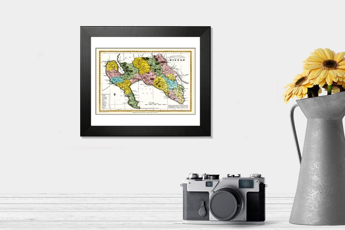
Framed Print of Old County Map of Wigtown Scotland 1847 by A&C Black
A finely detailed facimile remastered in full colour from an antique original map of Wigtownshire featured in A&C Blacks Atlas of 1847. Each Parish is numbered using an index table, colour rendition beautifully differentiating all of the Parishes. As well as principal roads, towns, villages and hamlets, these county maps of Scotland feature key battle sites marked with two crossed swords and the date of the battle. Welcome to the Mapseeker Image library and enter an historic gateway to one of the largest on-line collections of Historic Maps, Nostalgic Views, Vista's and Panorama's from a World gone by. © Mapseeker Publishing Ltd
Artwork supplied by MapSeeker (Remastered from an original antique map published from the Atlas by Adam & Charles Black 1847 by Mapseeker Publishing Ltd, Courtesy of the Collins Bartholomew Map Archive)
Your chosen combination is quickly and professionally made to order, our shipping page has more details
If you are not entirely happy with your items, simply return them to us within 30 days for a replacement or full refund. Please read our full returns policy.
Media ID 20347642
Old Scottish County Map , Old County Map Of Scotland , Antique Scottish Maps For Sale
Editors Comments
Discover the rich history of Wigtownshire with our Old County Map of Wigtown, Scotland 1847 by A&C Black. This framed print is a faithful facsimile of the antique original map, meticulously remastered in full color. Dating back to A&C Black's Atlas of 1847, this finely detailed map shows the intricacies of Wigtownshire's geography and topography during that era. Bring a touch of history into your home or office with this authentic framed print.
This artwork is also available as...
Photo Prints - Discover the charm of Scotland with our Photo Prints, featuring an Old County Map of Wigtown from 1847 by A&C Black. This beautifully remastered facsimile map shows Wigtownshire in full colour, originally featured in A&C Blacks Atlas of 1847. Perfect for history enthusiasts and home decor lovers alike.
Photo Mugs - Photo Mugs featuring vintage maps. This Old County Map of Wigtown Scotland 1847 by A&C Black from MapSeeker is a beautifully remastered facsimile in full colour, perfect for map enthusiasts and history buffs. Perfect personalized gifts or office accessories, our custom Photo Mugs are ideal for anyone who loves geography and nostalgia.
Poster Prints - Introducing the Old County Map of Wigtown, Scotland 1847 by A&C Black from our range of Poster Prints. This beautiful, finely detailed facsimile is a remastered reproduction of an antique original map, taken from A&C Black's Atlas of 1847. Transport yourself back in time with this representation of Wigtownshire, meticulously brought to life in full colour. A must-have for history enthusiasts and those with a connection to the region, this poster print is an addition to any wall. Order yours today.
Metal Prints - Step back in time with our Metal Print of the Old County Map of Wigtown, Scotland 1847, from A&C Black's Atlas. This finely detailed facsimile, remastered in full colour, shows the antique charm of Wigtownshire's historical cartography. Each Metal Print is meticulously crafted to bring out the rich textures and intricate details of the original map, making it an addition to any home or office. Experience the beauty and history of Scotland like never before with our high-quality, long-lasting Metal Prints.
Canvas Prints - Introducing the Old County Map of Wigtown, Scotland 1847 by A&C Black from our Canvas Prints collection. This finely detailed reproduction is a faithful facsimile of the antique original map, which was featured in A&C Black's Atlas of 1847. Each canvas print boasts full-color remastering, bringing out the intricate lines and hues of this historical cartography. Transport yourself back in time with this representation of Wigtownshire's rich heritage. Perfect for adding an air of antiquity and charm to any room in your home or office.
Mouse Mats - Bring a touch of Scotland's rich history to your workspace with our Mouse Mats. This reproduction of an 1847 Old County Map of Wigtown, Scotland by A&C Black is a beautifully detailed facsimile remastered in full colour from an antique original map featured in A&C Blacks Atlas of 1847.
Modern Frame 12"x10"
Ready to Hang Contemporary Framed Prints adds style, protection, and a polished touch to your space - effortlessly.
Your artwork will be printed as shown in the preview. To adjust please select Edit Printed Image under the Buy button
Made and Shipped from within the USA or Canada as appropriate. Printed on 10"x8" Premium Matte Paper offering bright, white paper with a matte finish with a digitally rendered mat surround offering the timeless look of professionally mounted artwork. Our 1″ Frames are available in a range of colours with clear acrylic shatterproof glazing and Kraft pad backer. Matte Paper offer a lighter-weight alternative to fine art paper which is optimized for artwork and can be suitable for photography in scenarios where a less glossy appearance is preferred. This sustainable paper printing is an alternative to our premium fine art paper. Each frame is 1″ wide by 3/4″ deep and glazed using standard 1/16” clear PETG to protect and enhance the visibility of each print. Ready to hang with a sawtooth metal hanger and sturdy backer.
These are individually made so all sizes are approximate
Estimated Image Size (if not cropped) is 20.4cm x 13.6cm (8" x 5.4")
Estimated Product Size is 30.5cm x 25.4cm (12" x 10")
Features In These Collections
> Europe > United Kingdom > Scotland > Dumfries and Galloway > Wigtown
> Europe > United Kingdom > Scotland > Maps
> Europe > United Kingdom > Scotland > Wigtownshire
> Maps and Charts > Early Maps
> MapSeeker > Maps From The British Isles > Scotland and Counties PORTFOLIO