Framed Print > Europe > Portugal > Maps
Framed Print : Map Of Spain And Portugal From Smiths General Atlas Published London 1850 By C. Smith Mapseller Number 172 The Strand


![]()
Framed Photos from Design Pics
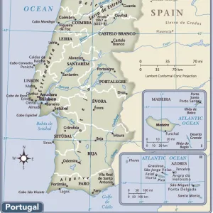
Map Of Spain And Portugal From Smiths General Atlas Published London 1850 By C. Smith Mapseller Number 172 The Strand
Design Pics offers Distinctively Different Imagery representing over 1,500 contributors
Media ID 18189664
© Ken Welsh / Design Pics
Atlas Cartography General London Peninsula Portugal Smith Spain Iberia Iberian Nineteenth Smiths
12"x10" Modern Frame
["Step back in time with our vintage Map Of Spain And Portugal from the Smiths General Atlas, published in London in 1850. This beautifully detailed framed print, by renowned mapmaker C. Smith Mapseller Number 172, offers a captivating glimpse into the historical geography of Europe. Each line and border reveals the political landscape of the time, making this a must-have addition to any home or office. The antique aesthetic adds character and charm to any space, transporting you back to an era of exploration and discovery. This is not just a map, it's a piece of history."](Map Of Spain And Portugal from Smiths General Atlas, published London 1850 By C. Smith Mapseller Number 172 The Strand. Vintage framed print.)
10x8 Print in an MDF Wooden Frame with 180 gsm Satin Finish Paper. Glazed using shatter proof thin plexi glass. Frame thickness is 1 inch and depth 0.75 inch. Fluted cardboard backing held with clips. Supplied ready to hang with sawtooth hanger and rubber bumpers. Spot clean with a damp cloth. Packaged foam wrapped in a card.
Contemporary Framed and Mounted Prints - Professionally Made and Ready to Hang
Estimated Image Size (if not cropped) is 25.4cm x 25.4cm (10" x 10")
Estimated Product Size is 30.5cm x 25.4cm (12" x 10")
These are individually made so all sizes are approximate
Artwork printed orientated as per the preview above, with landscape (horizontal) or portrait (vertical) orientation to match the source image.
FEATURES IN THESE COLLECTIONS
> Europe
> Portugal
> Related Images
> Maps and Charts
> Related Images
> Maps and Charts
> Spain
EDITORS COMMENTS
This print showcases a historic map of Spain and Portugal from the renowned Smith's General Atlas, published in London in 1850 by C. Smith Mapseller. The map is an exquisite example of 19th-century cartography, meticulously crafted with vibrant colors that bring the Iberian Peninsula to life. The horizontal composition allows for a comprehensive view of both countries, highlighting their geographical features and intricate details. Spain and Portugal's borders are clearly outlined, while major cities, rivers, mountains, and other significant landmarks are intricately labeled. As we delve into this piece of history captured by photographer Ken Welsh, we can't help but be transported back to a time when maps were treasured possessions used for exploration and navigation. This particular map holds immense historical value as it provides insights into the political boundaries and cultural landscapes of Spain and Portugal during the 19th century. Smith's General Atlas was highly regarded for its accuracy and attention to detail. Its publication at Number 172 The Strand in London solidified C. Smith Mapseller's reputation as a trusted source for cartographic materials. Whether you're an enthusiast of vintage maps or simply appreciate the beauty found within historical artifacts like this one, this print serves as a fascinating window into our past – reminding us of how far we've come in understanding our world through cartography.
MADE IN THE USA
Safe Shipping with 30 Day Money Back Guarantee
FREE PERSONALISATION*
We are proud to offer a range of customisation features including Personalised Captions, Color Filters and Picture Zoom Tools
SECURE PAYMENTS
We happily accept a wide range of payment options so you can pay for the things you need in the way that is most convenient for you
* Options may vary by product and licensing agreement. Zoomed Pictures can be adjusted in the Cart.