Home > Arts > Photorealistic artworks > Detailed art pieces > Masterful detailing in art
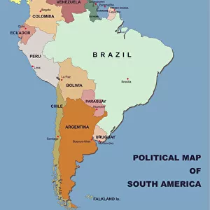
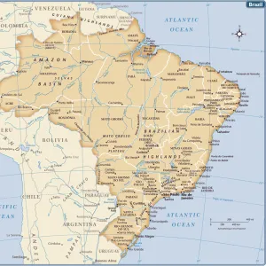
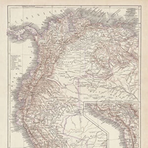
South America Physical Map, Engraving, 1892

![]()
Wall Art and Photo Gifts from Fine Art Storehouse
South America Physical Map, Engraving, 1892
Very rare, beautifully detailed engraving of South America Physical Map, Engraving, Published in 1892. Original edition from my own archives. Copyright has expired on this artwork. Digitally restored
Unleash your creativity and transform your space into a visual masterpiece!
bauhaus1000
Media ID 13609143
© This content is subject to copyright
18th Century Argentina Art Product Atlantic Ocean Brazil Chart Chile Colombia Colors Country Geographic Area Ecuador Geographical Border Graph Land Pacific Ocean Peru South America The Americas Topography View Into Land Multi Colored
FEATURES IN THESE COLLECTIONS
> Arts
> Photorealistic artworks
> Detailed art pieces
> Masterful detailing in art
> Fine Art Storehouse
> Map
> Historical Maps
> Fine Art Storehouse
> Map
> USA Maps
> Maps and Charts
> Early Maps
> North America
> United States of America
> Maps
> South America
> Argentina
> Maps
> South America
> Brazil
> Maps
> South America
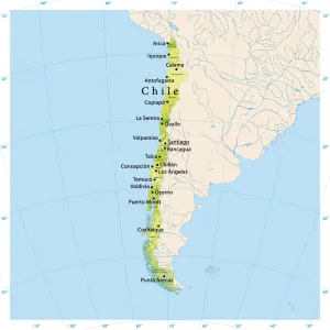
> Chile
> Maps
> South America
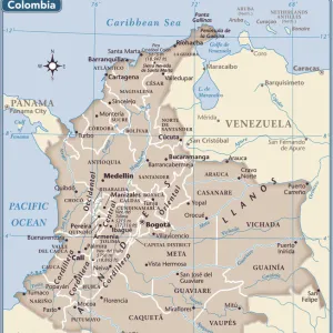
> Colombia
> Maps
> South America
> Ecuador
> Maps
> South America
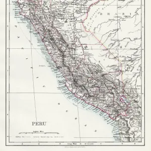
> Peru
> Maps
EDITORS COMMENTS
This rare and exquisitely detailed engraving of the South America Physical Map takes us back to 1892, a time when cartography was both an art form and a scientific endeavor. From my personal archives, this original edition showcases the beauty of craftsmanship that has stood the test of time. With its copyright expired, this artwork now belongs to the public domain. Digitally restored to its former glory, every intricate line and contour comes alive in vibrant colors. The map captures the vastness and diversity of South America's geographic landscape with precision. From the towering Andes Mountains stretching across multiple countries to the lush Amazon rainforest teeming with life, this print offers a captivating view into land largely unexplored during that era. As we explore this piece further, our eyes are drawn to familiar names like Brazil, Argentina, Chile, Peru, Colombia - each country marked by distinct borders on this archival illustration. The Atlantic Ocean meets the eastern shores while the Pacific Ocean embraces its western coastline. Transporting us back in time through its 19th-century style and etching technique reminiscent of old-world charm, this antique map is not just a historical artifact but also an artistic masterpiece. It serves as a reminder of humanity's quest for knowledge about our planet's physical geography. Whether you're an avid collector or simply appreciate fine art prints that tell stories from centuries pasts, this South America Physical Map engraving is sure to captivate your imagination and add timeless elegance to any space it graces.
MADE IN THE USA
Safe Shipping with 30 Day Money Back Guarantee
FREE PERSONALISATION*
We are proud to offer a range of customisation features including Personalised Captions, Color Filters and Picture Zoom Tools
SECURE PAYMENTS
We happily accept a wide range of payment options so you can pay for the things you need in the way that is most convenient for you
* Options may vary by product and licensing agreement. Zoomed Pictures can be adjusted in the Cart.