Home > Asia > Georgia > Maps
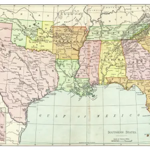
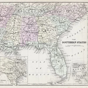
Antique Map of Eastern USA

![]()
Wall Art and Photo Gifts from Fine Art Storehouse
Antique Map of Eastern USA
Antique Map from 1867 of Eastern United States of America
Unleash your creativity and transform your space into a visual masterpiece!
duncan1890
Media ID 13666593
© Duncan Walker
Alabama American Culture Arkansas Chart Connecticut Delaware Delaware Us State Eastern Usa Equipment Florida Florida Us State Georgia Georgia Us State Gulf Coast States Kentucky Louisiana Maine Maryland Maryland State Massachusetts Mid Atlantic Usa Mississippi Navigational Equipment New England New England Usa New Hampshire New Jersey New York State North America North Carolina North Carolina Us State Past Pennsylvania Retro Revival South Carolina Southern Usa Styles Tennessee The Americas Vermont Virginia Virginia Us State West Virginia Image Created 19th Century Obsolete Retro Styled Victorian Style
FEATURES IN THESE COLLECTIONS
> Europe
> France
> Canton
> Maine
> Europe
> United Kingdom
> England
> Hampshire
> Related Images
> Europe
> United Kingdom
> England
> Maps
> Europe
> United Kingdom
> England
> Paintings
> Europe
> United Kingdom
> England
> York
> Fine Art Storehouse
> Map
> Historical Maps
> Fine Art Storehouse
> Map
> USA Maps
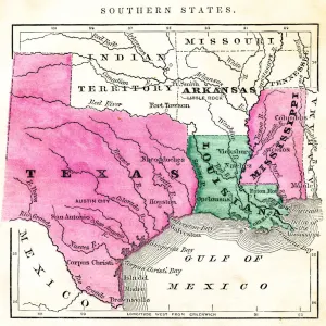
> USA Southern States Historical Maps
> Fine Art Storehouse
> Map
> USA Maps
> Maps and Charts
> Early Maps
> North America
> United States of America
> Alabama
> Related Images
EDITORS COMMENTS
This print takes us back in time to the 19th century, showcasing an exquisite Antique Map of Eastern USA. With its retro revival and Victorian style, this piece is a true gem for history enthusiasts and lovers of American culture. The intricately engraved image transports us to a bygone era when cartography was both an art form and a vital navigational tool. The map encompasses the eastern region of the United States, featuring states such as Florida, New Hampshire, Vermont, Massachusetts, Connecticut, Maine, New York State, New Jersey, Maryland, Delaware, Virginia, Pennsylvania and more. It beautifully captures the diverse landscapes and historical significance of these areas. As we explore this antique masterpiece further southward on the map's journey through time and space; we encounter enchanting places like South Carolina, Louisiana, Tennessee, Mississippi, Kentucky, and Georgia among others - all representing different facets of Southern USA's rich heritage. The attention to detail in this color image is remarkable; every line meticulously etched with precision. This print serves as a window into America's past while also highlighting the evolution of cartographic equipment over time. Whether you are fascinated by history or simply appreciate vintage aesthetics, this stunning illustration will transport you back centuries ago. Its timeless charm makes it an ideal addition to any home decor, a testament to our enduring fascination with maps as both practical tools and works of art.
MADE IN THE USA
Safe Shipping with 30 Day Money Back Guarantee
FREE PERSONALISATION*
We are proud to offer a range of customisation features including Personalised Captions, Color Filters and Picture Zoom Tools
SECURE PAYMENTS
We happily accept a wide range of payment options so you can pay for the things you need in the way that is most convenient for you
* Options may vary by product and licensing agreement. Zoomed Pictures can be adjusted in the Cart.