Fraud Blocker Skip to main content

Home > Arts > Street art graffiti > Digital art > Vector illustrations

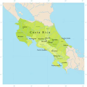
Costa Rica Vector Map

Costa Rica Vector Map
Sold 3
In Stock
We accept all major credit cards

Fine Art Storehouse Photo Prints and Wall Art

Costa Rica Vector Map

+++. Unleash your creativity and transform your space into a visual masterpiece. © Frank Ramspott, all rights reserved

Frank Ramspott

Media ID 14457443

Atlantic Ocean Caribbean Sea Central America Clip Art Computer Graphic Costa Rica Country Geographic Area Green Gulf Of Mexico Latitude Longitude Pacific Ocean San Jose Square Vector Cartago Digitally Generated Image Heredia Puerto Limon Puntarenas

FEATURES IN THESE COLLECTIONS

> Arts > Artists > O > Oceanic Oceanic

> Arts > Street art graffiti > Digital art > Digital paintings

> Arts > Street art graffiti > Digital art > Vector illustrations

> Fine Art Storehouse > Map

> Maps and Charts > Americas

> Maps and Charts > Related Images

> North America > Costa Rica > Limon

> North America > Costa Rica > Maps

> North America > Costa Rica > Puntarenas

> North America > Costa Rica > Related Images

> North America > Costa Rica > San Jose

SECURE PAYMENTS
We happily accept a wide range of payment options so you can pay for the things you need in the way that is most convenient for you

MADE IN THE USA
Safe Shipping with 30 Day Money Back Guarantee

FREE PERSONALISATION
We are proud to offer a range of customisation including Cropping, Captions, and Filters. Zoom Cropping can be adjusted in the Basket.


EDITORS COMMENTS

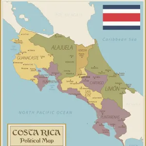
This stunning print captures the beauty and essence of Costa Rica in a unique way. Created by talented artist Frank Ramspott, this vector map showcases the country's geographic area with intricate details and vibrant colors. The image features a square-shaped map that highlights various regions of Costa Rica, including San Jose, Puntarenas, Heredia, Cartago, and Puerto Limon. The coastal areas are beautifully depicted with shades of blue representing the Caribbean Sea on one side and the Pacific Ocean on the other. The map also includes the Atlantic Ocean and Gulf of Mexico to provide a comprehensive view. With its digitally generated design, this artwork combines cartography and illustration to create an eye-catching piece. The use of clip art elements adds depth to the composition while maintaining accuracy in depicting physical geography. Ideal for travel enthusiasts or anyone interested in exploring new destinations, this Costa Rica Vector Map is both informative and visually appealing. Whether displayed at home or in an office space, it serves as a reminder of the country's natural wonders and cultural richness.

diamond
Made With High Grade Materials
thumb_up
Professional Quality Finish
package_2
Carefully Packed To Aid Safe Arrival

You May Also Like


Costa Rica country mapCosta Rica country map
Add to Basket
political map of south america in vector formatpolitical map of south america in vector format
Add to Basket
Reference Map of SpainReference Map of Spain
Add to Basket
Political Map of Costa Rica with FlagPolitical Map of Costa Rica with Flag
Add to Basket
Caribbean islands, 1870sCaribbean islands, 1870s
Add to Basket
Central America, Costa RicaCentral America, Costa Rica
Add to Basket
PAULI MURRAY (1910-1985). American civil rights activist and authorPAULI MURRAY (1910-1985). American civil rights activist and author
Add to Basket
Honduras country mapHonduras country map
Add to Basket
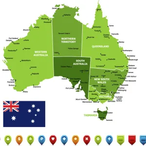
Australia MapAustralia Map
Add to Basket
Highly detailed USA Road MapHighly detailed USA Road Map
Add to Basket
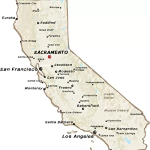
map of californiamap of california
Add to Basket
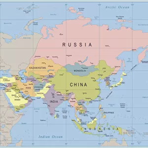
Asia Map - illustrationAsia Map - illustration
Add to Basket

Gallery Wall Inspiration

Antique map of Britain under the Ancient Romans
Map of Anglo-Saxon Kingdoms and the Danelaw, 9th Century
Map of earth population 1895
Antique map of the Roman Empire
Newfoundland map 1884
Map of Middle East - illustration
Apostle Pauls Missionary Journeys, lithograph, published in 1886
Reference Map of Spain
Ethnological map of the Austro-Hungarian Empire, lithograph, published in 1897
Map of the Byzantine Empire in the 9th Century
Map of Ireland 1897
Coloured Map of Nigeria with Flag
England in the Ninth Century
Cuba map 1896
Antique map, Liverpool and Birkenhead, England, 19th Century
Map of Southern States USA 1895
Earth map according to Herodotus
Antique map of USA in the 19th Century, 1873
Antique map of Britain under the Anglo Saxons
NYC Region and Long Island Map
Antique map of South Africa, 1884, 19th Century
Map of Samoan islands: Savai i, Upolu, and Tutuila, lithograph, 1897
Antique map of Greece, Romania, Bulgaria, 1897, late 19th Century
City map of Florence, Italy, lithograph, published in 1897
Antique map of Austria Hungary 19th Century
Arizona map 1893
Flat map of Austria with the Austrian flag

Discover Our Collections


MapMap
View Collection
San JoseSan Jose
View Collection
Costa Rica Related ImagesCosta Rica Related Images
View Collection
LimonLimon
View Collection
PuntarenasPuntarenas
View Collection
MapsMaps
View Collection
Oceanic OceanicOceanic Oceanic
View Collection
Maps and Charts Related ImagesMaps and Charts Related Images
View Collection
AmericasAmericas
View Collection
Digital paintingsDigital paintings
View Collection
Vector illustrationsVector illustrations
View Collection


© Copyright Media Storehouse, All Rights Reserved 2003 - 2024
Facebook     Pinterest     Card Payments     Reviews IO