Home > North America > United States of America > New York > New York > Maps
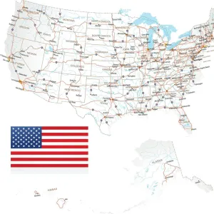
North America relief map 1875

![]()
Wall Art and Photo Gifts from Fine Art Storehouse
North America relief map 1875
The Independent Course Comprehensive Geography by James Monteith, A.S. Barnes & Co, New York & Chicago 1875
Unleash your creativity and transform your space into a visual masterpiece!
THEPALMER
Media ID 13612197
© This content is subject to copyright
Globe Navigational Equipment North America Paper Relief Map
FEATURES IN THESE COLLECTIONS
> Fine Art Storehouse
> The Magical World of Illustration
> Palmer Illustrated Collection
> Fine Art Storehouse
> Map
> Historical Maps
> Fine Art Storehouse
> Map
> USA Maps
> Maps and Charts
> Early Maps
> Maps and Charts
> World
> North America
> United States of America
> Maps
> North America
> United States of America
> New York
> New York
> Maps
EDITORS COMMENTS
This print takes us back in time to the year 1875, showcasing a meticulously detailed relief map of North America. The map, featured in James Monteith's renowned book "The Independent Course Comprehensive Geography" offers a fascinating glimpse into the geographical understanding of that era. Published by A. S. Barnes & Co in New York and Chicago, this antique engraving is a true testament to the artistry and precision of cartography. Displayed vertically, this vintage piece exudes an air of authenticity with its aged paper texture and delicate engravings. The intricate illustration showcases not only the physical geography but also serves as a navigational tool for globe enthusiasts from that period. Every contour and elevation is intricately depicted on this relief map, allowing viewers to appreciate the diverse topography of North America. As we gaze upon this historical artifact expertly captured by THEPALMER for Fine Art Storehouse, we are transported back in time when maps were cherished possessions used for exploration and education alike. It serves as a reminder of how our understanding of the world has evolved over centuries while appreciating the craftsmanship involved in creating such masterpieces. Whether you are an avid collector or simply intrigued by history, this remarkable print invites you to immerse yourself in an era where cartography was both science and art - capturing not just landforms but also igniting curiosity about our planet's wonders.
MADE IN THE USA
Safe Shipping with 30 Day Money Back Guarantee
FREE PERSONALISATION*
We are proud to offer a range of customisation features including Personalised Captions, Color Filters and Picture Zoom Tools
SECURE PAYMENTS
We happily accept a wide range of payment options so you can pay for the things you need in the way that is most convenient for you
* Options may vary by product and licensing agreement. Zoomed Pictures can be adjusted in the Cart.