Home > Arts > Modern art pieces > Textures and patterns in modern > Modern paintings
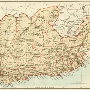
Map of Canada and New Brunswick 1867

![]()
Wall Art and Photo Gifts from Fine Art Storehouse
Map of Canada and New Brunswick 1867
Mitchells Modern Atlas - Published by E.H. Buttler & Co - Philadelphia 1867
Unleash your creativity and transform your space into a visual masterpiece!
THEPALMER
Media ID 13668947
© Roberto A Sanchez
British Empire Canada North America Northeast Paper Quebec Sepia Toned Textured Effect New Brunswick Canada Obsolete
FEATURES IN THESE COLLECTIONS
> Arts
> Modern art pieces
> Textures and patterns in modern
> Modern paintings
> Arts
> Modern art pieces
> Textures and patterns in modern
> Fine Art Storehouse
> The Magical World of Illustration
> Palmer Illustrated Collection
> Fine Art Storehouse
> Map
> Historical Maps
> Maps and Charts
> British Empire Maps
> Maps and Charts
> Related Images
> North America
> Canada
> Maps
> North America
> Canada
> Related Images
> North America
> Related Images
EDITORS COMMENTS
In this photo print, we are transported back in time to the year 1867, where we find ourselves gazing upon a beautifully detailed map of Canada and New Brunswick. This vintage piece from Mitchell's Modern Atlas, published by E. H. Buttler & Co in Philadelphia, showcases the artistry of cartography during that era. The image exudes an air of nostalgia with its engraved texture and sepia-toned effect. The intricate lines and delicate details on the paper give us a glimpse into a world long gone by. As our eyes wander across the map, we can't help but marvel at how different the borders were compared to today. This historic artifact reminds us of Canada's place within the British Empire at that time. It serves as a testament to both exploration and colonization efforts undertaken by European powers during this period. The focus on Quebec and New Brunswick highlights their significance within Canada's northeast region. The horizontal orientation allows for easy navigation through various territories depicted on this illustration. "The Map of Canada and New Brunswick 1867" is not just an obsolete representation; it is also a window into history itself – offering insight into past travel routes, geographical boundaries, and political landscapes. Its presence adds character to any space while igniting curiosity about our nation's rich heritage.
MADE IN THE USA
Safe Shipping with 30 Day Money Back Guarantee
FREE PERSONALISATION*
We are proud to offer a range of customisation features including Personalised Captions, Color Filters and Picture Zoom Tools
SECURE PAYMENTS
We happily accept a wide range of payment options so you can pay for the things you need in the way that is most convenient for you
* Options may vary by product and licensing agreement. Zoomed Pictures can be adjusted in the Cart.