Fine Art Print > Arts > Artists > H > Jodocus Hondius
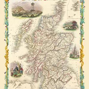
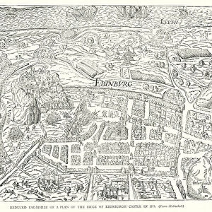
Fine Art Print : Old County Map of Kyle and Mid Ayrshire 1654 by johan Blaeu from the Atlas Novus


![]()
Fine Art Prints From MapSeeker
Old County Map of Kyle and Mid Ayrshire 1654 by johan Blaeu from the Atlas Novus
This detailed and most attractive reproduction map of Kyle and Mid Ayrshire has been carefully art worked from a scan of an antique original. A map of the historic Scottish district of Kyle, bordering Carrick, Galloway and Clydsdale. Based on the work of the famous Scottish surveyor Timothy Pont. Map is very detailed, with the inclusion of rivers, lochs, mountains, cities, villages and castles. With decorative title and scale cartouches, the former surrounded by regional figures and their livestock. Dedication is in a fantastically detailed cartouche, the Scottish rampant lion crest flanked by two further lions and with the motto conscia virtus. Some of the decoration has been picked out in gold. Latin text to verso. From Blaeus Atlas Novus. The famous firm of Dutch cartographers and publishers was established in the late 16th century by Willem Janszoon Blaeu in Amsterdam. Blaeu was a maker of globes and scientific instruments and purchased some of his early map plates from Jodocus Hondius. From this small beginning was to emerge one of the largest and most prolific map publishing houses of the seventeenth century
Welcome to the Mapseeker Image library and enter an historic gateway to one of the largest on-line collections of Historic Maps, Nostalgic Views, Vista's and Panorama's from a World gone by.
Media ID 20347830
Blaeu Blaeu Family Blaue Map County Map County Map Of Scotland Historic Map Johan Blaeu Johan Blaeu Map Old Blaue Map Old County Map Old Scottish County Map Scottish County Map Kyle
21"x14" (+3" Border) Fine Art Print
Discover the rich history of Kyle and Mid Ayrshire with our exquisite Fine Art Print of the Old County Map by Johan Blaeu from the Atlas Novus. This stunning reproduction, brought to you by Media Storehouse and MapSeeker, showcases intricate details of the region as it appeared in 1654. Carefully art-worked from a high-resolution scan of an original antique map, each print boasts vibrant colors and sharp lines, transporting you back in time. Add this beautiful piece to your home or office for an elegant and thought-provoking addition to your decor.
21x14 image printed on 27x20 Fine Art Rag Paper with 3" (76mm) white border. Our Fine Art Prints are printed on 300gsm 100% acid free, PH neutral paper with archival properties. This printing method is used by museums and art collections to exhibit photographs and art reproductions.
Our fine art prints are high-quality prints made using a paper called Photo Rag. This 100% cotton rag fibre paper is known for its exceptional image sharpness, rich colors, and high level of detail, making it a popular choice for professional photographers and artists. Photo rag paper is our clear recommendation for a fine art paper print. If you can afford to spend more on a higher quality paper, then Photo Rag is our clear recommendation for a fine art paper print.
Estimated Image Size (if not cropped) is 53.3cm x 35.5cm (21" x 14")
Estimated Product Size is 68.6cm x 50.8cm (27" x 20")
These are individually made so all sizes are approximate
Artwork printed orientated as per the preview above, with landscape (horizontal) orientation to match the source image.
FEATURES IN THESE COLLECTIONS
> Animals
> Mammals
> Mountain Lion
> Arts
> Artists
> B
> Willem Blaeu
> Arts
> Artists
> H
> Jodocus Hondius
> Arts
> Photorealistic artworks
> Detailed art pieces
> Masterful detailing in art
> Europe
> United Kingdom
> Scotland
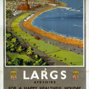
> Ayrshire
> Europe
> United Kingdom
> Scotland
> Castles
> Europe
> United Kingdom
> Scotland
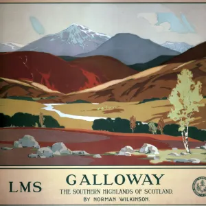
> Dumfries and Galloway
> Related Images
> Europe
> United Kingdom
> Scotland
> Maps
> Europe
> United Kingdom
> Scotland
> Rivers
> Europe
> United Kingdom
> Scotland
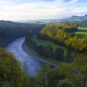
> Scottish Borders
> Related Images
> Maps and Charts
> Willem Janszoon Blaeu
> MapSeeker
> Maps from the British Isles
> Scotland and Counties PORTFOLIO
EDITORS COMMENTS
This beautifully crafted reproduction map of Kyle and Mid Ayrshire takes us back in time to the year 1654. Created by renowned cartographer Johan Blaeu, this print is a true work of art that captures the essence of this historic Scottish district. Based on the meticulous surveys conducted by Timothy Pont, this highly detailed map showcases the rivers, lochs, mountains, cities, villages, and castles that define Kyle's landscape. The inclusion of decorative title and scale cartouches adds an elegant touch to the overall design. These ornate elements are adorned with regional figures and their livestock, bringing life to the map. One cannot help but be captivated by the dedication cartouche featured on this print. With intricate details highlighted in gold, it proudly displays Scotland's rampant lion crest flanked by two additional lions. Accompanied by the motto "conscia virtus" meaning conscious virtue or bravery knows itself well. Originating from Blaeu's Atlas Novus collection, which was published by his esteemed Dutch firm established in Amsterdam during the late 16th century. This company would go on to become one of history's largest and most prolific map publishing houses throughout the seventeenth century. Whether you're a history enthusiast or simply appreciate fine craftsmanship, this reproduction map offers a glimpse into Scotland's past while showcasing Johan Blaeu's remarkable talent as a cartographer.
MADE IN THE USA
Safe Shipping with 30 Day Money Back Guarantee
FREE PERSONALISATION*
We are proud to offer a range of customisation features including Personalised Captions, Color Filters and Picture Zoom Tools
SECURE PAYMENTS
We happily accept a wide range of payment options so you can pay for the things you need in the way that is most convenient for you
* Options may vary by product and licensing agreement. Zoomed Pictures can be adjusted in the Basket.