Home > Arts > Artists > I > Indian School Indian School
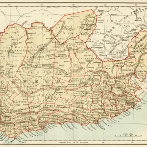
Index Chart of the Cutch Topographical Survey by the Trigonometrical Branch, Survey of India

![]()
Wall Art and Photo Gifts from Fine Art Finder
Index Chart of the Cutch Topographical Survey by the Trigonometrical Branch, Survey of India
XCF306007 Index Chart of the Cutch Topographical Survey by the Trigonometrical Branch, Survey of India, Dehra Dun, November, 1881 (colour litho) by English School, (19th century); Private Collection; English, out of copyright
Media ID 18254899
© Private Collection / Bridgeman Images
Boundaries Boundary British Empire Geographic Gulf Gwalior Mapping Rann Region State Territory Kutch
FEATURES IN THESE COLLECTIONS
> Arts
> Artists
> I
> Indian School Indian School
> Asia
> India
> Related Images
> Fine Art Finder
> Schools
> English School
> Maps and Charts
> British Empire Maps
> Maps and Charts
> India
> Maps and Charts
> Related Images
MADE IN THE USA
Safe Shipping with 30 Day Money Back Guarantee
FREE PERSONALISATION*
We are proud to offer a range of customisation features including Personalised Captions, Color Filters and Picture Zoom Tools
SECURE PAYMENTS
We happily accept a wide range of payment options so you can pay for the things you need in the way that is most convenient for you
* Options may vary by product and licensing agreement. Zoomed Pictures can be adjusted in the Cart.