Fraud Blocker Skip to main content

Home > Fine Art Finder > Artists > John Seller

John Seller Collection

Choose a picture from our John Seller Collection for your Wall Art and Photo Gifts

51 items

Background imageJohn Seller Collection: Portrait of the 'Groeningen'. Built 1641. 48-guns. Chartered by Denmark 1666-1667

Portrait of the 'Groeningen'. Built 1641. 48-guns. Chartered by Denmark 1666-1667 and not thereafter mentioned
7342055 Portrait of the 'Groeningen'. Built 1641. 48-guns. Chartered by Denmark 1666-1667 and not thereafter mentioned. Also called 'Stad Groeningen', 'Wapen van Groeningen' and 'Zwarte Arend'

Background imageJohn Seller Collection: 'A new mappe of the sea coasts of England, France and Holland, wherein the English names, situation

'A new mappe of the sea coasts of England, France and Holland, wherein the English names, situation
7340046 'A new mappe of the sea coasts of England, France and Holland, wherein the English names, situation, point of the compass, and distance of the several ports, harbours, havens, creeks

Background imageJohn Seller Collection: St Pauls Covent Garden (engraving)

St Pauls Covent Garden (engraving)
608066 St Pauls Covent Garden (engraving) by Seller, John (1632-97); Private Collection; (add.info.: St Pauls Covent Garden); Look and Learn / Peter Jackson Collection

Background imageJohn Seller Collection: Polar projection map with Arctic Circle, c.1680 (coloured engraving)

Polar projection map with Arctic Circle, c.1680 (coloured engraving)
7295393 Polar projection map with Arctic Circle, c.1680 (coloured engraving) by Seller, John (1632-97); 44x55 cm; National Maritime Museum, London

Background imageJohn Seller Collection: Planesphaeri Coelestis Hemisphaerium Meridionale, 1700 (coloured print)

Planesphaeri Coelestis Hemisphaerium Meridionale, 1700 (coloured print)
7340115 Planesphaeri Coelestis Hemisphaerium Meridionale, 1700 (coloured print) by Allard, Carel (c.1648-1709); 63x55 cm; National Maritime Museum, London

Background imageJohn Seller Collection: The starry zodiac, by the limits of which the visible paths of all the planets are bounded - John

The starry zodiac, by the limits of which the visible paths of all the planets are bounded - John Seller author
7340114 The starry zodiac, by the limits of which the visible paths of all the planets are bounded - John Seller author, hydrographer of the most serene king, 1679 (engraving) by Seller

Background imageJohn Seller Collection: A chart of Brazil bound in Jacob Colom's 'Atlas of werelts-water-deel en des selfs zee-custen'

A chart of Brazil bound in Jacob Colom's 'Atlas of werelts-water-deel en des selfs zee-custen'
7340056 A chart of Brazil bound in Jacob Colom's 'Atlas of werelts-water-deel en des selfs zee-custen', 1656 (bound sheet) by Colom, Arnold (1624-68); 57x65 cm; National Maritime Museum, London

Background imageJohn Seller Collection: The last and most accurate description of Jamaica, 1675 (engraving)

The last and most accurate description of Jamaica, 1675 (engraving)
7340053 The last and most accurate description of Jamaica, 1675 (engraving) by Seller, John (1632-97); 42.5x54 cm; National Maritime Museum, London

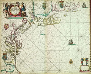
Background imageJohn Seller Collection: A chart of the sea coasts of new England, New Jersey, Virginia

A chart of the sea coasts of new England, New Jersey, Virginia, Maryland and Carolina from Cape Cod to Cape Hatteras
7340051 A chart of the sea coasts of new England, New Jersey, Virginia, Maryland and Carolina from Cape Cod to Cape Hatteras, 1675 (print) by Seller

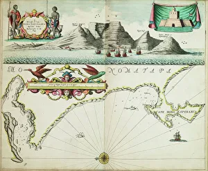
Background imageJohn Seller Collection: A chart of the seacoasts from the Landsend of England to Cape Bona Esperanca, 1675 (engraving)

A chart of the seacoasts from the Landsend of England to Cape Bona Esperanca, 1675 (engraving)
7340048 A chart of the seacoasts from the Landsend of England to Cape Bona Esperanca, 1675 (engraving) by Seller, John (1632-97); 45x55.5 cm; National Maritime Museum, London

Background imageJohn Seller Collection: Seascape, late 19th century - mid 20th century (oil on paper)

Seascape, late 19th century - mid 20th century (oil on paper)
7342413 Seascape, late 19th century - mid 20th century (oil on paper) by Everett, John (1876-1949); 15x19.4 cm; National Maritime Museum, London

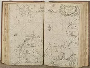
Background imageJohn Seller Collection: The English pilot the first book: describing the northern navigation, c.1671 (paper)

The English pilot the first book: describing the northern navigation, c.1671 (paper)
7342405 The English pilot the first book: describing the northern navigation, c.1671 (paper) by Seller, John (1632-97); National Maritime Museum, London, UK; (add.info.: Creator: John Seller Map 6)

Background imageJohn Seller Collection: Alderney Harbour, plan of breakwater and Admiralty property, 1878 (paper, lithograph)

Alderney Harbour, plan of breakwater and Admiralty property, 1878 (paper, lithograph)
7339472 Alderney Harbour, plan of breakwater and Admiralty property, 1878 (paper, lithograph) by British School, (19th century); 41x47 cm; National Maritime Museum, London

Background imageJohn Seller Collection: Map of Bombay and Sallset by Samuel Thornton, Hydrographer to the East India Company

Map of Bombay and Sallset by Samuel Thornton, Hydrographer to the East India Company, first published circa 1685
7339463 Map of Bombay and Sallset by Samuel Thornton, Hydrographer to the East India Company, first published circa 1685, 1734 (engraving) by Seller

Background imageJohn Seller Collection: A nautical survey of the Bay of Brest and the Ushant Islands by Captain Hurd RN, 1807

A nautical survey of the Bay of Brest and the Ushant Islands by Captain Hurd RN, 1807, 1816-23 (chart)
7337589 A nautical survey of the Bay of Brest and the Ushant Islands by Captain Hurd RN, 1807, 1816-23 (chart) by Hurd, R.N

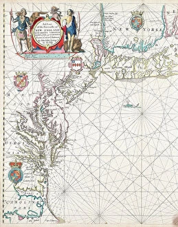
Background imageJohn Seller Collection: A chart of the sea coasts of New England, New Jersey, Virginia

A chart of the sea coasts of New England, New Jersey, Virginia, Maryland and Carolina from Cape Cod to Cape Hatteras
7337587 A chart of the sea coasts of New England, New Jersey, Virginia, Maryland and Carolina from Cape Cod to Cape Hatteras, 1675 (engraving) by Seller

Background imageJohn Seller Collection: Super Pacific of the Northern Railway of France

Super Pacific of the Northern Railway of France
ACT251522 Super Pacific of the Northern Railway of France, illustration from The Wonder Book of Railways, fourteenth edition edited by Harry Golding, 1929 (colour litho) by English School

Background imageJohn Seller Collection: A Chart of the Sea Coasts of Russia, Lapland, Finmarke, Nova Zemla and Greenland

A Chart of the Sea Coasts of Russia, Lapland, Finmarke, Nova Zemla and Greenland
XYC251516 A Chart of the Sea Coasts of Russia, Lapland, Finmarke, Nova Zemla and Greenland, 1671 (engraving) by Seller, John (1632-97); 43.4x52.9 cm; Yale Center for British Art

Background imageJohn Seller Collection: The Month of January / The Louvre, from the series of tapestries

The Month of January / The Louvre, from the series of tapestries
XIR391182 The Month of January/ The Louvre, from the series of tapestries The Months or Royal Residences, produced in the Gobelins Workshop for Louis XIV (tapestry) by Le Brun

Background imageJohn Seller Collection: Ms 1288 Chart of the Sea Coasts of England & Ireland and of the Bay of Biscay (engraving)

Ms 1288 Chart of the Sea Coasts of England & Ireland and of the Bay of Biscay (engraving)
BIF391161 Ms 1288 Chart of the Sea Coasts of England & Ireland and of the Bay of Biscay (engraving) by Seller, John (1632-97); Bibliotheque de l Institut de France, Paris, France; English

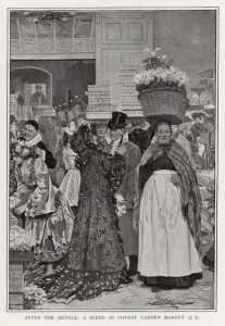
Background imageJohn Seller Collection: After the revels - a scene in Covent Garden Market (litho)

After the revels - a scene in Covent Garden Market (litho)
608073 After the revels - a scene in Covent Garden Market (litho) by Buckland, Arthur Herbert (1870-fl.1927); Private Collection; (add.info)

Background imageJohn Seller Collection: A new and correct sea chart of the whole world showing the variations of the compass as they were

A new and correct sea chart of the whole world showing the variations of the compass as they were found in the year
7340787 A new and correct sea chart of the whole world showing the variations of the compass as they were found in the year 1700, 1702 (engraving) by British School

Background imageJohn Seller Collection: A chart of the easternmost part of the East Indies with all the adjacent islands from Cape Comorin

A chart of the easternmost part of the East Indies with all the adjacent islands from Cape Comorin to Japan
7340780 A chart of the easternmost part of the East Indies with all the adjacent islands from Cape Comorin to Japan, 1675 (Hand coloured engraving) by Seller

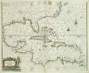
Background imageJohn Seller Collection: Pascaerte vande Caribische eylanden, vande Barbados tot aende Bocht van Mexico

Pascaerte vande Caribische eylanden, vande Barbados tot aende Bocht van Mexico, 1661 (technical drawing)
7340062 Pascaerte vande Caribische eylanden, vande Barbados tot aende Bocht van Mexico, 1661 (technical drawing) by Doncker, Hendrick (c.1626-99); 43.5x53 cm; National Maritime Museum, London

Background imageJohn Seller Collection: A chart of the trading part of the East Indies and China, with the adjacent islands

A chart of the trading part of the East Indies and China, with the adjacent islands, from Surrat to Japan, 1677 (print)
7340055 A chart of the trading part of the East Indies and China, with the adjacent islands, from Surrat to Japan, 1677 (print) by Seller, John (1632-97); 44.5x56 cm; National Maritime Museum

Background imageJohn Seller Collection: The windward passage from Jamaica, betwene the east end of Cuba, and the west end of Hispaniola

The windward passage from Jamaica, betwene the east end of Cuba, and the west end of Hispaniola, 1675 (engraving)
7340052 The windward passage from Jamaica, betwene the east end of Cuba, and the west end of Hispaniola, 1675 (engraving) by Seller, John (1632-97); 43x54 cm; National Maritime Museum, London

Background imageJohn Seller Collection: A map of the city and port of Tripoli in Barbary, 1675 (coloured engraving)

A map of the city and port of Tripoli in Barbary, 1675 (coloured engraving)
7340047 A map of the city and port of Tripoli in Barbary, 1675 (coloured engraving) by Seller, John (1632-97); 42x53 cm; National Maritime Museum, London

Background imageJohn Seller Collection: The coast of England from the Southforeland to Orfordness, 1675 (coloured engraving)

The coast of England from the Southforeland to Orfordness, 1675 (coloured engraving)
7340045 The coast of England from the Southforeland to Orfordness, 1675 (coloured engraving) by Seller, John (1632-97); 43.5x54 cm; National Maritime Museum, London

Background imageJohn Seller Collection: A chart of the North Sea, 1675 (coloured engraving)

A chart of the North Sea, 1675 (coloured engraving)
7340044 A chart of the North Sea, 1675 (coloured engraving) by Seller, John (1632-97); 43.5x54 cm; National Maritime Museum, London

Background imageJohn Seller Collection: A correct chart of the east coast, from Hasbrough or Haisbrough Sand to Kingston upon Hull

A correct chart of the east coast, from Hasbrough or Haisbrough Sand to Kingston upon Hull, 1797 (print)
7340042 A correct chart of the east coast, from Hasbrough or Haisbrough Sand to Kingston upon Hull, 1797 (print) by Diston, John (fl.1797); 53.5x75 cm; National Maritime Museum, London

Background imageJohn Seller Collection: World map by John Seller, 1675 (coloured engraving)

World map by John Seller, 1675 (coloured engraving)
7340041 World map by John Seller, 1675 (coloured engraving) by Seller, John (1632-97); 44x55 cm; National Maritime Museum, London

Background imageJohn Seller Collection: Ships of the 14th & 15th centuries, 1812 (coloured etching)

Ships of the 14th & 15th centuries, 1812 (coloured etching)
7341605 Ships of the 14th & 15th centuries, 1812 (coloured etching) by Atkinson, John Augustus (1775-1831) (after); 25.2x32.6 cm; National Maritime Museum, London, UK; (add.info.: Creator: C.H.S)

Background imageJohn Seller Collection: Map containing the island and kingdom of Sicily, with a part of Naples

Map containing the island and kingdom of Sicily, with a part of Naples, and other adjacent coasts including
7339456 Map containing the island and kingdom of Sicily, with a part of Naples, and other adjacent coasts including the Tyrrhenean Sea, 1676 (coloured engraving) by Seller

Background imageJohn Seller Collection: West Indies Mosquito Coast Utilla Island surveyed by Commander R. Owen 1835, 1843 (print)

West Indies Mosquito Coast Utilla Island surveyed by Commander R. Owen 1835, 1843 (print)
7340635 West Indies Mosquito Coast Utilla Island surveyed by Commander R. Owen 1835, 1843 (print) by Walker, J. & C. (19th century); 63x45.3 cm; National Maritime Museum, London

Background imageJohn Seller Collection: Chart of Jamaica, Barbados, St Christopher, Martinique, Antigua and Bermuda

Chart of Jamaica, Barbados, St Christopher, Martinique, Antigua and Bermuda, 1713 (coloured engraving)
7340629 Chart of Jamaica, Barbados, St Christopher, Martinique, Antigua and Bermuda, 1713 (coloured engraving) by Seller, John (1632-97); National Maritime Museum, London

Background imageJohn Seller Collection: Edward Augustus Inglefield (1820-1894), 1894 (photo)

Edward Augustus Inglefield (1820-1894), 1894 (photo)
7340619 Edward Augustus Inglefield (1820-1894), 1894 (photo) by Unknown Artist, (19th century); National Maritime Museum, London

Background imageJohn Seller Collection: A chart of the sea coasts of England, Flanders and Holland, c.1672 (print)

A chart of the sea coasts of England, Flanders and Holland, c.1672 (print)
7340614 A chart of the sea coasts of England, Flanders and Holland, c.1672 (print) by Seller, John (1632-97); National Maritime Museum, London

Background imageJohn Seller Collection: Pascaart van de Noort Zee verthoonende in zich alle de Custen en havens daer rontom gelegen

Pascaart van de Noort Zee verthoonende in zich alle de Custen en havens daer rontom gelegen., 1654 (print, paper)
7340057 Pascaart van de Noort Zee verthoonende in zich alle de Custen en havens daer rontom gelegen., 1654 (print, paper) by Wit, Frederick de (1630-1706); 50.5x58.5 cm; National Maritime Museum

Background imageJohn Seller Collection: A chart of the easternmost part of the East Indies with all the adjacent islands from Cape Comorin

A chart of the easternmost part of the East Indies with all the adjacent islands from Cape Comorin to Japan
7340050 A chart of the easternmost part of the East Indies with all the adjacent islands from Cape Comorin to Japan, 1675 (coloured engraving) by Seller

Background imageJohn Seller Collection: Plan of the bays of Polkerris and Mevagizey in Cornwall, 1779 (engraving)

Plan of the bays of Polkerris and Mevagizey in Cornwall, 1779 (engraving)
7340128 Plan of the bays of Polkerris and Mevagizey in Cornwall, 1779 (engraving) by British School, (18th Century); 73.5x54 cm; National Maritime Museum, London

Background imageJohn Seller Collection: A general chart of the northern navigation, 1675 (coloured engraving)

A general chart of the northern navigation, 1675 (coloured engraving)
7340043 A general chart of the northern navigation, 1675 (coloured engraving) by Seller, John (1632-97); 43.5x54 cm; National Maritime Museum, London

Background imageJohn Seller Collection: The Carybsche Eylanden of Barbados to the bend of Mexico, 1656 (engraving)

The Carybsche Eylanden of Barbados to the bend of Mexico, 1656 (engraving)
7340058 The Carybsche Eylanden of Barbados to the bend of Mexico, 1656 (engraving) by Colom, Arnold (1624-68) & Colom, Jacob Aertsz (1600-73); 55x64 cm; National Maritime Museum, London

Background imageJohn Seller Collection: A chart of Guinea describing the sea coast from Cape de Verde to Cape Bona Esperanca

A chart of Guinea describing the sea coast from Cape de Verde to Cape Bona Esperanca, 1677 (coloured engraving)
7340049 A chart of Guinea describing the sea coast from Cape de Verde to Cape Bona Esperanca, 1677 (coloured engraving) by Seller, John (1632-97); 43x54 cm; National Maritime Museum, London

Background imageJohn Seller Collection: Seascape, late 19th century - mid 20th century (oil on paper)

Seascape, late 19th century - mid 20th century (oil on paper)
7342417 Seascape, late 19th century - mid 20th century (oil on paper) by Everett, John (1876-1949); 25.2x35.5 cm; National Maritime Museum, London

Background imageJohn Seller Collection: The English pilot the first book: describing the northern navigation, c.1671 (paper)

The English pilot the first book: describing the northern navigation, c.1671 (paper)
7342407 The English pilot the first book: describing the northern navigation, c.1671 (paper) by Seller, John (1632-97); National Maritime Museum, London

Background imageJohn Seller Collection: The English pilot the first book: describing the northern navigation, c.1671 (paper)

The English pilot the first book: describing the northern navigation, c.1671 (paper)
7342404 The English pilot the first book: describing the northern navigation, c.1671 (paper) by Seller, John (1632-97); National Maritime Museum, London

Background imageJohn Seller Collection: Captain Edward Augustus Inglefield (1820-94), 1854 (b/w photo)

Captain Edward Augustus Inglefield (1820-94), 1854 (b/w photo)
7295424 Captain Edward Augustus Inglefield (1820-94), 1854 (b/w photo) by British School, (19th century); 16.2x21.2 cm; National Maritime Museum, London

Background imageJohn Seller Collection: A chart of the coast of America from Newfoundland to Cape Cod, 1675 (engraving)

A chart of the coast of America from Newfoundland to Cape Cod, 1675 (engraving)
7295422 A chart of the coast of America from Newfoundland to Cape Cod, 1675 (engraving) by Seller, John (1632-97); 45x55.5 cm; National Maritime Museum, London


All Professionally Made to Order for Quick Shipping


-

Why Choose Us?

We are a leading provider of Art Prints and Photo Gifts since 2003, working in partnership with a range of Sporting Clubs, Charities, Museums and Picture Libraries. A large share of profits from any of their images will go directly towards supporting that charity or club. Our archive of images is carefully curated to bring you a wide range of subjects, including landscapes, wildlife, architecture, and more. We ship from our partner labs in the UK, USA, EU (Netherlands) and Australia.
+

How do I place an order?

Ordering is quick & easy - Just follow 5 Simple Steps:
  1. Find your image: Use our search box or browse our online photo Collections to find the image you want.

  2. Choose your print format: Select your desired product and add it to your cart.

  3. Enter your details: If you're a returning customer, simply enter your email address and password, and we'll fill in your billing and shipping address details. All personal details are held securely and are fully GDPR compliant. As standard, we remove all Personally Identifiable Information after 12 months.

  4. Pay for your purchase: We use state-of-the-art security for online shopping and do not have access to your card details.

  5. Sit back and relax: We'll email you confirmation of your order and when it's dispatched. Registered customers can also track orders in the 'My Account' area.

+

How do I pay for an order?

You can pay for your order with most of the major credit and debit cards, or PayPal. For added security, major financial institutions process payment details separately and securely on our behalf. We do not have access to your online payment card details. Online payments are preferred however we do take phone orders. For UK customers only we accept cheques issued against a UK bank.
+

Is my data safe?

We take data security very seriously. We do not have access to your full card details and all payments are requested over a fully secure connection. Additionally, we fully comply with current European and GDPR legislation, and automatically remove all personal data after at most 12 months (unless you have an account with us and have signed in recently). We also have a strict opt-in policy and would never sell your personal details. Your data is only used to fulfill your order promptly and efficiently.
+

Is wall art ready to hang?

For quick and easy installation all wall art, including framed prints, canvas prints and metal prints are supplied with a ready to hang solution on the back. Generally, saw tooth hangers are applied as they allow wall art to hang flush against the wall. The serrated edge of the hanger prevents the frame from shifting or tilting when hung.
+

Are the photo prints fade resistant?

Yes, we use archival quality photo paper photographic paper for vivid reproduction Prints are an accurate representations of the original artwork, which is preserved for artistic character and authenticity. We guarantee they match previews shown on our web site